Wapanocca National Wildlife Refuge
Community Reviews
Been here? Share the conditions.
Reviews, ratings & photos are added in the free Snoflo iOS app — rate a spot, tag the conditions, and your visit is verified by location. Add or manage your reviews from the app.
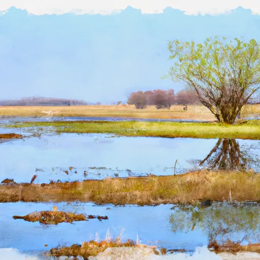
Wapanocca National Wildlife Refuge
Reasons to visit Wapanocca National Wildlife Refuge:
1. Biodiversity: The refuge is home to a wide variety of flora and fauna, including waterfowl, shorebirds, songbirds, deer, bobcats, and river otters.
2. Birdwatching: With its location along the Mississippi Flyway, the refuge attracts a remarkable number of migratory birds, making it a popular spot for birdwatching enthusiasts.
3. Photography: The diverse landscapes, including marshes, swamps, forests, and lakes, provide stunning backdrops for nature photography.
4. Outdoor Recreation: Visitors can enjoy activities such as hiking, wildlife observation, fishing, and hunting (subject to specific regulations).
Points of interest at Wapanocca National Wildlife Refuge:
1. Wapanocca Lake: This 600-acre lake is a focal point of the refuge and provides a crucial habitat for waterfowl and other aquatic species.
2. Nature Trails: The refuge offers several trails, including the Wapanocca Bayou Trail and the Holly Ridge Interpretive Trail, allowing visitors to explore the diverse ecosystems.
3. Cypress Creek: This winding creek showcases the beauty of the surrounding bottomland hardwood forest and provides excellent opportunities for wildlife observation.
Interesting facts about the area:
1. Wapanocca National Wildlife Refuge was established in 1961 to provide habitat for migratory birds and other wildlife.
2. The refuge is situated on the Mississippi Alluvial Plain, an area known for its rich and fertile soils.
3. The name "Wapanocca" is derived from a Native American phrase meaning "land of the setting sun."
The best time of year to visit:
The refuge has something to offer year-round, but the ideal time to visit depends on your interests. Spring and fall are the peak seasons for birdwatching as numerous species migrate through the area. Late winter and early spring are also great for waterfowl observation. Wildlife viewing is excellent throughout the year, and the fall season brings breathtaking foliage. Summer can be hot and humid, but it offers opportunities for fishing and observing nesting birds.
Please note that information accuracy and availability may vary, so it's always a good idea to check with official sources such as the U.S. Fish and Wildlife Service for the most up-to-date information before planning your visit.
Plan your visit down to the hour
Same weather feed Snoflo's iOS app uses -- updated continuously from NOAA / yr.no.
Next 5 days, hour by hour
Temperature line with weather symbols on top, snow + rain accumulation as columns, humidity as a dotted line.
5-day forecast table
Every 3 hours, broken out across temperature, snow, rain, humidity, and wind.
| Time | Condition | Temp (°F) | Snow (in) | Rain (in) | Humidity (%) | Wind (mps) | Wind dir |
|---|---|---|---|---|---|---|---|
| Loading detailed forecast… | |||||||
15-day temperature & precipitation
Daily temperatures, snow, and rain projected over the next two weeks.
Responsible recreation & Leave No Trace
- Know before you go
- Check the operator's site for hours, permit requirements, seasonal closures, and fire restrictions before heading out.
- Stay on trail
- Stick to marked paths to protect vegetation, prevent erosion, and avoid disturbing wildlife habitat.
- Respect wildlife
- Observe from a distance, never feed wildlife, and store food securely if camping is permitted on-site.
- Pack it in, pack it out
- Carry out all trash, food scraps, and gear. Many parks have limited or no trash service.
- Leave what you find
- Don't take rocks, plants, or artifacts. They make the park what it is for the next visitor.
Set push alerts in the Snoflo app
Save Wapanocca National Wildlife Refuge as a favorite, set a custom threshold (precipitation, freezing temperatures, fire-restriction days), and the iOS app will push the moment conditions cross.
About Wapanocca National Wildlife Refuge
What can I do at Wapanocca National Wildlife Refuge?
Most Snoflo-tracked parks support hiking, picnicking, and wildlife viewing. Check the operator's site for activity-specific rules (camping, fishing, paddling, hunting).
How fresh is the weather data?
The hourly forecast updates throughout the day from NOAA / yr.no. Streamflow comes live from USGS streamgauges.
When is the best time to visit?
Use the 15-day temperature & precipitation outlook on this page to plan -- pick a window with comfortable temperatures and low precipitation.
How do I get to Wapanocca National Wildlife Refuge?
Tap Directions in the hero above to open driving directions in Google Maps, or Open in map to center the Snoflo interactive map on the park.
Can I get alerts when conditions change?
Yes -- alerts are managed in the Snoflo iOS app. Favorite this park, set a threshold (temperature, precipitation), and you'll get a push the moment it crosses.
Park & land designation reference
A quick legend for the federal and state land categories Snoflo tracks. Each designation comes with different rules around access, recreation, and resource extraction.
- National Park
- Large protected natural areas managed by the federal government to preserve significant landscapes, ecosystems, and cultural resources; recreation is allowed but conservation is the priority.
- State Park
- Public natural or recreational areas managed by a state government, typically smaller than national parks and focused on regional natural features, recreation, and education.
- Local Park
- Community-level parks managed by cities or counties, emphasizing recreation, playgrounds, sports, and green space close to populated areas.
- Wilderness Area
- The highest level of land protection in the U.S.; designated areas where nature is left essentially untouched, with no roads, structures, or motorized motorized access permitted.
- National Recreation Area
- Areas set aside primarily for outdoor recreation (boating, hiking, fishing, often around reservoirs, rivers, or scenic landscapes); may allow more development.
- National Conservation Area (BLM)
- BLM-managed areas with special ecological, cultural, or scientific value; more protection than typical BLM land but less strict than Wilderness Areas.
- State Forest
- State-managed forests focused on habitat, watershed, recreation, and sustainable timber harvest.
- Bureau of Land Management (BLM) Land
- Vast federal lands managed for mixed use -- recreation, grazing, mining, conservation -- with fewer restrictions than national parks or forests.