Community Reviews
Been here? Share the conditions.
Reviews, ratings & photos are added in the free Snoflo iOS app — rate a spot, tag the conditions, and your visit is verified by location. Add or manage your reviews from the app.
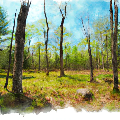
Windsor State Forest
Reasons to visit:
1. Breathtaking Scenery: Windsor State Forest boasts an abundance of natural beauty, including dense forests, serene streams, and picturesque landscapes. Nature enthusiasts will be captivated by the stunning views and tranquil surroundings.
2. Outdoor Activities: The forest provides ample opportunities for outdoor recreation. Visitors can engage in hiking, camping, fishing, birdwatching, and picnicking. The well-maintained trails cater to both novice and experienced hikers, offering a chance to explore the peaceful wilderness.
3. Historical Significance: The forest encompasses remnants of the past, such as cellar holes from early settlers, stone walls, and even an old cemetery. History buffs will find these remnants intriguing, gaining insights into the region's past.
Points of interest:
1. Tannery Falls: One of the highlights of Windsor State Forest is Tannery Falls, a majestic waterfall cascading down a rocky gorge. Hiking trails lead to this stunning natural wonder, offering a rewarding experience for visitors.
2. Windsor Jambs: Another notable attraction is Windsor Jambs, a series of narrow gorges carved by the East Branch of the Westfield River. The impressive rock formations and rushing water create a captivating sight.
3. Pond Loop Trail: This scenic trail encircles Windsor Pond, providing an opportunity to observe various wildlife species while enjoying a leisurely walk.
Interesting facts:
1. Windsor State Forest covers an area of approximately 1,522 acres and is nestled within the Berkshire region of Massachusetts.
2. The forest was established in 1910 and is managed by the Massachusetts Department of Conservation and Recreation.
3. The area showcases a diverse ecosystem, featuring both deciduous and coniferous forests, as well as wetlands and small streams.
Best time to visit:
The ideal time to visit Windsor State Forest is during the late spring, summer, and early fall. The forest comes alive with blooming wildflowers and vibrant foliage, providing a picturesque backdrop for outdoor activities. It is advisable to check weather conditions and trail accessibility before planning your visit.
To ensure accuracy, it is recommended to verify the information provided by cross-referencing multiple independent sources.
Trails in Windsor State Forest
Named trails whose route falls inside the park.
Plan your visit down to the hour
Same weather feed Snoflo's iOS app uses -- updated continuously from NOAA / yr.no.
Next 5 days, hour by hour
Temperature line with weather symbols on top, snow + rain accumulation as columns, humidity as a dotted line.
5-day forecast table
Every 3 hours, broken out across temperature, snow, rain, humidity, and wind.
| Time | Condition | Temp (°F) | Snow (in) | Rain (in) | Humidity (%) | Wind (mps) | Wind dir |
|---|---|---|---|---|---|---|---|
| Loading detailed forecast… | |||||||
15-day temperature & precipitation
Daily temperatures, snow, and rain projected over the next two weeks.
Responsible recreation & Leave No Trace
- Know before you go
- Check the operator's site for hours, permit requirements, seasonal closures, and fire restrictions before heading out.
- Stay on trail
- Stick to marked paths to protect vegetation, prevent erosion, and avoid disturbing wildlife habitat.
- Respect wildlife
- Observe from a distance, never feed wildlife, and store food securely if camping is permitted on-site.
- Pack it in, pack it out
- Carry out all trash, food scraps, and gear. Many parks have limited or no trash service.
- Leave what you find
- Don't take rocks, plants, or artifacts. They make the park what it is for the next visitor.
Set push alerts in the Snoflo app
Save Windsor State Forest as a favorite, set a custom threshold (precipitation, freezing temperatures, fire-restriction days), and the iOS app will push the moment conditions cross.
About Windsor State Forest
What can I do at Windsor State Forest?
Most Snoflo-tracked parks support hiking, picnicking, and wildlife viewing. Check the operator's site for activity-specific rules (camping, fishing, paddling, hunting).
How fresh is the weather data?
The hourly forecast updates throughout the day from NOAA / yr.no. Streamflow comes live from USGS streamgauges.
When is the best time to visit?
Use the 15-day temperature & precipitation outlook on this page to plan -- pick a window with comfortable temperatures and low precipitation.
How do I get to Windsor State Forest?
Tap Directions in the hero above to open driving directions in Google Maps, or Open in map to center the Snoflo interactive map on the park.
Can I get alerts when conditions change?
Yes -- alerts are managed in the Snoflo iOS app. Favorite this park, set a threshold (temperature, precipitation), and you'll get a push the moment it crosses.
Park & land designation reference
A quick legend for the federal and state land categories Snoflo tracks. Each designation comes with different rules around access, recreation, and resource extraction.
- National Park
- Large protected natural areas managed by the federal government to preserve significant landscapes, ecosystems, and cultural resources; recreation is allowed but conservation is the priority.
- State Park
- Public natural or recreational areas managed by a state government, typically smaller than national parks and focused on regional natural features, recreation, and education.
- Local Park
- Community-level parks managed by cities or counties, emphasizing recreation, playgrounds, sports, and green space close to populated areas.
- Wilderness Area
- The highest level of land protection in the U.S.; designated areas where nature is left essentially untouched, with no roads, structures, or motorized motorized access permitted.
- National Recreation Area
- Areas set aside primarily for outdoor recreation (boating, hiking, fishing, often around reservoirs, rivers, or scenic landscapes); may allow more development.
- National Conservation Area (BLM)
- BLM-managed areas with special ecological, cultural, or scientific value; more protection than typical BLM land but less strict than Wilderness Areas.
- State Forest
- State-managed forests focused on habitat, watershed, recreation, and sustainable timber harvest.
- Bureau of Land Management (BLM) Land
- Vast federal lands managed for mixed use -- recreation, grazing, mining, conservation -- with fewer restrictions than national parks or forests.