St. Catherine Creek National Wildlife Refuge
Community Reviews
Been here? Share the conditions.
Reviews, ratings & photos are added in the free Snoflo iOS app — rate a spot, tag the conditions, and your visit is verified by location. Add or manage your reviews from the app.
St. Catherine Creek National Wildlife Refuge
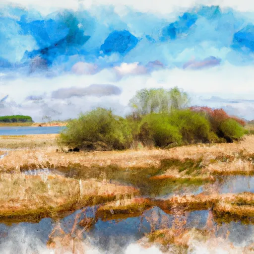
St. Catherine Creek National Wildlife Refuge is a protected area covering approximately 25,000 acres in southwestern Mississippi. It offers a diverse and beautiful natural habitat, making it an attractive destination for nature enthusiasts and outdoor recreation enthusiasts.
Reasons to visit:
1. Wildlife Viewing: The refuge is home to a variety of wildlife species, including white-tailed deer, wild turkey, bobcats, migratory birds, and numerous reptiles and amphibians. It provides excellent opportunities for birdwatching and wildlife photography.
2. Hiking and Nature Trails: Visitors can explore the refuge through its well-maintained trails, offering a chance to immerse themselves in the natural surroundings and observe the local flora and fauna.
3. Hunting and Fishing: St. Catherine Creek National Wildlife Refuge provides limited hunting opportunities for deer, turkey, and small game during specific seasons. Fishing is also permitted in designated areas.
Points of interest:
1. Observation Tower: The refuge features an observation tower that provides a panoramic view of the diverse habitats and offers an ideal vantage point for birdwatchers.
2. Boardwalk: A boardwalk trail takes visitors through a cypress-tupelo swamp, offering a unique experience of this distinct ecosystem.
3. Wildlife Drive: A scenic drive allows visitors to explore the refuge by vehicle and provides opportunities to spot wildlife along the way.
Interesting facts:
1. The refuge was established in 1990 to protect and enhance habitat for migratory birds and other wildlife species.
2. St. Catherine Creek flows through the refuge, offering a vital water source for the diverse wildlife and plant communities.
3. The refuge also functions as a conservation area for the federally endangered Louisiana black bear.
Best time to visit:
The best time to visit St. Catherine Creek National Wildlife Refuge is during spring and fall when the weather is mild, and migratory bird species are passing through the area. Spring offers an opportunity to witness the bustling activity of nesting birds, while fall brings an array of colorful foliage.
Remember, it is always important to verify the accuracy of information from multiple independent sources to ensure the most up-to-date and accurate details about any destination.
Plan your visit down to the hour
Same weather feed Snoflo's iOS app uses -- updated continuously from NOAA / yr.no.
Next 5 days, hour by hour
Temperature line with weather symbols on top, snow + rain accumulation as columns, humidity as a dotted line.
5-day forecast table
Every 3 hours, broken out across temperature, snow, rain, humidity, and wind.
| Time | Condition | Temp (°F) | Snow (in) | Rain (in) | Humidity (%) | Wind (mps) | Wind dir |
|---|---|---|---|---|---|---|---|
| Loading detailed forecast… | |||||||
15-day temperature & precipitation
Daily temperatures, snow, and rain projected over the next two weeks.
Responsible recreation & Leave No Trace
- Know before you go
- Check the operator's site for hours, permit requirements, seasonal closures, and fire restrictions before heading out.
- Stay on trail
- Stick to marked paths to protect vegetation, prevent erosion, and avoid disturbing wildlife habitat.
- Respect wildlife
- Observe from a distance, never feed wildlife, and store food securely if camping is permitted on-site.
- Pack it in, pack it out
- Carry out all trash, food scraps, and gear. Many parks have limited or no trash service.
- Leave what you find
- Don't take rocks, plants, or artifacts. They make the park what it is for the next visitor.
Set push alerts in the Snoflo app
Save St. Catherine Creek National Wildlife Refuge as a favorite, set a custom threshold (precipitation, freezing temperatures, fire-restriction days), and the iOS app will push the moment conditions cross.
About St. Catherine Creek National Wildlife Refuge
What can I do at St. Catherine Creek National Wildlife Refuge?
Most Snoflo-tracked parks support hiking, picnicking, and wildlife viewing. Check the operator's site for activity-specific rules (camping, fishing, paddling, hunting).
How fresh is the weather data?
The hourly forecast updates throughout the day from NOAA / yr.no. Streamflow comes live from USGS streamgauges.
When is the best time to visit?
Use the 15-day temperature & precipitation outlook on this page to plan -- pick a window with comfortable temperatures and low precipitation.
How do I get to St. Catherine Creek National Wildlife Refuge?
Tap Directions in the hero above to open driving directions in Google Maps, or Open in map to center the Snoflo interactive map on the park.
Can I get alerts when conditions change?
Yes -- alerts are managed in the Snoflo iOS app. Favorite this park, set a threshold (temperature, precipitation), and you'll get a push the moment it crosses.
Park & land designation reference
A quick legend for the federal and state land categories Snoflo tracks. Each designation comes with different rules around access, recreation, and resource extraction.
- National Park
- Large protected natural areas managed by the federal government to preserve significant landscapes, ecosystems, and cultural resources; recreation is allowed but conservation is the priority.
- State Park
- Public natural or recreational areas managed by a state government, typically smaller than national parks and focused on regional natural features, recreation, and education.
- Local Park
- Community-level parks managed by cities or counties, emphasizing recreation, playgrounds, sports, and green space close to populated areas.
- Wilderness Area
- The highest level of land protection in the U.S.; designated areas where nature is left essentially untouched, with no roads, structures, or motorized motorized access permitted.
- National Recreation Area
- Areas set aside primarily for outdoor recreation (boating, hiking, fishing, often around reservoirs, rivers, or scenic landscapes); may allow more development.
- National Conservation Area (BLM)
- BLM-managed areas with special ecological, cultural, or scientific value; more protection than typical BLM land but less strict than Wilderness Areas.
- State Forest
- State-managed forests focused on habitat, watershed, recreation, and sustainable timber harvest.
- Bureau of Land Management (BLM) Land
- Vast federal lands managed for mixed use -- recreation, grazing, mining, conservation -- with fewer restrictions than national parks or forests.