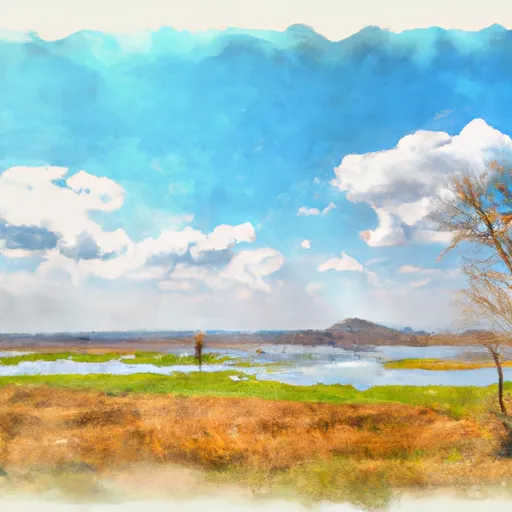
Trempealeau National Wildlife Refuge
Community Reviews
Been here? Share the conditions.
Reviews, ratings & photos are added in the free Snoflo iOS app — rate a spot, tag the conditions, and your visit is verified by location. Add or manage your reviews from the app.
Trempealeau National Wildlife Refuge
Reasons to Visit:
1. Biodiversity: Trempealeau National Wildlife Refuge boasts diverse ecosystems, including wetlands, marshes, prairies, and forested areas. It provides habitat for more than 240 bird species, numerous mammals, reptiles, and amphibians.
2. Bird Watching: With its location along the Mississippi Flyway, the refuge is a crucial stopover for migratory birds. It is particularly renowned for bald eagles, waterfowl, and various songbirds.
3. Recreational Activities: The refuge offers opportunities for outdoor activities such as hiking, wildlife photography, fishing, hunting (during certain seasons), and nature observation.
4. Environmental Education: Trempealeau hosts educational programs, guided tours, and interpretive exhibits to enhance visitors' understanding of the area's wildlife, habitats, and conservation efforts.
Points of Interest:
1. Observation Deck: The refuge features an observation deck overlooking large open water areas, providing an ideal spot for bird watching and panoramic views of the Mississippi River.
2. Auto Tour Route: Visitors can take a self-guided auto tour along the designated route to explore the refuge's scenic landscapes, observation points, and wildlife viewing areas.
3. Prairie's Edge Nature Store: Located at the refuge headquarters, the store offers books, nature-related gifts, and educational items.
Interesting Facts:
1. Established in 1936, Trempealeau National Wildlife Refuge spans over 6,446 acres, encompassing both land and water areas.
2. The refuge has been designated as a globally important bird area due to its significance for migratory birds and waterfowl.
3. Trempealeau is home to a variety of threatened and endangered species, including the river otter, northern cricket frog, and Hine's emerald dragonfly.
Best Time to Visit:
The best time to visit Trempealeau National Wildlife Refuge depends on one's interests. For bird enthusiasts, spring and fall migrations offer the highest diversity and abundance of species. Spring also brings the opportunity to witness waterfowl courtship displays. Summer offers lush greenery and the chance to spot young animals, while fall showcases the beautiful colors of changing foliage. However, the refuge remains open year-round, and each season has its unique attractions.
Please note that the accuracy of this information may be subject to change, so it is advisable to verify specific details, such as visitor hours and current wildlife sightings, through official sources before planning a visit.
Trails in Trempealeau National Wildlife Refuge
Named trails whose route falls inside the park.
Plan your visit down to the hour
Same weather feed Snoflo's iOS app uses -- updated continuously from NOAA / yr.no.
Next 5 days, hour by hour
Temperature line with weather symbols on top, snow + rain accumulation as columns, humidity as a dotted line.
5-day forecast table
Every 3 hours, broken out across temperature, snow, rain, humidity, and wind.
| Time | Condition | Temp (°F) | Snow (in) | Rain (in) | Humidity (%) | Wind (mps) | Wind dir |
|---|---|---|---|---|---|---|---|
| Loading detailed forecast… | |||||||
15-day temperature & precipitation
Daily temperatures, snow, and rain projected over the next two weeks.
Responsible recreation & Leave No Trace
- Know before you go
- Check the operator's site for hours, permit requirements, seasonal closures, and fire restrictions before heading out.
- Stay on trail
- Stick to marked paths to protect vegetation, prevent erosion, and avoid disturbing wildlife habitat.
- Respect wildlife
- Observe from a distance, never feed wildlife, and store food securely if camping is permitted on-site.
- Pack it in, pack it out
- Carry out all trash, food scraps, and gear. Many parks have limited or no trash service.
- Leave what you find
- Don't take rocks, plants, or artifacts. They make the park what it is for the next visitor.
Set push alerts in the Snoflo app
Save Trempealeau National Wildlife Refuge as a favorite, set a custom threshold (precipitation, freezing temperatures, fire-restriction days), and the iOS app will push the moment conditions cross.
About Trempealeau National Wildlife Refuge
What can I do at Trempealeau National Wildlife Refuge?
Most Snoflo-tracked parks support hiking, picnicking, and wildlife viewing. Check the operator's site for activity-specific rules (camping, fishing, paddling, hunting).
How fresh is the weather data?
The hourly forecast updates throughout the day from NOAA / yr.no. Streamflow comes live from USGS streamgauges.
When is the best time to visit?
Use the 15-day temperature & precipitation outlook on this page to plan -- pick a window with comfortable temperatures and low precipitation.
How do I get to Trempealeau National Wildlife Refuge?
Tap Directions in the hero above to open driving directions in Google Maps, or Open in map to center the Snoflo interactive map on the park.
Can I get alerts when conditions change?
Yes -- alerts are managed in the Snoflo iOS app. Favorite this park, set a threshold (temperature, precipitation), and you'll get a push the moment it crosses.
Park & land designation reference
A quick legend for the federal and state land categories Snoflo tracks. Each designation comes with different rules around access, recreation, and resource extraction.
- National Park
- Large protected natural areas managed by the federal government to preserve significant landscapes, ecosystems, and cultural resources; recreation is allowed but conservation is the priority.
- State Park
- Public natural or recreational areas managed by a state government, typically smaller than national parks and focused on regional natural features, recreation, and education.
- Local Park
- Community-level parks managed by cities or counties, emphasizing recreation, playgrounds, sports, and green space close to populated areas.
- Wilderness Area
- The highest level of land protection in the U.S.; designated areas where nature is left essentially untouched, with no roads, structures, or motorized motorized access permitted.
- National Recreation Area
- Areas set aside primarily for outdoor recreation (boating, hiking, fishing, often around reservoirs, rivers, or scenic landscapes); may allow more development.
- National Conservation Area (BLM)
- BLM-managed areas with special ecological, cultural, or scientific value; more protection than typical BLM land but less strict than Wilderness Areas.
- State Forest
- State-managed forests focused on habitat, watershed, recreation, and sustainable timber harvest.
- Bureau of Land Management (BLM) Land
- Vast federal lands managed for mixed use -- recreation, grazing, mining, conservation -- with fewer restrictions than national parks or forests.