Graybill Park
Leave a RatingNearby: Boston Heights Park Heren Park
Last Updated: February 11, 2026
Graybill Park is a picturesque park located in Montana that offers visitors a range of outdoor activities.
Summary
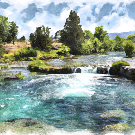
The park is situated along the Missouri River and boasts stunning views of the surrounding mountains. There are plenty of reasons to visit the park, including its hiking and biking trails, fishing spots, and wildlife viewing opportunities.
One of the main points of interest in Graybill Park is the Missouri River. Visitors can enjoy fishing for trout, bass, and walleye in the river, or take a canoe or kayak out for a peaceful paddle. The park also features several hiking and biking trails that wind through the surrounding hills and provide scenic views of the area.
In addition to outdoor activities, there are also several amenities in the park, including picnic areas, playgrounds, and campsites. These facilities make Graybill Park a great destination for families and anyone looking to spend time in the great outdoors.
Interesting facts about the area include the fact that Graybill Park was once a cattle ranch before being converted into a public park. The park is also home to several species of wildlife, including deer, elk, and bighorn sheep.
The best time of year to visit Graybill Park is during the summer months, when the weather is warm and sunny. Visitors can enjoy all of the outdoor activities that the park has to offer, as well as taking in the beautiful scenery. However, the park is open year-round, so visitors can enjoy winter activities like snowshoeing and cross-country skiing during the colder months.
Overall, Graybill Park is a must-visit destination for anyone looking to experience the natural beauty of Montana. With its stunning scenery, outdoor activities, and range of amenities, it is the perfect place to spend a day or a weekend exploring the great outdoors.
°F
°F
mph
Wind
%
Humidity
15-Day Weather Outlook
5-Day Hourly Forecast Detail
Park & Land Designation Reference
Large protected natural areas managed by the federal government to preserve significant landscapes, ecosystems, and cultural resources; recreation is allowed but conservation is the priority.
State Park
Public natural or recreational areas managed by a state government, typically smaller than national parks and focused on regional natural features, recreation, and education.
Local Park
Community-level parks managed by cities or counties, emphasizing recreation, playgrounds, sports, and green space close to populated areas.
Wilderness Area
The highest level of land protection in the U.S.; designated areas where nature is left essentially untouched, with no roads, structures, or motorized access permitted.
National Recreation Area
Areas set aside primarily for outdoor recreation (boating, hiking, fishing), often around reservoirs, rivers, or scenic landscapes; may allow more development.
National Conservation Area (BLM)
BLM-managed areas with special ecological, cultural, or scientific value; more protection than typical BLM land but less strict than Wilderness Areas.
State Forest
State-managed forests focused on habitat, watershed, recreation, and sustainable timber harvest.
National Forest
Federally managed lands focused on multiple use—recreation, wildlife habitat, watershed protection, and resource extraction (like timber)—unlike the stricter protections of national parks.
Wilderness
A protected area set aside to conserve specific resources—such as wildlife, habitats, or scientific features—with regulations varying widely depending on the managing agency and purpose.
Bureau of Land Management (BLM) Land
Vast federal lands managed for mixed use—recreation, grazing, mining, conservation—with fewer restrictions than national parks or forests.
Related References

 Boston Heights Park
 Heren Park
 Veterans Memorial
 Kiwanis Park North
 Giant Springs State Park