Gipsy Lake Campground
Community Reviews
Been here? Share the conditions.
Reviews, ratings & photos are added in the free Snoflo iOS app — rate a spot, tag the conditions, and your visit is verified by location. Add or manage your reviews from the app.
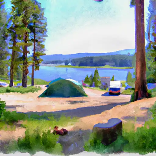
Gipsy Lake
What's on-site at Gipsy Lake
Key facilities Snoflo tracks for this campground. Confirm with the operator before booking -- amenities can change seasonally.
Plan your trip down to the hour
Same weather feed Snoflo's iOS app uses -- updated continuously from NOAA / yr.no.
Next 5 days, hour by hour
Temperature line with weather symbols on top, snow + rain accumulation as columns, humidity as a dotted line.
5-day forecast table
Every 3 hours, broken out across temperature, snow, rain, humidity, and wind. Each cell is colour-coded relative to the column min/max so trends jump out at a glance.
| Time | Condition | Temp (°F) | Snow (in) | Rain (in) | Humidity (%) | Wind (mps) | Wind dir |
|---|---|---|---|---|---|---|---|
| Loading detailed forecast… | |||||||
15-day temperature & precipitation
Daily temperatures, snow, and rain projected over the next two weeks. Hover any point for the full breakdown.
Other campgrounds in the area
Snoflo-tracked campsites within driving distance of Gipsy Lake, with reservations status.
| Campground | Reservations | Toilets | View |
|---|---|---|---|
| Gipsy Lake Campground | ✓ | ✗ | → |
| Thompson Guard Station | ✓ | ✗ | → |
| Skidway Campground | ✗ | ✗ | → |
| Skidway | ✗ | ✓ | → |
| Rillway Cabin | ✓ | ✗ | → |
Nearby streamflow
USGS streamgauges within reach of Gipsy Lake -- pulled live from the National Water Information System.
| Streamgauge | Discharge | View |
|---|---|---|
| Smith River Near Ft Logan Mt | 95 cfs | → |
| Smith River Bl Eagle Cr Nr Fort Logan Mt | 139 cfs | → |
| Missouri River At Toston Mt | 3,620 cfs | → |
| Prickly Pear Creek Near Clancy Mt | 21 cfs | → |
| Missouri River Bl Hauser Lake Nr Helena Mt | 3,320 cfs | → |
| South Fork Musselshell R Ab Martinsdale Mt | 43 cfs | → |
Nearby snow depths
NRCS SNOTEL stations within reach of Gipsy Lake -- relevant when planning a shoulder-season or alpine trip.
| SNOTEL station | Snowpack | 24h Snowfall | View |
|---|---|---|---|
| Nohrsc Boulder Mountain | 0.0 in | 0.0 in | → |
| Boulder Mountain | 0.0 in | 0.0 in | → |
| Pickfoot Creek | 1.0 in | 0.0 in | → |
| Pickfoot Creek | 1.0 in | 0.0 in | → |
| Elk Peak | 0.0 in | 0.0 in | → |
| Elk Peak | 0.0 in | 0.0 in | → |
Plan a longer trip
The closest parks, lakes, boat launches, and paddle runs so a camping night can grow into a full weekend.
Boat launches
- Confederate Campground
- Confederate
- Newlan Creek Reservoir
- West Loop Broadwater County
- Goose Bay
- White Earth Campground
Fishing spots
- Duck Creek (Upper Missouri Drainage)
- Deep Creek (Upper Missouri Drainage)
- Canyon Ferry Lake
- Newlan Reservoir
- Newlan Creek
- Battle Creek
Points of interest
Camping essentials & Leave No Trace
- Pack it in, pack it out
- Take all trash, food scraps, and gear back with you to keep campsites clean and protect wildlife.
- Respect wildlife
- Observe animals from a distance, store food securely, and never feed wildlife to maintain natural behavior and safety.
- Know before you go
- Check weather, fire restrictions, trail conditions, and permit requirements to ensure a safe and well-planned trip.
- Minimize campfire impact
- Use established fire rings, keep fires small, fully extinguish them, or opt for a camp stove when fires are restricted.
- Leave what you find
- Preserve natural and cultural features by avoiding removal of plants, rocks, artifacts, or other elements of the environment.
Set push alerts in the Snoflo app
Save Gipsy Lake as a favorite, set a custom threshold (precipitation, snowpack, freezing temperatures), and the iOS app will push the moment conditions cross.
About Gipsy Lake
Can I make reservations at Gipsy Lake?
This campground does not appear to accept reservations -- it's typically first-come, first-served. Arrive early on summer weekends.
How fresh is the weather data on this page?
The hourly forecast updates throughout the day from the NOAA / yr.no public feeds. Streamflow data is pulled live from USGS streamgauges and snowpack from the NRCS SNOTEL network.
What's the best time of year to visit?
Use the 15-day temperature & precipitation outlook on this page to plan -- pick a window with comfortable temperatures and low precipitation. For longer trips, the 5-day hourly meteogram shows snow + rain accumulation hour-by-hour.
How do I get to Gipsy Lake?
Tap Directions in the hero above to open driving directions in Google Maps, or Open in map to center the Snoflo interactive map on the campground.
Can I get alerts when conditions change?
Yes -- alerts are managed through the Snoflo iOS app. Favorite this campground, set a threshold (temperature, snowpack, precipitation), and you'll get a push the moment it crosses.
Other campgrounds near here
Snoflo-tracked campgrounds within driving distance of Gipsy Lake.