Succor Creek State Natural Area
Community Reviews
Been here? Share the conditions.
Reviews, ratings & photos are added in the free Snoflo iOS app — rate a spot, tag the conditions, and your visit is verified by location. Add or manage your reviews from the app.
Succor Creek State Natural Area
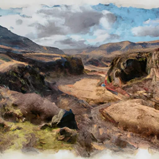
Situated in the southeastern corner of the state, Succor Creek State Natural Area is characterized by rugged canyons, towering cliffs, and a diverse array of flora and fauna. It covers around 6,000 acres and is part of the Leslie Gulch-Succor Creek Scenic Area managed by the Bureau of Land Management.
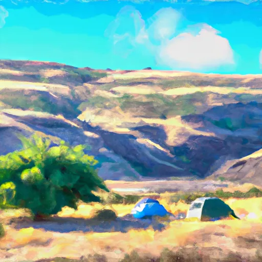
Reasons to visit Succor Creek State Natural Area are numerous. Firstly, it offers exceptional opportunities for outdoor activities such as hiking, photography, bird watching, camping, and rock hounding. The area is a haven for geology enthusiasts, as it showcases fascinating rock formations, including volcanic tuffs and basalt flows. Additionally, Succor Creek runs through the park, providing visitors with the chance to relax by the water's edge or try their hand at fishing.
Some notable points of interest within the park include the towering Succor Creek Canyon, the photogenic Leslie Gulch, and the stunning Honeycombs formation, known for its hexagonal rock columns. Wildlife enthusiasts can spot a variety of bird species, including golden eagles, prairie falcons, and great horned owls. Mammals such as mule deer, coyotes, and bobcats can also be observed in their natural habitat.
Interesting facts about Succor Creek State Natural Area include its rich Native American history. The area was inhabited by the Northern Paiute and Shoshone tribes for thousands of years before European settlers arrived. Additionally, the park's scenic beauty has made it a popular filming location for various movies and commercials.
The best time to visit Succor Creek State Natural Area largely depends on personal preferences. Spring and fall offer pleasant temperatures, wildflower blooms, and the avoidance of summer crowds. Summer can be quite hot, but it is an excellent time for camping and stargazing. Winter visits are less common due to colder temperatures, but the park's serene atmosphere and potential for snowy landscapes can be a unique experience for those seeking solitude and tranquility.
To ensure accuracy, it is recommended to verify the information provided across multiple independent sources such as the official website of Oregon State Parks, travel guides, and reputable outdoor enthusiast platforms.
Camping in Succor Creek State Natural Area
Campgrounds inside the park, with today's conditions score.
Plan your visit down to the hour
Same weather feed Snoflo's iOS app uses -- updated continuously from NOAA / yr.no.
Next 5 days, hour by hour
Temperature line with weather symbols on top, snow + rain accumulation as columns, humidity as a dotted line.
5-day forecast table
Every 3 hours, broken out across temperature, snow, rain, humidity, and wind.
| Time | Condition | Temp (°F) | Snow (in) | Rain (in) | Humidity (%) | Wind (mps) | Wind dir |
|---|---|---|---|---|---|---|---|
| Loading detailed forecast… | |||||||
15-day temperature & precipitation
Daily temperatures, snow, and rain projected over the next two weeks.
Responsible recreation & Leave No Trace
- Know before you go
- Check the operator's site for hours, permit requirements, seasonal closures, and fire restrictions before heading out.
- Stay on trail
- Stick to marked paths to protect vegetation, prevent erosion, and avoid disturbing wildlife habitat.
- Respect wildlife
- Observe from a distance, never feed wildlife, and store food securely if camping is permitted on-site.
- Pack it in, pack it out
- Carry out all trash, food scraps, and gear. Many parks have limited or no trash service.
- Leave what you find
- Don't take rocks, plants, or artifacts. They make the park what it is for the next visitor.
Set push alerts in the Snoflo app
Save Succor Creek State Natural Area as a favorite, set a custom threshold (precipitation, freezing temperatures, fire-restriction days), and the iOS app will push the moment conditions cross.
About Succor Creek State Natural Area
What can I do at Succor Creek State Natural Area?
Most Snoflo-tracked parks support hiking, picnicking, and wildlife viewing. Check the operator's site for activity-specific rules (camping, fishing, paddling, hunting).
How fresh is the weather data?
The hourly forecast updates throughout the day from NOAA / yr.no. Streamflow comes live from USGS streamgauges.
When is the best time to visit?
Use the 15-day temperature & precipitation outlook on this page to plan -- pick a window with comfortable temperatures and low precipitation.
How do I get to Succor Creek State Natural Area?
Tap Directions in the hero above to open driving directions in Google Maps, or Open in map to center the Snoflo interactive map on the park.
Can I get alerts when conditions change?
Yes -- alerts are managed in the Snoflo iOS app. Favorite this park, set a threshold (temperature, precipitation), and you'll get a push the moment it crosses.
Park & land designation reference
A quick legend for the federal and state land categories Snoflo tracks. Each designation comes with different rules around access, recreation, and resource extraction.
- National Park
- Large protected natural areas managed by the federal government to preserve significant landscapes, ecosystems, and cultural resources; recreation is allowed but conservation is the priority.
- State Park
- Public natural or recreational areas managed by a state government, typically smaller than national parks and focused on regional natural features, recreation, and education.
- Local Park
- Community-level parks managed by cities or counties, emphasizing recreation, playgrounds, sports, and green space close to populated areas.
- Wilderness Area
- The highest level of land protection in the U.S.; designated areas where nature is left essentially untouched, with no roads, structures, or motorized motorized access permitted.
- National Recreation Area
- Areas set aside primarily for outdoor recreation (boating, hiking, fishing, often around reservoirs, rivers, or scenic landscapes); may allow more development.
- National Conservation Area (BLM)
- BLM-managed areas with special ecological, cultural, or scientific value; more protection than typical BLM land but less strict than Wilderness Areas.
- State Forest
- State-managed forests focused on habitat, watershed, recreation, and sustainable timber harvest.
- Bureau of Land Management (BLM) Land
- Vast federal lands managed for mixed use -- recreation, grazing, mining, conservation -- with fewer restrictions than national parks or forests.