Unity Forest State Scenic Corridor
Community Reviews
Been here? Share the conditions.
Reviews, ratings & photos are added in the free Snoflo iOS app — rate a spot, tag the conditions, and your visit is verified by location. Add or manage your reviews from the app.
Unity Forest State Scenic Corridor
1. Reasons to visit:
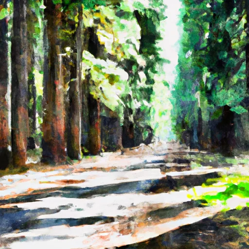
- Natural Beauty: Unity Forest State Scenic Corridor is home to a diverse range of landscapes, including dense forests, rolling hills, and picturesque meadows. Visitors can enjoy the tranquil atmosphere and immerse themselves in the beauty of nature.
- Hiking and Trails: The corridor offers several hiking trails, varying in difficulty and length, that allow visitors to explore the area's unique flora and fauna. These trails offer stunning views and opportunities for wildlife spotting.
- Camping and Picnicking: Unity Forest State Scenic Corridor provides multiple well-maintained campsites and picnic areas, allowing visitors to enjoy overnight stays or leisurely picnics surrounded by nature.
2. Points of interest:
- East Fork Canyon: This scenic canyon within the corridor is known for its breathtaking views, offering a chance to witness the dramatic landscapes carved by the East Fork of the John Day River.
- Wildlife Viewing: Unity Forest State Scenic Corridor is home to a variety of wildlife, including deer, elk, coyotes, and numerous bird species. Birdwatchers and wildlife enthusiasts will especially enjoy exploring the area.
- Historic Sites: The corridor encompasses remnants of early pioneer settlements, providing a glimpse into the region's history. The historic Unity Guard Station is worth a visit, showcasing an authentic ranger station from the 1930s.
3. Interesting facts:
- Unity Forest State Scenic Corridor is part of the larger John Day River Basin, which is recognized as one of the longest free-flowing rivers in the contiguous United States.
- The corridor spans approximately 26 miles and covers an area of over 6,000 acres, ensuring ample space for exploration and recreation.
- The region's forests primarily consist of Douglas fir, ponderosa pine, and western larch, creating a visually appealing and ecologically diverse environment.
4. Best time to visit:
The ideal time to visit Unity Forest State Scenic Corridor is during the late spring and summer months, typically between May and September. During this time, the weather is generally pleasant, allowing for comfortable outdoor activities. Spring brings vibrant wildflowers, while summer offers opportunities for camping, hiking, and wildlife viewing. It is advisable to check the weather conditions and trail accessibility before planning a visit.
Please note that while efforts have been made to ensure accuracy, it is always recommended to cross-verify information from multiple independent sources before making travel plans.
Plan your visit down to the hour
Same weather feed Snoflo's iOS app uses -- updated continuously from NOAA / yr.no.
Next 5 days, hour by hour
Temperature line with weather symbols on top, snow + rain accumulation as columns, humidity as a dotted line.
5-day forecast table
Every 3 hours, broken out across temperature, snow, rain, humidity, and wind.
| Time | Condition | Temp (°F) | Snow (in) | Rain (in) | Humidity (%) | Wind (mps) | Wind dir |
|---|---|---|---|---|---|---|---|
| Loading detailed forecast… | |||||||
15-day temperature & precipitation
Daily temperatures, snow, and rain projected over the next two weeks.
Responsible recreation & Leave No Trace
- Know before you go
- Check the operator's site for hours, permit requirements, seasonal closures, and fire restrictions before heading out.
- Stay on trail
- Stick to marked paths to protect vegetation, prevent erosion, and avoid disturbing wildlife habitat.
- Respect wildlife
- Observe from a distance, never feed wildlife, and store food securely if camping is permitted on-site.
- Pack it in, pack it out
- Carry out all trash, food scraps, and gear. Many parks have limited or no trash service.
- Leave what you find
- Don't take rocks, plants, or artifacts. They make the park what it is for the next visitor.
Set push alerts in the Snoflo app
Save Unity Forest State Scenic Corridor as a favorite, set a custom threshold (precipitation, freezing temperatures, fire-restriction days), and the iOS app will push the moment conditions cross.
About Unity Forest State Scenic Corridor
What can I do at Unity Forest State Scenic Corridor?
Most Snoflo-tracked parks support hiking, picnicking, and wildlife viewing. Check the operator's site for activity-specific rules (camping, fishing, paddling, hunting).
How fresh is the weather data?
The hourly forecast updates throughout the day from NOAA / yr.no. Streamflow comes live from USGS streamgauges.
When is the best time to visit?
Use the 15-day temperature & precipitation outlook on this page to plan -- pick a window with comfortable temperatures and low precipitation.
How do I get to Unity Forest State Scenic Corridor?
Tap Directions in the hero above to open driving directions in Google Maps, or Open in map to center the Snoflo interactive map on the park.
Can I get alerts when conditions change?
Yes -- alerts are managed in the Snoflo iOS app. Favorite this park, set a threshold (temperature, precipitation), and you'll get a push the moment it crosses.
Park & land designation reference
A quick legend for the federal and state land categories Snoflo tracks. Each designation comes with different rules around access, recreation, and resource extraction.
- National Park
- Large protected natural areas managed by the federal government to preserve significant landscapes, ecosystems, and cultural resources; recreation is allowed but conservation is the priority.
- State Park
- Public natural or recreational areas managed by a state government, typically smaller than national parks and focused on regional natural features, recreation, and education.
- Local Park
- Community-level parks managed by cities or counties, emphasizing recreation, playgrounds, sports, and green space close to populated areas.
- Wilderness Area
- The highest level of land protection in the U.S.; designated areas where nature is left essentially untouched, with no roads, structures, or motorized motorized access permitted.
- National Recreation Area
- Areas set aside primarily for outdoor recreation (boating, hiking, fishing, often around reservoirs, rivers, or scenic landscapes); may allow more development.
- National Conservation Area (BLM)
- BLM-managed areas with special ecological, cultural, or scientific value; more protection than typical BLM land but less strict than Wilderness Areas.
- State Forest
- State-managed forests focused on habitat, watershed, recreation, and sustainable timber harvest.
- Bureau of Land Management (BLM) Land
- Vast federal lands managed for mixed use -- recreation, grazing, mining, conservation -- with fewer restrictions than national parks or forests.