Wilderness North Fork Umatilla
Community Reviews
Been here? Share the conditions.
Reviews, ratings & photos are added in the free Snoflo iOS app — rate a spot, tag the conditions, and your visit is verified by location. Add or manage your reviews from the app.

Wilderness North Fork Umatilla
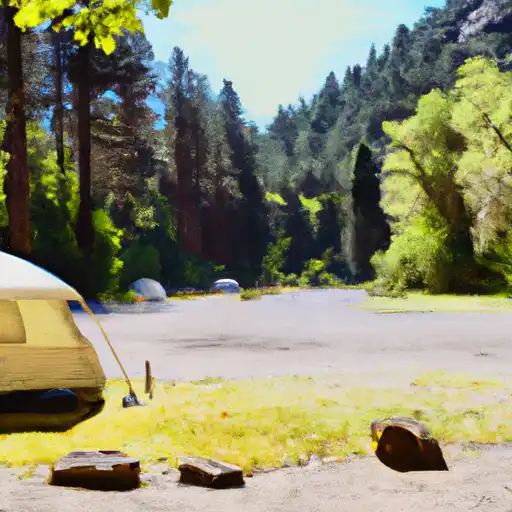
One of the main points of interest in this area is the North Fork Umatilla Wilderness, a protected area spanning over 20,000 acres. This wilderness is characterized by its diverse ecosystems, ranging from lush forests to high alpine meadows. It provides a home to a variety of wildlife, including elk, deer, black bears, and numerous bird species.
Hikers and outdoor enthusiasts will find an abundance of trails to explore, allowing them to immerse themselves in the beauty of the wilderness. One popular trail is the North Fork Umatilla Trail, which provides panoramic views of the surrounding mountains, valleys, and meadows. Additionally, the area offers opportunities for camping, fishing, and wildlife observation.
Interesting facts about the Wilderness North Fork Umatilla include its designation as a wilderness area by the U.S. Congress in 1984, ensuring its preservation and protection for future generations. The region is also home to the North Fork Umatilla River, which flows through the wilderness, providing a serene and picturesque backdrop for visitors.
The best time to visit the Wilderness North Fork Umatilla largely depends on personal preferences and desired activities. Summer months (June to August) offer pleasant weather, with temperatures ranging from 70°F to 85°F (21°C to 29°C), making it ideal for hiking and camping. Fall (September to November) showcases stunning foliage colors, creating a scenic atmosphere. However, it's worth noting that winters in this area can be harsh, with heavy snowfall, limiting certain activities.
To ensure accuracy, it is recommended to verify the information provided across multiple independent sources, such as official state park websites, travel guides, and reputable tourism organizations.
Snowpack in Wilderness North Fork Umatilla
Current snow depth at SNOTEL stations inside the park boundary.
Trails in Wilderness North Fork Umatilla
Named trails whose route falls inside the park.
Camping in Wilderness North Fork Umatilla
Campgrounds inside the park, with today's conditions score.

Plan your visit down to the hour
Same weather feed Snoflo's iOS app uses -- updated continuously from NOAA / yr.no.
Next 5 days, hour by hour
Temperature line with weather symbols on top, snow + rain accumulation as columns, humidity as a dotted line.
5-day forecast table
Every 3 hours, broken out across temperature, snow, rain, humidity, and wind.
| Time | Condition | Temp (°F) | Snow (in) | Rain (in) | Humidity (%) | Wind (mps) | Wind dir |
|---|---|---|---|---|---|---|---|
| Loading detailed forecast… | |||||||
15-day temperature & precipitation
Daily temperatures, snow, and rain projected over the next two weeks.
Responsible recreation & Leave No Trace
- Know before you go
- Check the operator's site for hours, permit requirements, seasonal closures, and fire restrictions before heading out.
- Stay on trail
- Stick to marked paths to protect vegetation, prevent erosion, and avoid disturbing wildlife habitat.
- Respect wildlife
- Observe from a distance, never feed wildlife, and store food securely if camping is permitted on-site.
- Pack it in, pack it out
- Carry out all trash, food scraps, and gear. Many parks have limited or no trash service.
- Leave what you find
- Don't take rocks, plants, or artifacts. They make the park what it is for the next visitor.
Set push alerts in the Snoflo app
Save Wilderness North Fork Umatilla as a favorite, set a custom threshold (precipitation, freezing temperatures, fire-restriction days), and the iOS app will push the moment conditions cross.
About Wilderness North Fork Umatilla
What can I do at Wilderness North Fork Umatilla?
Most Snoflo-tracked parks support hiking, picnicking, and wildlife viewing. Check the operator's site for activity-specific rules (camping, fishing, paddling, hunting).
How fresh is the weather data?
The hourly forecast updates throughout the day from NOAA / yr.no. Streamflow comes live from USGS streamgauges.
When is the best time to visit?
Use the 15-day temperature & precipitation outlook on this page to plan -- pick a window with comfortable temperatures and low precipitation.
How do I get to Wilderness North Fork Umatilla?
Tap Directions in the hero above to open driving directions in Google Maps, or Open in map to center the Snoflo interactive map on the park.
Can I get alerts when conditions change?
Yes -- alerts are managed in the Snoflo iOS app. Favorite this park, set a threshold (temperature, precipitation), and you'll get a push the moment it crosses.
Park & land designation reference
A quick legend for the federal and state land categories Snoflo tracks. Each designation comes with different rules around access, recreation, and resource extraction.
- National Park
- Large protected natural areas managed by the federal government to preserve significant landscapes, ecosystems, and cultural resources; recreation is allowed but conservation is the priority.
- State Park
- Public natural or recreational areas managed by a state government, typically smaller than national parks and focused on regional natural features, recreation, and education.
- Local Park
- Community-level parks managed by cities or counties, emphasizing recreation, playgrounds, sports, and green space close to populated areas.
- Wilderness Area
- The highest level of land protection in the U.S.; designated areas where nature is left essentially untouched, with no roads, structures, or motorized motorized access permitted.
- National Recreation Area
- Areas set aside primarily for outdoor recreation (boating, hiking, fishing, often around reservoirs, rivers, or scenic landscapes); may allow more development.
- National Conservation Area (BLM)
- BLM-managed areas with special ecological, cultural, or scientific value; more protection than typical BLM land but less strict than Wilderness Areas.
- State Forest
- State-managed forests focused on habitat, watershed, recreation, and sustainable timber harvest.
- Bureau of Land Management (BLM) Land
- Vast federal lands managed for mixed use -- recreation, grazing, mining, conservation -- with fewer restrictions than national parks or forests.