Umatilla Forks Campground
Community Reviews
Been here? Share the conditions.
Reviews, ratings & photos are added in the free Snoflo iOS app — rate a spot, tag the conditions, and your visit is verified by location. Add or manage your reviews from the app.
Umatilla Forks
There are several nearby points of interest, including the historic town of Ukiah and the Umatilla National Forest, which offers miles of hiking trails and scenic drives. Additionally, a short drive away is the Wildhorse Resort and Casino, where visitors can enjoy gaming, dining, and live entertainment.
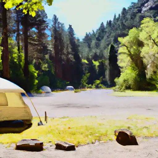
The Umatilla Forks camping area offers amenities such as picnic tables, fire pits, and vault toilets. It is a first-come, first-served campground with 12 campsites available.
An interesting fact about the area is that it was once a mining town in the late 1800s and early 1900s. The nearby town of Granite was a hub for gold and silver mining and boasted a population of over 2,000 residents at one point.
The best time of year to visit Umatilla Forks camping area is from May to September with average temperatures ranging from 60-80°F. However, visitors should be prepared for cooler temperatures at night and occasional rainfall. Overall, this campground offers a peaceful and scenic getaway for nature lovers and history enthusiasts alike.
What's on-site at Umatilla Forks
Key facilities Snoflo tracks for this campground. Confirm with the operator before booking -- amenities can change seasonally.
Plan your trip down to the hour
Same weather feed Snoflo's iOS app uses -- updated continuously from NOAA / yr.no.
Next 5 days, hour by hour
Temperature line with weather symbols on top, snow + rain accumulation as columns, humidity as a dotted line.
5-day forecast table
Every 3 hours, broken out across temperature, snow, rain, humidity, and wind. Each cell is colour-coded relative to the column min/max so trends jump out at a glance.
| Time | Condition | Temp (°F) | Snow (in) | Rain (in) | Humidity (%) | Wind (mps) | Wind dir |
|---|---|---|---|---|---|---|---|
| Loading detailed forecast… | |||||||
15-day temperature & precipitation
Daily temperatures, snow, and rain projected over the next two weeks. Hover any point for the full breakdown.
Nearby streamflow
USGS streamgauges within reach of Umatilla Forks -- pulled live from the National Water Information System.
| Streamgauge | Discharge | View |
|---|---|---|
| Umatilla River Above Meacham Creek | 33 cfs | → |
| Meacham Creek At Gibbon | 12 cfs | → |
| Mill Creek Near Walla Walla | 32 cfs | → |
| Minam River Near Minam | 102 cfs | → |
| Mill Creek At Walla Walla | 8 cfs | → |
| Mill Creek At Five Mile Rd Br Nr Walla Walla | 634 cfs | → |
Nearby snow depths
NRCS SNOTEL stations within reach of Umatilla Forks -- relevant when planning a shoulder-season or alpine trip.
| SNOTEL station | Snowpack | 24h Snowfall | View |
|---|---|---|---|
| High Ridge | 0.0 in | 0.0 in | → |
| Nohrsc High Ridge | 0.0 in | 0.0 in | → |
| Emigrant Springs | 0.0 in | 0.0 in | → |
| Nohrsc Milk Shakes | 1.0 in | 0.0 in | → |
| Milk Shakes | 2.0 in | 1.0 in | → |
| Bowman Springs | 0.0 in | 0.0 in | → |
Plan a longer trip
The closest parks, lakes, boat launches, and paddle runs so a camping night can grow into a full weekend.
Parks
- Wilderness North Fork Umatilla
- Emigrant Springs State Heritage Area
- Blue Mountain Forest State Scenic Corridor
- Minam State Recreation Area
- Murr Sports Park
- Tietan Park
Boat launches
Camping essentials & Leave No Trace
- Pack it in, pack it out
- Take all trash, food scraps, and gear back with you to keep campsites clean and protect wildlife.
- Respect wildlife
- Observe animals from a distance, store food securely, and never feed wildlife to maintain natural behavior and safety.
- Know before you go
- Check weather, fire restrictions, trail conditions, and permit requirements to ensure a safe and well-planned trip.
- Minimize campfire impact
- Use established fire rings, keep fires small, fully extinguish them, or opt for a camp stove when fires are restricted.
- Leave what you find
- Preserve natural and cultural features by avoiding removal of plants, rocks, artifacts, or other elements of the environment.
Set push alerts in the Snoflo app
Save Umatilla Forks as a favorite, set a custom threshold (precipitation, snowpack, freezing temperatures), and the iOS app will push the moment conditions cross.
About Umatilla Forks
Can I make reservations at Umatilla Forks?
This campground does not appear to accept reservations -- it's typically first-come, first-served. Arrive early on summer weekends.
How fresh is the weather data on this page?
The hourly forecast updates throughout the day from the NOAA / yr.no public feeds. Streamflow data is pulled live from USGS streamgauges and snowpack from the NRCS SNOTEL network.
What's the best time of year to visit?
Use the 15-day temperature & precipitation outlook on this page to plan -- pick a window with comfortable temperatures and low precipitation. For longer trips, the 5-day hourly meteogram shows snow + rain accumulation hour-by-hour.
How do I get to Umatilla Forks?
Tap Directions in the hero above to open driving directions in Google Maps, or Open in map to center the Snoflo interactive map on the campground.
Can I get alerts when conditions change?
Yes -- alerts are managed through the Snoflo iOS app. Favorite this campground, set a threshold (temperature, snowpack, precipitation), and you'll get a push the moment it crosses.