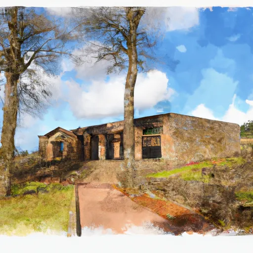
Willamette Stone State Heritage Site
Community Reviews
Been here? Share the conditions.
Reviews, ratings & photos are added in the free Snoflo iOS app — rate a spot, tag the conditions, and your visit is verified by location. Add or manage your reviews from the app.
Willamette Stone State Heritage Site
Reasons to Visit:
1. Historical Significance: Willamette Stone is the point from which all public land surveys in Oregon were initially measured starting in 1851. It played a crucial role in the establishment of the state's land ownership system.
2. Cultural Icon: As a state heritage site, it offers visitors a chance to connect with Oregon's rich history and appreciate the efforts made to accurately measure and divide the land.
3. Natural Surroundings: The site is set amidst beautiful surroundings, providing opportunities for scenic walks and picnics.
Points of Interest:
1. Willamette Stone Monument: The main attraction is the stone monument marking the initial point of surveys. This monument is a replica, as the original, which was a small stone embedded in the ground, deteriorated over time.
2. Informational Signage: The site features informative signs detailing the history and significance of the Willamette Stone, offering visitors an educational experience.
Interesting Facts:
1. Location: Willamette Stone State Heritage Site is situated at the confluence of Washington, Multnomah, and Yamhill counties, near the town of Hillsboro, Oregon.
2. Initial Point: The initial point established at Willamette Stone was used as the basis for nearly all land surveys in Oregon, covering millions of acres.
3. International Boundary: The original stone marked not only the starting point for Oregon's land surveys but also the boundary line between the United States and the Oregon Territory, which stretched north to Canada.
Best Time to Visit:
The best time to visit Willamette Stone State Heritage Site is during the spring and summer months (April to September) when the weather is usually pleasant, and the surrounding landscape is vibrant and picturesque. It is advisable to check the weather forecast before planning a visit, as rainy conditions can dampen the experience.
Accuracy Verification:
To ensure accuracy, it is recommended to refer to multiple independent sources such as:
1. Oregon State Parks official website: https://stateparks.oregon.gov/index.cfm?do=park.profile&parkId=169
2. Local tourism websites or visitor information centers in Oregon.
3. Oregon historical societies or organizations specializing in Oregon history.
4. Travel blogs or articles from reputable sources like Lonely Planet or National Geographic.
Plan your visit down to the hour
Same weather feed Snoflo's iOS app uses -- updated continuously from NOAA / yr.no.
Next 5 days, hour by hour
Temperature line with weather symbols on top, snow + rain accumulation as columns, humidity as a dotted line.
5-day forecast table
Every 3 hours, broken out across temperature, snow, rain, humidity, and wind.
| Time | Condition | Temp (°F) | Snow (in) | Rain (in) | Humidity (%) | Wind (mps) | Wind dir |
|---|---|---|---|---|---|---|---|
| Loading detailed forecast… | |||||||
15-day temperature & precipitation
Daily temperatures, snow, and rain projected over the next two weeks.
Responsible recreation & Leave No Trace
- Know before you go
- Check the operator's site for hours, permit requirements, seasonal closures, and fire restrictions before heading out.
- Stay on trail
- Stick to marked paths to protect vegetation, prevent erosion, and avoid disturbing wildlife habitat.
- Respect wildlife
- Observe from a distance, never feed wildlife, and store food securely if camping is permitted on-site.
- Pack it in, pack it out
- Carry out all trash, food scraps, and gear. Many parks have limited or no trash service.
- Leave what you find
- Don't take rocks, plants, or artifacts. They make the park what it is for the next visitor.
Set push alerts in the Snoflo app
Save Willamette Stone State Heritage Site as a favorite, set a custom threshold (precipitation, freezing temperatures, fire-restriction days), and the iOS app will push the moment conditions cross.
About Willamette Stone State Heritage Site
What can I do at Willamette Stone State Heritage Site?
Most Snoflo-tracked parks support hiking, picnicking, and wildlife viewing. Check the operator's site for activity-specific rules (camping, fishing, paddling, hunting).
How fresh is the weather data?
The hourly forecast updates throughout the day from NOAA / yr.no. Streamflow comes live from USGS streamgauges.
When is the best time to visit?
Use the 15-day temperature & precipitation outlook on this page to plan -- pick a window with comfortable temperatures and low precipitation.
How do I get to Willamette Stone State Heritage Site?
Tap Directions in the hero above to open driving directions in Google Maps, or Open in map to center the Snoflo interactive map on the park.
Can I get alerts when conditions change?
Yes -- alerts are managed in the Snoflo iOS app. Favorite this park, set a threshold (temperature, precipitation), and you'll get a push the moment it crosses.
Park & land designation reference
A quick legend for the federal and state land categories Snoflo tracks. Each designation comes with different rules around access, recreation, and resource extraction.
- National Park
- Large protected natural areas managed by the federal government to preserve significant landscapes, ecosystems, and cultural resources; recreation is allowed but conservation is the priority.
- State Park
- Public natural or recreational areas managed by a state government, typically smaller than national parks and focused on regional natural features, recreation, and education.
- Local Park
- Community-level parks managed by cities or counties, emphasizing recreation, playgrounds, sports, and green space close to populated areas.
- Wilderness Area
- The highest level of land protection in the U.S.; designated areas where nature is left essentially untouched, with no roads, structures, or motorized motorized access permitted.
- National Recreation Area
- Areas set aside primarily for outdoor recreation (boating, hiking, fishing, often around reservoirs, rivers, or scenic landscapes); may allow more development.
- National Conservation Area (BLM)
- BLM-managed areas with special ecological, cultural, or scientific value; more protection than typical BLM land but less strict than Wilderness Areas.
- State Forest
- State-managed forests focused on habitat, watershed, recreation, and sustainable timber harvest.
- Bureau of Land Management (BLM) Land
- Vast federal lands managed for mixed use -- recreation, grazing, mining, conservation -- with fewer restrictions than national parks or forests.