White Hills State Wildlife Area
Community Reviews
Been here? Share the conditions.
Reviews, ratings & photos are added in the free Snoflo iOS app — rate a spot, tag the conditions, and your visit is verified by location. Add or manage your reviews from the app.
White Hills State Wildlife Area
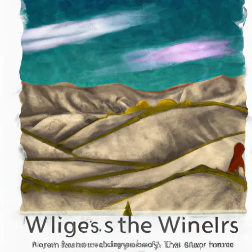
One of the main reasons to visit White Hills State Wildlife Area is its stunning landscape. The area features a mix of desert, grassland, and wetland habitats, providing a rich environment for various wildlife species. Visitors can enjoy breathtaking views of the White Hills mountain range and the surrounding valleys.
The wildlife area is home to a diverse range of animals, including pronghorn antelope, mule deer, coyotes, and various bird species. Birdwatchers will particularly enjoy the area, as it serves as a critical resting and breeding place for migratory birds. Raptors, such as hawks and eagles, can be spotted soaring above the area's rugged terrain.
One of the notable points of interest in White Hills State Wildlife Area is the Utah Lake shoreline, providing opportunities for fishing, boating, and picnicking. Fishing enthusiasts can try their luck catching species like channel catfish, walleye, and black bass in the lake's abundant waters. The area also features a network of hiking and biking trails, allowing visitors to explore the diverse ecosystem up close.
Interesting facts about the area include its historical significance. Native American artifacts and petroglyphs can be found in some areas, offering glimpses into the region's rich cultural heritage.
The best time to visit White Hills State Wildlife Area is during spring and fall. Spring brings vibrant wildflowers and migratory bird activity, while fall offers stunning foliage colors. Summers can be hot, so visitors should plan accordingly and bring plenty of water.
To ensure accuracy, it is recommended to verify information from multiple independent sources, such as the official website of Utah Division of Wildlife Resources or reputable travel guides.
Trails in White Hills State Wildlife Area
Named trails whose route falls inside the park.
Plan your visit down to the hour
Same weather feed Snoflo's iOS app uses -- updated continuously from NOAA / yr.no.
Next 5 days, hour by hour
Temperature line with weather symbols on top, snow + rain accumulation as columns, humidity as a dotted line.
5-day forecast table
Every 3 hours, broken out across temperature, snow, rain, humidity, and wind.
| Time | Condition | Temp (°F) | Snow (in) | Rain (in) | Humidity (%) | Wind (mps) | Wind dir |
|---|---|---|---|---|---|---|---|
| Loading detailed forecast… | |||||||
15-day temperature & precipitation
Daily temperatures, snow, and rain projected over the next two weeks.
Responsible recreation & Leave No Trace
- Know before you go
- Check the operator's site for hours, permit requirements, seasonal closures, and fire restrictions before heading out.
- Stay on trail
- Stick to marked paths to protect vegetation, prevent erosion, and avoid disturbing wildlife habitat.
- Respect wildlife
- Observe from a distance, never feed wildlife, and store food securely if camping is permitted on-site.
- Pack it in, pack it out
- Carry out all trash, food scraps, and gear. Many parks have limited or no trash service.
- Leave what you find
- Don't take rocks, plants, or artifacts. They make the park what it is for the next visitor.
Set push alerts in the Snoflo app
Save White Hills State Wildlife Area as a favorite, set a custom threshold (precipitation, freezing temperatures, fire-restriction days), and the iOS app will push the moment conditions cross.
About White Hills State Wildlife Area
What can I do at White Hills State Wildlife Area?
Most Snoflo-tracked parks support hiking, picnicking, and wildlife viewing. Check the operator's site for activity-specific rules (camping, fishing, paddling, hunting).
How fresh is the weather data?
The hourly forecast updates throughout the day from NOAA / yr.no. Streamflow comes live from USGS streamgauges.
When is the best time to visit?
Use the 15-day temperature & precipitation outlook on this page to plan -- pick a window with comfortable temperatures and low precipitation.
How do I get to White Hills State Wildlife Area?
Tap Directions in the hero above to open driving directions in Google Maps, or Open in map to center the Snoflo interactive map on the park.
Can I get alerts when conditions change?
Yes -- alerts are managed in the Snoflo iOS app. Favorite this park, set a threshold (temperature, precipitation), and you'll get a push the moment it crosses.
Park & land designation reference
A quick legend for the federal and state land categories Snoflo tracks. Each designation comes with different rules around access, recreation, and resource extraction.
- National Park
- Large protected natural areas managed by the federal government to preserve significant landscapes, ecosystems, and cultural resources; recreation is allowed but conservation is the priority.
- State Park
- Public natural or recreational areas managed by a state government, typically smaller than national parks and focused on regional natural features, recreation, and education.
- Local Park
- Community-level parks managed by cities or counties, emphasizing recreation, playgrounds, sports, and green space close to populated areas.
- Wilderness Area
- The highest level of land protection in the U.S.; designated areas where nature is left essentially untouched, with no roads, structures, or motorized motorized access permitted.
- National Recreation Area
- Areas set aside primarily for outdoor recreation (boating, hiking, fishing, often around reservoirs, rivers, or scenic landscapes); may allow more development.
- National Conservation Area (BLM)
- BLM-managed areas with special ecological, cultural, or scientific value; more protection than typical BLM land but less strict than Wilderness Areas.
- State Forest
- State-managed forests focused on habitat, watershed, recreation, and sustainable timber harvest.
- Bureau of Land Management (BLM) Land
- Vast federal lands managed for mixed use -- recreation, grazing, mining, conservation -- with fewer restrictions than national parks or forests.