Underhill State Park
Community Reviews
Been here? Share the conditions.
Reviews, ratings & photos are added in the free Snoflo iOS app — rate a spot, tag the conditions, and your visit is verified by location. Add or manage your reviews from the app.
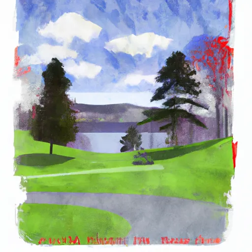
Underhill State Park
One of the primary reasons to visit Underhill State Park is its extensive network of hiking trails. The park is home to Vermont's highest peak, Mount Mansfield, which stands at an impressive 4,393 feet. The Long Trail, a popular hiking trail that extends along the Green Mountains, can also be accessed from the park. Hikers can enjoy challenging treks to the summit of Mount Mansfield, witnessing breathtaking views of the surrounding valleys and Lake Champlain from the top.
In addition to hiking opportunities, Underhill State Park boasts several other notable points of interest. The park encompasses a diverse range of ecosystems, including dense forests, alpine tundra, and unique flora and fauna. It is particularly renowned for its wildflowers, with vibrant displays of trillium, lady slippers, and other native species during the spring and summer months. The park's rugged cliffs and rocky outcrops provide ideal habitats for peregrine falcons, offering a chance for birdwatchers to spot these majestic birds.
For those interested in local history, Underhill State Park is located in close proximity to the historic Underhill Village, known for its well-preserved 19th-century architecture and charming ambiance. Visitors can explore the village's quaint shops, visit the historic Underhill Town Hall, or attend community events that celebrate the area's heritage.
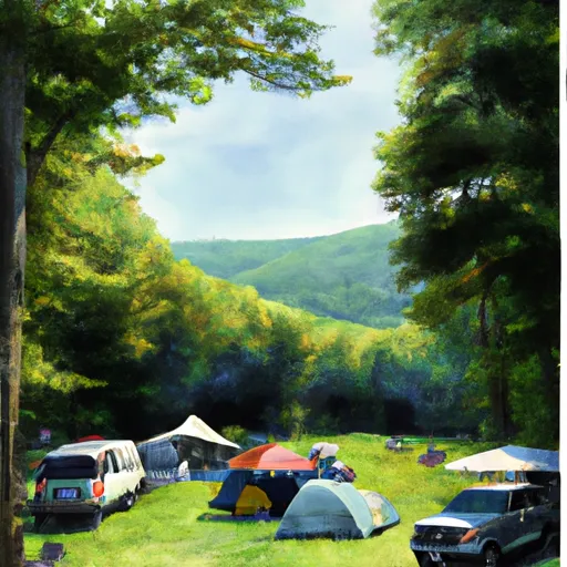
The best time to visit Underhill State Park largely depends on individual preferences and desired activities. The park offers a spectrum of experiences throughout the year. Spring brings blooming wildflowers and pleasant temperatures, making it an excellent time to hike and witness the rejuvenation of nature. Summer offers warmer weather and longer daylight hours, providing ample opportunities for outdoor activities such as camping, picnicking, and wildlife observation. Autumn paints the park in vibrant colors as the foliage reaches its peak, creating a breathtaking backdrop for hiking and photography. Winter transforms Underhill State Park into a winter wonderland, attracting snowshoers and cross-country skiers to explore the snowy trails.
To ensure accuracy, it is always recommended to cross-reference information about Underhill State Park from multiple independent sources, such as official park websites, visitor guides, and reputable travel websites.
Snowpack in Underhill State Park
Current snow depth at SNOTEL stations inside the park boundary.
Trails in Underhill State Park
Named trails whose route falls inside the park.
Camping in Underhill State Park
Campgrounds inside the park, with today's conditions score.

Plan your visit down to the hour
Same weather feed Snoflo's iOS app uses -- updated continuously from NOAA / yr.no.
Next 5 days, hour by hour
Temperature line with weather symbols on top, snow + rain accumulation as columns, humidity as a dotted line.
5-day forecast table
Every 3 hours, broken out across temperature, snow, rain, humidity, and wind.
| Time | Condition | Temp (°F) | Snow (in) | Rain (in) | Humidity (%) | Wind (mps) | Wind dir |
|---|---|---|---|---|---|---|---|
| Loading detailed forecast… | |||||||
15-day temperature & precipitation
Daily temperatures, snow, and rain projected over the next two weeks.
Responsible recreation & Leave No Trace
- Know before you go
- Check the operator's site for hours, permit requirements, seasonal closures, and fire restrictions before heading out.
- Stay on trail
- Stick to marked paths to protect vegetation, prevent erosion, and avoid disturbing wildlife habitat.
- Respect wildlife
- Observe from a distance, never feed wildlife, and store food securely if camping is permitted on-site.
- Pack it in, pack it out
- Carry out all trash, food scraps, and gear. Many parks have limited or no trash service.
- Leave what you find
- Don't take rocks, plants, or artifacts. They make the park what it is for the next visitor.
Set push alerts in the Snoflo app
Save Underhill State Park as a favorite, set a custom threshold (precipitation, freezing temperatures, fire-restriction days), and the iOS app will push the moment conditions cross.
About Underhill State Park
What can I do at Underhill State Park?
Most Snoflo-tracked parks support hiking, picnicking, and wildlife viewing. Check the operator's site for activity-specific rules (camping, fishing, paddling, hunting).
How fresh is the weather data?
The hourly forecast updates throughout the day from NOAA / yr.no. Streamflow comes live from USGS streamgauges.
When is the best time to visit?
Use the 15-day temperature & precipitation outlook on this page to plan -- pick a window with comfortable temperatures and low precipitation.
How do I get to Underhill State Park?
Tap Directions in the hero above to open driving directions in Google Maps, or Open in map to center the Snoflo interactive map on the park.
Can I get alerts when conditions change?
Yes -- alerts are managed in the Snoflo iOS app. Favorite this park, set a threshold (temperature, precipitation), and you'll get a push the moment it crosses.
Park & land designation reference
A quick legend for the federal and state land categories Snoflo tracks. Each designation comes with different rules around access, recreation, and resource extraction.
- National Park
- Large protected natural areas managed by the federal government to preserve significant landscapes, ecosystems, and cultural resources; recreation is allowed but conservation is the priority.
- State Park
- Public natural or recreational areas managed by a state government, typically smaller than national parks and focused on regional natural features, recreation, and education.
- Local Park
- Community-level parks managed by cities or counties, emphasizing recreation, playgrounds, sports, and green space close to populated areas.
- Wilderness Area
- The highest level of land protection in the U.S.; designated areas where nature is left essentially untouched, with no roads, structures, or motorized motorized access permitted.
- National Recreation Area
- Areas set aside primarily for outdoor recreation (boating, hiking, fishing, often around reservoirs, rivers, or scenic landscapes); may allow more development.
- National Conservation Area (BLM)
- BLM-managed areas with special ecological, cultural, or scientific value; more protection than typical BLM land but less strict than Wilderness Areas.
- State Forest
- State-managed forests focused on habitat, watershed, recreation, and sustainable timber harvest.
- Bureau of Land Management (BLM) Land
- Vast federal lands managed for mixed use -- recreation, grazing, mining, conservation -- with fewer restrictions than national parks or forests.