The Cedars State Natural Area Preserve
Community Reviews
Been here? Share the conditions.
Reviews, ratings & photos are added in the free Snoflo iOS app — rate a spot, tag the conditions, and your visit is verified by location. Add or manage your reviews from the app.
The Cedars State Natural Area Preserve
Reasons to Visit:
1. Biodiversity: The preserve is recognized for its exceptional biodiversity, encompassing various habitats such as wetlands, upland forests, and rare plant communities. It offers nature enthusiasts and researchers a chance to explore and appreciate the diverse flora and fauna of Virginia.
2. Rare Species: The area is home to several rare and threatened plant and animal species, making it an ideal location for wildlife enthusiasts and conservationists.
3. Educational Opportunities: The preserve provides educational programs and interpretive trails for visitors, offering a chance to learn about the unique ecosystems and conservation efforts in the area.
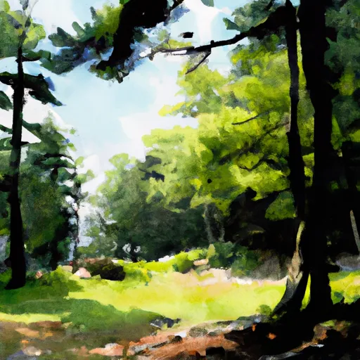
4. Scenic Beauty: The natural area boasts picturesque landscapes, including stunning views of the Clinch River, making it a great destination for photographers and nature lovers alike.
Points of Interest:
1. The Clinch River: The preserve is situated along the Clinch River, known for its exceptional water quality and biodiversity. Visitors can enjoy fishing, kayaking, or simply taking in the scenic beauty of this pristine river.
2. Unique Plant Communities: The Cedars State Natural Area Preserve is renowned for its globally rare plant communities, including montane pine-oak forests and Appalachian hemlock forests. These ecosystems provide habitats for a diverse range of plant species.
3. Wildlife: The preserve supports a variety of wildlife, including the state-endangered Eastern hellbender salamander, timber rattlesnakes, and various migratory birds.
Interesting Facts:
1. The Cedars State Natural Area Preserve covers approximately 436 acres and was established in 1986 to protect its unique ecological features.
2. It is home to over 50 rare plant species, including the globally rare running buffalo clover and persistent trillium.
3. The preserve is part of the larger Clinch River Environmental Studies Organization (CRESO) project, which aims to promote research, education, and conservation efforts in the Clinch River Valley.
Best Time to Visit:
The best time to visit The Cedars State Natural Area Preserve is during the spring and fall seasons when the weather is pleasant, and the vegetation is most vibrant. Springtime offers a chance to witness blooming wildflowers, while the fall showcases the beautiful autumn foliage. However, it is advisable to check with local authorities or the preserve's official website for specific opening hours and seasonal closures.
Please note that as information can change over time, it is always recommended to verify the accuracy and current conditions of The Cedars State Natural Area Preserve before planning a visit.
Plan your visit down to the hour
Same weather feed Snoflo's iOS app uses -- updated continuously from NOAA / yr.no.
Next 5 days, hour by hour
Temperature line with weather symbols on top, snow + rain accumulation as columns, humidity as a dotted line.
5-day forecast table
Every 3 hours, broken out across temperature, snow, rain, humidity, and wind.
| Time | Condition | Temp (°F) | Snow (in) | Rain (in) | Humidity (%) | Wind (mps) | Wind dir |
|---|---|---|---|---|---|---|---|
| Loading detailed forecast… | |||||||
15-day temperature & precipitation
Daily temperatures, snow, and rain projected over the next two weeks.
Responsible recreation & Leave No Trace
- Know before you go
- Check the operator's site for hours, permit requirements, seasonal closures, and fire restrictions before heading out.
- Stay on trail
- Stick to marked paths to protect vegetation, prevent erosion, and avoid disturbing wildlife habitat.
- Respect wildlife
- Observe from a distance, never feed wildlife, and store food securely if camping is permitted on-site.
- Pack it in, pack it out
- Carry out all trash, food scraps, and gear. Many parks have limited or no trash service.
- Leave what you find
- Don't take rocks, plants, or artifacts. They make the park what it is for the next visitor.
Set push alerts in the Snoflo app
Save The Cedars State Natural Area Preserve as a favorite, set a custom threshold (precipitation, freezing temperatures, fire-restriction days), and the iOS app will push the moment conditions cross.
About The Cedars State Natural Area Preserve
What can I do at The Cedars State Natural Area Preserve?
Most Snoflo-tracked parks support hiking, picnicking, and wildlife viewing. Check the operator's site for activity-specific rules (camping, fishing, paddling, hunting).
How fresh is the weather data?
The hourly forecast updates throughout the day from NOAA / yr.no. Streamflow comes live from USGS streamgauges.
When is the best time to visit?
Use the 15-day temperature & precipitation outlook on this page to plan -- pick a window with comfortable temperatures and low precipitation.
How do I get to The Cedars State Natural Area Preserve?
Tap Directions in the hero above to open driving directions in Google Maps, or Open in map to center the Snoflo interactive map on the park.
Can I get alerts when conditions change?
Yes -- alerts are managed in the Snoflo iOS app. Favorite this park, set a threshold (temperature, precipitation), and you'll get a push the moment it crosses.
Park & land designation reference
A quick legend for the federal and state land categories Snoflo tracks. Each designation comes with different rules around access, recreation, and resource extraction.
- National Park
- Large protected natural areas managed by the federal government to preserve significant landscapes, ecosystems, and cultural resources; recreation is allowed but conservation is the priority.
- State Park
- Public natural or recreational areas managed by a state government, typically smaller than national parks and focused on regional natural features, recreation, and education.
- Local Park
- Community-level parks managed by cities or counties, emphasizing recreation, playgrounds, sports, and green space close to populated areas.
- Wilderness Area
- The highest level of land protection in the U.S.; designated areas where nature is left essentially untouched, with no roads, structures, or motorized motorized access permitted.
- National Recreation Area
- Areas set aside primarily for outdoor recreation (boating, hiking, fishing, often around reservoirs, rivers, or scenic landscapes); may allow more development.
- National Conservation Area (BLM)
- BLM-managed areas with special ecological, cultural, or scientific value; more protection than typical BLM land but less strict than Wilderness Areas.
- State Forest
- State-managed forests focused on habitat, watershed, recreation, and sustainable timber harvest.
- Bureau of Land Management (BLM) Land
- Vast federal lands managed for mixed use -- recreation, grazing, mining, conservation -- with fewer restrictions than national parks or forests.