Flood Watch
2026-11-02T05:00:00-07:00

* WHAT...Flooding caused by excessive rainfall is possible. * WHERE...A portion of Southeast Arizona, including the following areas, Baboquivari Mountains, Catalina and Rincon Mountains, Dragoon and Mule and Huachuca and Santa Rita Mountains, Galiuro and Pinaleno Mountains, South Central Pinal County, Southeast Pinal County, Tohono O'odham Nation, Tucson Metro Area, Upper Gila River Valley, Upper San Pedro River Valley, Upper Santa Cruz River Valley/Altar Valley and White Mountains of Graham and Greenlee Counties. * WHEN...From Saturday evening through early Monday morning. * IMPACTS...Excessive runoff may result in flooding of rivers, creeks, streams, and other low-lying and flood-prone locations. Flooding may occur in poor drainage and urban areas. Low-water crossings may be flooded. * ADDITIONAL DETAILS... - A strong weather system approaching the area will bring widespread to numerous showers Sunday, November 1. Moderate to locally heavy rainfall with rainfall totals 0.5 to 1 inch possible in the valleys and 1 to 2+ inches possible in the mountains. - http://www.weather.gov/safety/flood
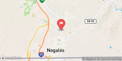
Nogales Wash At Nogales Ariz Historical Data

Historical Data


Streamflow Range


Date Average 2026 2025 2022 2021 2020 2019 2018 2017 2016 2015 2014 2013 2012 2011
01-01 5.02
01-02 2.52
01-03 3.01
01-04 3.31
01-05 3.98
01-06 3.38
01-07 3.49
01-08 9.9
01-09 3.62
01-10 3.89
01-11 3.35
01-12 2.99
01-13 3.25
01-14 3.45
01-15 3.33
01-16 3.41
01-17 3.18
01-18 3.05
01-19 3.65
01-20 3.43
01-21 18.99
01-22 3.45
01-23 28.56
01-24 3.24
01-25 31.81
01-26 2.61
01-27 8.68
01-28 3.53
01-29 3.31
01-30 4.05
01-31 5.07
02-01 3.9
02-02 3.11
02-03 3.05
02-04 3.7
02-05 3.17
02-06 3.53
02-07 3.49
02-08 3.74
02-09 3.19
02-10 3.35
02-11 3.72
02-12 3.48
02-13 3.47
02-14 3.65
02-15 27.22
02-16 4.27
02-17 5.59
02-18 3.29
02-19 11.39
02-20 3.35
02-21 3.59
02-22 7.78
02-23 3.45
02-24 3.31
02-25 3.4
02-26 3.32
02-27 3.27
02-28 3.23
02-29 2.86
03-01 3.2
03-02 4.18
03-03 3.31
03-04 3.35
03-05 3.47
03-06 3.4
03-07 3.33
03-08 3.86
03-09 4.29
03-10 8.05
03-11 3.05
03-12 20.08
03-13 6.71
03-14 3.41
03-15 3.1
03-16 2.95
03-17 2.97
03-18 2.75
03-19 4.77
03-20 3.55
03-21 3.77
03-22 3.09
03-23 3.76
03-24 3.29
03-25 3.29
03-26 3.7
03-27 3.72
03-28 3.23
03-29 3.95
03-30 3.36
03-31 3.25
04-01 3.22
04-02 3.76
04-03 3.87
04-04 3.92
04-05 3.27
04-06 3.44
04-07 3.08
04-08 5.56
04-09 2.92
04-10 3.09
04-11 3.05
04-12 3.2
04-13 4.33
04-14 3.59
04-15 3.64
04-16 3.53
04-17 3.39
04-18 3.36
04-19 3.13
04-20 3.1
04-21 3.25
04-22 3.14
04-23 2.82
04-24 3.15
04-25 3.01
04-26 2.39
04-27 2.58
04-28 2.47
04-29 2.75
04-30 175.3
05-01 2.91
05-02 2.44
05-03 2.71
05-04 2.71
05-05 2.68
05-06 2.51
05-07 2.99
05-08 2.93
05-09 2.57
05-10 3.08
05-11 2.72
05-12 2.46
05-13 2.46
05-14 2.5
05-15 2.2
05-16 2.63
05-17 2.66
05-18 2.81
05-19 2.78
05-20 2.88
05-21 2.64
05-22 2.64
05-23 3.01
05-24 2.95
05-25 3.05
05-26 3.27
05-27 2.9
05-28 2.37
05-29 2.64
05-30 1.96
05-31 2.14
06-01 2.24
06-02 2.41
06-03 2.19
06-04 2.09
06-05 2.13
06-06 2.31
06-07 2.52
06-08 2.14
06-09 2.94
06-10 2.36
06-11 2.51
06-12 2.4
06-13 2.52
06-14 2.3
06-15 2.43
06-16 2.31
06-17 2.37
06-18 2.94
06-19 2.89
06-20 2.61
06-21 2.77
06-22 2.75
06-23 2.98
06-24 3.09
06-25 2.63
06-26 2.65
06-27 3.12
06-28 2.76
06-29 2.89
06-30 2.63
07-01 2.75
07-02 2.64
07-03 7.71
07-04 18.68
07-05 3.04
07-06 2.74
07-07 3.67
07-08 3.38
07-09 3.29
07-10 79.76
07-11 2.96
07-12 3.6
07-13 40.14
07-14 3.31
07-15 3.81
07-16 53.92
07-17 6.84
07-18 4.89
07-19 7.44
07-20 11.85
07-21 25.91
07-22 6.19
07-23 11.58
07-24 9.07
07-25 33.83
07-26 5.42
07-27 82.98
07-28 22.33
07-29 9.62
07-30 8.0
07-31 8.49
08-01 223.83
08-02 52.23
08-03 23.67
08-04 8.78
08-05 7.19
08-06 29.54
08-07 16.09
08-08 18.43
08-09 14.14
08-10 9.03
08-11 5.19
08-12 7.38
08-13 21.69
08-14 95.11
08-15 46.18
08-16 10.47
08-17 10.63
08-18 8.72
08-19 6.81
08-20 11.03
08-21 8.82
08-22 8.58
08-23 5.06
08-24 10.66
08-25 7.2
08-26 6.26
08-27 10.31
08-28 6.48
08-29 7.98
08-30 7.53
08-31 6.74
09-01 7.74
09-02 8.41
09-03 7.94
09-04 8.91
09-05 9.12
09-06 7.03
09-07 6.69
09-08 7.37
09-09 6.5
09-10 15.54
09-11 6.28
09-12 5.86
09-13 5.07
09-14 4.63
09-15 4.91
09-16 4.3
09-17 6.73
09-18 76.32
09-19 6.66
09-20 6.29
09-21 5.77
09-22 6.59
09-23 6.26
09-24 5.41
09-25 4.83
09-26 5.33
09-27 8.57
09-28 4.04
09-29 4.58
09-30 4.63
10-01 3.54
10-02 4.04
10-03 3.78
10-04 4.33
10-05 4.79
10-06 3.79
10-07 3.64
10-08 5.09
10-09 3.74
10-10 3.78
10-11 3.91
10-12 3.41
10-13 13.58
10-14 4.51
10-15 3.34
10-16 7.54
10-17 6.1
10-18 3.42
10-19 3.32
10-20 3.92
10-21 3.18
10-22 3.87
10-23 3.34
10-24 7.22
10-25 4.07
10-26 4.66
10-27 4.19
10-28 4.75
10-29 4.33
10-30 4.28
10-31 3.48
11-01 3.83
11-02 3.6
11-03 4.0
11-04 3.9
11-05 3.96
11-06 4.13
11-07 4.0
11-08 4.7
11-09 4.32
11-10 4.01
11-11 3.85
11-12 4.13
11-13 4.0
11-14 3.66
11-15 3.83
11-16 3.71
11-17 3.81
11-18 3.64
11-19 3.81
11-20 3.47
11-21 39.21
11-22 4.45
11-23 4.39
11-24 3.86
11-25 3.8
11-26 3.82
11-27 3.93
11-28 4.9
11-29 3.87
11-30 4.34
12-01 3.93
12-02 3.69
12-03 3.63
12-04 3.99
12-05 3.66
12-06 3.9
12-07 3.96
12-08 4.07
12-09 11.02
12-10 5.59
12-11 3.82
12-12 4.51
12-13 4.28
12-14 11.13
12-15 4.68
12-16 5.4
12-17 5.11
12-18 4.87
12-19 4.53
12-20 4.8
12-21 4.6
12-22 3.71
12-23 4.08
12-24 51.63
12-25 3.57
12-26 5.4
12-27 12.73
12-28 4.5
12-29 2.92
12-30 3.12
12-31 4.34

Annual Peak Streamflow


Seasonal Comparison


Oceanic Nino Index