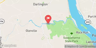
Streamflow discharge was last observed at 136 cfs, and a gauge height of 1.61 feet.
With the
% decrease since yesterday,
the streamflow average over the past 10 days is 87 .
Weather today, Tomorrow,
The gauge collects data on the water levels and flow rates, which are influenced by rainfall and snowmelt. The main constituents of the flow are precipitation and groundwater recharge. The Deer Creek is known for its scenic beauty and is a popular destination for fishing and boating. Some of the tributaries that feed into the Deer Creek include Broad Creek, Castleton Creek, and Morgan Run. The hydrology of the Deer Creek is affected by seasonal trends, with higher flow rates in the spring due to snowmelt and rainfall, and lower flow rates in the summer and fall. Interesting facts about the Deer Creek include the presence of several historic dams that were used for grist mills and the fact that it is home to several species of fish and wildlife.
| Elevation | 49.0 ft |
| Last Updated | |
| Gage height, ft | 1.61 ft |
| Stream water level elevation above NAVD 1988, in ft | 48.01 ft |
| Streamflow, ft³/s | 136.0 ft3/s |
| Percent of Normal | 104% |
| Year Over Year Average | 130 cfs |
| 24hr Flow Prediction | cfs |
| Maximum Recorded | 11,800 cfs |
| Geolocation | 39.62, -76.19 |