

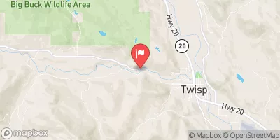
Twisp River Near Twisp, Wa Realtime Data
TWISP RIVER NEAR TWISP, WA
Realtime Data • Report • Conditions
39
Discharge (cfs)
6.9
Gauge Height (ft)
Streamflow discharge was last observed at 40 cfs, and a gauge height of 6.85 feet.
With the
% decrease since yesterday,
the streamflow average over the past 10 days is 42 .
Weather today, Tomorrow,
The primary flow providers to the river are snowmelt and precipitation. The river has several potential tributaries, including the South Fork Twisp River and McFarland Creek. There are no major dams along the river. The river experiences seasonal trends, with peak flows occurring in late spring and early summer due to snowmelt. Interesting facts about the hydrology of the river include its significance as a spawning ground for Chinook salmon and steelhead trout. Additionally, the river was historically used for irrigation and mining activities.
October 25, 2026
| Elevation | 1,669.0 ft |
| Last Updated | |
| Gage height, ft | 6.85 ft |
| Streamflow, ft³/s | 40.3 ft3/s |
| Percent of Normal | 48% |
| Year Over Year Average | 82 cfs |
| 24hr Flow Prediction | cfs |
| Maximum Recorded | 3,540 cfs |
 Continue with Snoflo Premium