A N Ingram Dam

A N Ingram
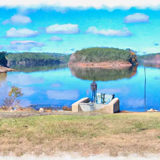
A N Ingram, located in Henry, Alabama, is a privately owned earth dam that was completed in 1958 for the primary purpose of recreation. Situated on the TR-OPINTLOCCO Creek, this dam has a hydraulic height of 25 feet and a structural height of 28 feet. With a storage capacity of 94 acre-feet, this dam serves as a low hazard potential structure with a condition assessment of "Not Rated". Despite not being regulated by the state, A N Ingram provides essential recreational opportunities for the community.
With a maximum discharge of 85 cubic feet per second, A N Ingram offers a safe and enjoyable environment for outdoor activities such as fishing and boating. The dam's close proximity to the Mobile District and Congressional District 02 in Alabama makes it easily accessible to visitors. Although it is not subject to state permitting or inspection, the dam's emergency action plan status and risk assessment remain unspecified. However, with its low hazard potential and solid structural integrity, A N Ingram stands as a reliable resource for water-based recreational activities in the area.
Overall, A N Ingram serves as a valuable asset for water resource and climate enthusiasts in Alabama. Its scenic location on TR-OPINTLOCCO Creek and ample storage capacity make it a popular destination for recreational activities. While its regulatory status and risk assessment may be unclear, the dam's long history of providing recreation in the region speaks to its importance in the local community. Whether for fishing, boating, or simply enjoying the outdoors, A N Ingram remains a cherished spot for outdoor enthusiasts to connect with nature and water resources.
Plan around the weather
Same NOAA / yr.no feed Snoflo's iOS app uses. Watch the precipitation column on the meteogram -- rain on the basin upstream typically lifts inflow 24-72 hours later.
Next 5 days, hour by hour
Temperature line with weather symbols on top, snow + rain accumulation as columns, humidity as a dotted line.
5-day forecast table
Every 3 hours, broken out across temperature, snow, rain, humidity, and wind. Each cell is colour-coded relative to the column min/max.
| Time | Condition | Temp (°F) | Snow (in) | Rain (in) | Humidity (%) | Wind (mps) | Wind dir |
|---|---|---|---|---|---|---|---|
| Loading detailed forecast… | |||||||
15-day temperature & precipitation
Daily temperatures, snow, and rain projected over the next two weeks.
Nearby streamflow gauges
USGS streamgauges around A N Ingram -- inflows here typically show up in storage 24-72 hours later.
| Streamgauge | Discharge | View |
|---|---|---|
| Choctawhatchee River Near Newton | 185 cfs | → |
| Pea River Near Ariton Al | 58 cfs | → |
| Sawhatchee Creek At Cedar Springs | 85 cfs | → |
| Choctawhatchee River Near Bellwood Al | 588 cfs | → |
| Little Double Bridges Creek Nr Enterprise | 10 cfs | → |
| Pachitla Creek Near Edison | 237 cfs | → |


About A N Ingram
Where does the data for A N Ingram come from?
Structural and regulatory data come from the U.S. Army Corps of Engineers' National Inventory of Dams (NID). Weather forecast comes from NOAA / yr.no -- the same feed Snoflo's iOS app uses.
How often is the report updated?
NID structural data refreshes annually as the Corps publishes updated assessments. The weather forecast refreshes throughout the day.
What does the Low hazard rating mean?
The Corps of Engineers' hazard potential classification grades probable consequences if the dam fails: High = probable loss of human life; Significant = no probable loss of human life but possible economic loss / environmental damage; Low = no probable loss of human life, only minor economic / environmental losses. See the Dam Data Reference card below for the full definitions.
What's "% of normal"?
The current storage value compared to the historical average storage on this calendar day. 100% = right on average; values above 100% mean above-normal storage (wet year); values below mean below-normal (dry year or drought).
Can I get alerts when storage crosses a threshold?
Yes -- alerts are managed in the Snoflo iOS app. Favorite this dam, set a threshold, and you'll get a push the moment conditions cross.
Dam data reference
Condition Assessment
- Satisfactory
- No existing or potential dam safety deficiencies are recognized. Acceptable performance is expected under all loading conditions (static, hydrologic, seismic) in accordance with the minimum applicable state or federal regulatory criteria or tolerable risk guidelines.
- Fair
- No existing dam safety deficiencies are recognized for normal operating conditions. Rare or extreme hydrologic and/or seismic events may result in a dam safety deficiency. Risk may be in the range to take further action.
- Poor
- A dam safety deficiency is recognized for normal operating conditions which may realistically occur. Remedial action is necessary. POOR may also be used when uncertainties exist as to critical analysis parameters which identify a potential dam safety deficiency.
- Unsatisfactory
- A dam safety deficiency is recognized that requires immediate or emergency remedial action for problem resolution.
- Not Rated
- The dam has not been inspected, is not under state or federal jurisdiction, or has been inspected but, for whatever reason, has not been rated.
Hazard Potential Classification
- High
- Dams assigned the high hazard potential classification are those where failure or mis-operation will probably cause loss of human life.
- Significant
- Dams assigned the significant hazard potential classification are those dams where failure or mis-operation results in no probable loss of human life but can cause economic loss, environmental damage, disruption of lifeline facilities, or impact other concerns. Significant hazard potential classification dams are often located in predominantly rural or agricultural areas but could be in areas with population and significant infrastructure.
- Low
- Dams assigned the low hazard potential classification are those where failure or mis-operation results in no probable loss of human life and low economic and/or environmental losses. Losses are principally limited to the owner's property.
- Undetermined
- Dams for which a downstream hazard potential has not been designated or is not provided.