College Lake dam

College Lake
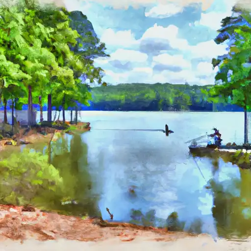
Located in Wadley, Alabama, College Lake is a privately owned fish and wildlife pond designed by the USDA NRCS and completed in 1966. With a dam height of 21 feet and a length of 650 feet, the lake has a storage capacity of 172 acre-feet and serves as a recreational spot for locals. The primary purpose of College Lake is to support fish and wildlife, making it a vital resource for biodiversity in the area.
Despite not being regulated by the state, College Lake has a significant hazard potential and a moderate risk assessment rating. The spillway, with a width of 52 feet, is uncontrolled, adding to the potential risks associated with the dam. The last inspection of the dam took place in 1979, and its condition is currently not rated. While the lake provides a valuable habitat for wildlife and recreational opportunities, its maintenance and safety should be a priority to mitigate any potential risks to the surrounding community and environment.
With its scenic location near Carlisle Branch and Tallapoosa River, College Lake offers a tranquil setting for nature enthusiasts and climate advocates to appreciate and protect. The dam's construction by the Natural Resources Conservation Service highlights the importance of sustainable water resource management in supporting local ecosystems and recreational activities. As efforts to assess and address the dam's safety continue, College Lake remains a key feature in Randolph County, Alabama, embodying the delicate balance between human enjoyment and environmental stewardship in the face of changing climate patterns.
Plan around the weather
Same NOAA / yr.no feed Snoflo's iOS app uses. Watch the precipitation column on the meteogram -- rain on the basin upstream typically lifts inflow 24-72 hours later.
Next 5 days, hour by hour
Temperature line with weather symbols on top, snow + rain accumulation as columns, humidity as a dotted line.
5-day forecast table
Every 3 hours, broken out across temperature, snow, rain, humidity, and wind. Each cell is colour-coded relative to the column min/max.
| Time | Condition | Temp (°F) | Snow (in) | Rain (in) | Humidity (%) | Wind (mps) | Wind dir |
|---|---|---|---|---|---|---|---|
| Loading detailed forecast… | |||||||
15-day temperature & precipitation
Daily temperatures, snow, and rain projected over the next two weeks.
Nearby streamflow gauges
USGS streamgauges around College Lake -- inflows here typically show up in storage 24-72 hours later.
| Streamgauge | Discharge | View |
|---|---|---|
| Tallapoosa River At Wadley Al | 1,930 cfs | → |
| Tallapoosa River Nr New Site | 1,990 cfs | → |
| Hillabee Creek Near Hackneyville Al | 389 cfs | → |
| Little Tallapoosa River Near Newell Al | 221 cfs | → |
| Hillabahatchee Creek At Thaxton Rd | 10 cfs | → |
| Chattahoochee River At West Point | 826 cfs | → |


About College Lake
Where does the data for College Lake come from?
Structural and regulatory data come from the U.S. Army Corps of Engineers' National Inventory of Dams (NID). Weather forecast comes from NOAA / yr.no -- the same feed Snoflo's iOS app uses.
How often is the report updated?
NID structural data refreshes annually as the Corps publishes updated assessments. The weather forecast refreshes throughout the day.
What does the Significant hazard rating mean?
The Corps of Engineers' hazard potential classification grades probable consequences if the dam fails: High = probable loss of human life; Significant = no probable loss of human life but possible economic loss / environmental damage; Low = no probable loss of human life, only minor economic / environmental losses. See the Dam Data Reference card below for the full definitions.
What's "% of normal"?
The current storage value compared to the historical average storage on this calendar day. 100% = right on average; values above 100% mean above-normal storage (wet year); values below mean below-normal (dry year or drought).
Can I get alerts when storage crosses a threshold?
Yes -- alerts are managed in the Snoflo iOS app. Favorite this dam, set a threshold, and you'll get a push the moment conditions cross.
Dam data reference
Condition Assessment
- Satisfactory
- No existing or potential dam safety deficiencies are recognized. Acceptable performance is expected under all loading conditions (static, hydrologic, seismic) in accordance with the minimum applicable state or federal regulatory criteria or tolerable risk guidelines.
- Fair
- No existing dam safety deficiencies are recognized for normal operating conditions. Rare or extreme hydrologic and/or seismic events may result in a dam safety deficiency. Risk may be in the range to take further action.
- Poor
- A dam safety deficiency is recognized for normal operating conditions which may realistically occur. Remedial action is necessary. POOR may also be used when uncertainties exist as to critical analysis parameters which identify a potential dam safety deficiency.
- Unsatisfactory
- A dam safety deficiency is recognized that requires immediate or emergency remedial action for problem resolution.
- Not Rated
- The dam has not been inspected, is not under state or federal jurisdiction, or has been inspected but, for whatever reason, has not been rated.
Hazard Potential Classification
- High
- Dams assigned the high hazard potential classification are those where failure or mis-operation will probably cause loss of human life.
- Significant
- Dams assigned the significant hazard potential classification are those dams where failure or mis-operation results in no probable loss of human life but can cause economic loss, environmental damage, disruption of lifeline facilities, or impact other concerns. Significant hazard potential classification dams are often located in predominantly rural or agricultural areas but could be in areas with population and significant infrastructure.
- Low
- Dams assigned the low hazard potential classification are those where failure or mis-operation results in no probable loss of human life and low economic and/or environmental losses. Losses are principally limited to the owner's property.
- Undetermined
- Dams for which a downstream hazard potential has not been designated or is not provided.