


Reeds Lake Dam Reservoir Report
Last Updated: April 15, 2026
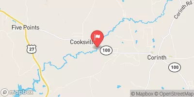
Nearby: Hadden Lake Dam Hagedons Lake Dam
°F
°F
mph
Wind
%
Humidity
Reeds Lake Dam, located in Troup, Georgia, on Caney Creek, is a private earth dam primarily built for recreational purposes.
Summary
Completed in 1950, the dam stands at a height of 28.3 feet and has a normal storage capacity of 276 acre-feet, with a maximum storage of 404 acre-feet. The dam has a low hazard potential and is classified as having a moderate risk level.
Although the dam is not regulated by the state, it undergoes regular inspections every 5 years to ensure its structural integrity. The dam features an uncontrolled spillway and outlet gates, and has not been modified since its completion. The surrounding area covers a surface area of 27.6 acres and has a drainage area of 655 square miles, making it a valuable recreational spot for water resource and climate enthusiasts to explore and enjoy.
Regional Streamflow Levels


15-Day Long Term Forecast
Year Completed |
1950 |
Dam Length |
345 |
Dam Height |
28.3 |
River Or Stream |
CANEY CREEK |
Primary Dam Type |
Earth |
Surface Area |
27.6 |
Hydraulic Height |
24.1 |
Drainage Area |
655 |
Nid Storage |
404 |
Outlet Gates |
Uncontrolled |
Hazard Potential |
Low |
Foundations |
Unlisted/Unknown |
Nid Height |
28 |
Seasonal Comparison
5-Day Hourly Forecast Detail
Dam Data Reference
Condition Assessment
SatisfactoryNo existing or potential dam safety deficiencies are recognized. Acceptable performance is expected under all loading conditions (static, hydrologic, seismic) in accordance with the minimum applicable state or federal regulatory criteria or tolerable risk guidelines.
Fair
No existing dam safety deficiencies are recognized for normal operating conditions. Rare or extreme hydrologic and/or seismic events may result in a dam safety deficiency. Risk may be in the range to take further action. Note: Rare or extreme event is defined by the regulatory agency based on their minimum
Poor A dam safety deficiency is recognized for normal operating conditions which may realistically occur. Remedial action is necessary. POOR may also be used when uncertainties exist as to critical analysis parameters which identify a potential dam safety deficiency. Investigations and studies are necessary.
Unsatisfactory
A dam safety deficiency is recognized that requires immediate or emergency remedial action for problem resolution.
Not Rated
The dam has not been inspected, is not under state or federal jurisdiction, or has been inspected but, for whatever reason, has not been rated.
Not Available
Dams for which the condition assessment is restricted to approved government users.
Hazard Potential Classification
HighDams assigned the high hazard potential classification are those where failure or mis-operation will probably cause loss of human life.
Significant
Dams assigned the significant hazard potential classification are those dams where failure or mis-operation results in no probable loss of human life but can cause economic loss, environment damage, disruption of lifeline facilities, or impact other concerns. Significant hazard potential classification dams are often located in predominantly rural or agricultural areas but could be in areas with population and significant infrastructure.
Low
Dams assigned the low hazard potential classification are those where failure or mis-operation results in no probable loss of human life and low economic and/or environmental losses. Losses are principally limited to the owner's property.
Undetermined
Dams for which a downstream hazard potential has not been designated or is not provided.
Not Available
Dams for which the downstream hazard potential is restricted to approved government users.
Area Campgrounds
| Location | Reservations | Toilets |
|---|---|---|
 Whitetail Ridge
|
||
 Pyne Road Park
|
||
 Brush Creek County Park
|
||
 Amity
Amity
|
||
 Burnt Village
|
 Pyne Road Park Mega Ramp