
Sister Grove Creek Ws Scs Site 36 Dam Reservoir Report
Last Updated: December 5, 2025
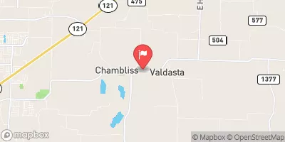
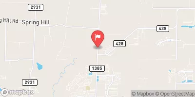
Sister Grove Creek WS SCS Site 36 Dam, located in Grayson County, Texas, is a vital structure designed by the USDA NRCS in 1960 for flood risk reduction along the TR-East Prong Sister Grove Creek.
°F
°F
mph
Wind
%
Humidity
Summary
This earth dam, standing at 21 feet in height and spanning 750 feet in length, serves to protect the surrounding area from potential flooding events. With a storage capacity of 218 acre-feet and a drainage area of 0.44 square miles, the dam plays a crucial role in managing water flow and minimizing the risk of inundation.
Despite being classified as having a fair condition assessment, the dam has a moderate risk level of 3, as per the latest data available. It is regulated by the Texas Commission on Environmental Quality (TCEQ) and undergoes regular inspections to ensure its structural integrity and functionality. The dam features an uncontrolled spillway with a width of 52 feet and two uncontrolled outlet gates. While the hazard potential is not available, the dam's risk management measures and emergency action plan (EAP) status remain unspecified, highlighting areas for further improvement and monitoring in the future.
For water resource and climate enthusiasts, Sister Grove Creek WS SCS Site 36 Dam presents an intriguing case study in flood risk reduction infrastructure. Its role in safeguarding the local community and environment against potential flooding events underscores the importance of effective dam management and maintenance practices. With a focus on continuous monitoring and improvement, this dam serves as a crucial asset in enhancing water resource resilience and climate adaptation efforts in the region.
Year Completed |
1960 |
Dam Length |
750 |
Dam Height |
21 |
River Or Stream |
TR-EAST PRONG SISTER GROVE CR |
Primary Dam Type |
Earth |
Surface Area |
3.9 |
Hydraulic Height |
21 |
Drainage Area |
0.44 |
Nid Storage |
218 |
Structural Height |
21 |
Outlet Gates |
Uncontrolled - 2 |
Hazard Potential |
Not Available |
Foundations |
Unlisted/Unknown |
Nid Height |
21 |
Seasonal Comparison
Weather Forecast
Nearby Streamflow Levels

Dam Data Reference
Condition Assessment
SatisfactoryNo existing or potential dam safety deficiencies are recognized. Acceptable performance is expected under all loading conditions (static, hydrologic, seismic) in accordance with the minimum applicable state or federal regulatory criteria or tolerable risk guidelines.
Fair
No existing dam safety deficiencies are recognized for normal operating conditions. Rare or extreme hydrologic and/or seismic events may result in a dam safety deficiency. Risk may be in the range to take further action. Note: Rare or extreme event is defined by the regulatory agency based on their minimum
Poor A dam safety deficiency is recognized for normal operating conditions which may realistically occur. Remedial action is necessary. POOR may also be used when uncertainties exist as to critical analysis parameters which identify a potential dam safety deficiency. Investigations and studies are necessary.
Unsatisfactory
A dam safety deficiency is recognized that requires immediate or emergency remedial action for problem resolution.
Not Rated
The dam has not been inspected, is not under state or federal jurisdiction, or has been inspected but, for whatever reason, has not been rated.
Not Available
Dams for which the condition assessment is restricted to approved government users.
Hazard Potential Classification
HighDams assigned the high hazard potential classification are those where failure or mis-operation will probably cause loss of human life.
Significant
Dams assigned the significant hazard potential classification are those dams where failure or mis-operation results in no probable loss of human life but can cause economic loss, environment damage, disruption of lifeline facilities, or impact other concerns. Significant hazard potential classification dams are often located in predominantly rural or agricultural areas but could be in areas with population and significant infrastructure.
Low
Dams assigned the low hazard potential classification are those where failure or mis-operation results in no probable loss of human life and low economic and/or environmental losses. Losses are principally limited to the owner's property.
Undetermined
Dams for which a downstream hazard potential has not been designated or is not provided.
Not Available
Dams for which the downstream hazard potential is restricted to approved government users.
 Sister Grove Creek Ws Scs Site 36 Dam
 Anna City Park
 Sherley Park
 Ferguson Field
 Howe Memorial Park
 Howe High School Athletic Fields