


Charlie Capps Lake Dam Reservoir Report
Last Updated: April 15, 2026
°F
°F
mph
Wind
%
Humidity
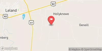
Charlie Capps Lake Dam, located in Bolivar, Mississippi, is a state-owned structure designed by the USDA NRCS for the primary purpose of recreation.
Summary
Completed in 1967, this earth dam stands at a height of 10 feet and spans a length of 26,400 feet, creating a reservoir with a storage capacity of 4,096 acre-feet. The dam sits on the Boykin Bayou and is regulated by the Mississippi Department of Environmental Quality, with inspections and enforcement measures in place to ensure its safety and compliance with state regulations.
Despite its low hazard potential, the dam's risk assessment is moderate, indicating a level 3 risk. The spillway is uncontrolled, and there are no outlet gates or locks associated with the structure. The dam's condition is currently not rated, and there is no emergency action plan in place. While the risk management measures and inundation maps are not specified, the state agency responsible for the dam's oversight is actively involved in its regulation, construction, and inspection, highlighting a commitment to maintaining the safety and integrity of Charlie Capps Lake Dam for water resource and climate enthusiasts to enjoy.
Regional Streamflow Levels
15-Day Long Term Forecast
Year Completed |
1967 |
Dam Length |
26400 |
Dam Height |
10 |
River Or Stream |
BOYKIN BAYOU |
Primary Dam Type |
Earth |
Surface Area |
473 |
Hydraulic Height |
8 |
Nid Storage |
4096 |
Structural Height |
10 |
Outlet Gates |
Uncontrolled |
Hazard Potential |
Low |
Foundations |
Soil |
Nid Height |
10 |
Seasonal Comparison
5-Day Hourly Forecast Detail
Dam Data Reference
Condition Assessment
SatisfactoryNo existing or potential dam safety deficiencies are recognized. Acceptable performance is expected under all loading conditions (static, hydrologic, seismic) in accordance with the minimum applicable state or federal regulatory criteria or tolerable risk guidelines.
Fair
No existing dam safety deficiencies are recognized for normal operating conditions. Rare or extreme hydrologic and/or seismic events may result in a dam safety deficiency. Risk may be in the range to take further action. Note: Rare or extreme event is defined by the regulatory agency based on their minimum
Poor A dam safety deficiency is recognized for normal operating conditions which may realistically occur. Remedial action is necessary. POOR may also be used when uncertainties exist as to critical analysis parameters which identify a potential dam safety deficiency. Investigations and studies are necessary.
Unsatisfactory
A dam safety deficiency is recognized that requires immediate or emergency remedial action for problem resolution.
Not Rated
The dam has not been inspected, is not under state or federal jurisdiction, or has been inspected but, for whatever reason, has not been rated.
Not Available
Dams for which the condition assessment is restricted to approved government users.
Hazard Potential Classification
HighDams assigned the high hazard potential classification are those where failure or mis-operation will probably cause loss of human life.
Significant
Dams assigned the significant hazard potential classification are those dams where failure or mis-operation results in no probable loss of human life but can cause economic loss, environment damage, disruption of lifeline facilities, or impact other concerns. Significant hazard potential classification dams are often located in predominantly rural or agricultural areas but could be in areas with population and significant infrastructure.
Low
Dams assigned the low hazard potential classification are those where failure or mis-operation results in no probable loss of human life and low economic and/or environmental losses. Losses are principally limited to the owner's property.
Undetermined
Dams for which a downstream hazard potential has not been designated or is not provided.
Not Available
Dams for which the downstream hazard potential is restricted to approved government users.