


Malta Farm Lake Dam No 2 Reservoir Report
Last Updated: April 25, 2026
°F
°F
mph
Wind
%
Humidity
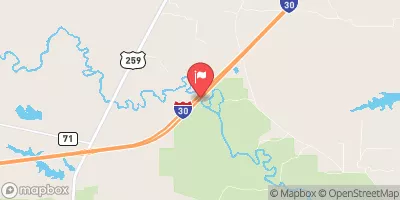
Malta Farm Lake Dam No 2, located in Bowie, Texas, was completed in 1950 and stands at a height of 20 feet with a length of 1700 feet.
Summary
This earth dam, primarily used for irrigation, holds a maximum storage capacity of 520 acre-feet and a normal storage capacity of 360 acre-feet. The dam overlooks Daniels Creek and serves as a recreational spot as well.
Despite being last inspected in 1985, Malta Farm Lake Dam No 2 is regulated by the Texas Commission on Environmental Quality (TCEQ) and undergoes state permitting, inspection, and enforcement. The spillway, with a width of 120 feet, is uncontrolled, and the dam has two uncontrolled outlet gates. The risk assessment for this dam is moderate, and it is classified as a buttress-type earth dam with an unknown foundation.
For water resource and climate enthusiasts, Malta Farm Lake Dam No 2 offers a glimpse into the irrigation practices and recreational opportunities in Bowie, Texas. With its historical significance dating back to 1950, this dam serves as a vital water resource for the surrounding area and highlights the importance of proper regulation and maintenance to ensure its safety and longevity in the face of changing climate conditions.
Regional Streamflow Levels
 Anderson Ck At Hwy 98 Nr Simms
|
398cfs |
 Red River Near De Kalb
|
6910cfs |
 Sulphur Rv At Ih 30 Nr Dalby Springs
|
46cfs |
 White Oak Ck At Ih 30 Nr Omaha
|
42cfs |
 Sulphur Rv Nr Texarkana
|
2030cfs |
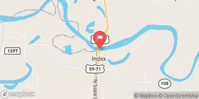 Red River At Index
|
5650cfs |
15-Day Long Term Forecast
Year Completed |
1950 |
Dam Length |
1700 |
Dam Height |
20 |
River Or Stream |
DANIELS CREEK |
Primary Dam Type |
Earth |
Surface Area |
60 |
Hydraulic Height |
20 |
Nid Storage |
520 |
Structural Height |
20 |
Outlet Gates |
Uncontrolled - 2 |
Hazard Potential |
Not Available |
Foundations |
Unlisted/Unknown |
Nid Height |
20 |
Seasonal Comparison
5-Day Hourly Forecast Detail
Dam Data Reference
Condition Assessment
SatisfactoryNo existing or potential dam safety deficiencies are recognized. Acceptable performance is expected under all loading conditions (static, hydrologic, seismic) in accordance with the minimum applicable state or federal regulatory criteria or tolerable risk guidelines.
Fair
No existing dam safety deficiencies are recognized for normal operating conditions. Rare or extreme hydrologic and/or seismic events may result in a dam safety deficiency. Risk may be in the range to take further action. Note: Rare or extreme event is defined by the regulatory agency based on their minimum
Poor A dam safety deficiency is recognized for normal operating conditions which may realistically occur. Remedial action is necessary. POOR may also be used when uncertainties exist as to critical analysis parameters which identify a potential dam safety deficiency. Investigations and studies are necessary.
Unsatisfactory
A dam safety deficiency is recognized that requires immediate or emergency remedial action for problem resolution.
Not Rated
The dam has not been inspected, is not under state or federal jurisdiction, or has been inspected but, for whatever reason, has not been rated.
Not Available
Dams for which the condition assessment is restricted to approved government users.
Hazard Potential Classification
HighDams assigned the high hazard potential classification are those where failure or mis-operation will probably cause loss of human life.
Significant
Dams assigned the significant hazard potential classification are those dams where failure or mis-operation results in no probable loss of human life but can cause economic loss, environment damage, disruption of lifeline facilities, or impact other concerns. Significant hazard potential classification dams are often located in predominantly rural or agricultural areas but could be in areas with population and significant infrastructure.
Low
Dams assigned the low hazard potential classification are those where failure or mis-operation results in no probable loss of human life and low economic and/or environmental losses. Losses are principally limited to the owner's property.
Undetermined
Dams for which a downstream hazard potential has not been designated or is not provided.
Not Available
Dams for which the downstream hazard potential is restricted to approved government users.