


Mays Lake Dam Reservoir Report
Last Updated: April 25, 2026
Nearby: Lake Arrowhead Dam Indian Hills Dam
°F
°F
mph
Wind
%
Humidity
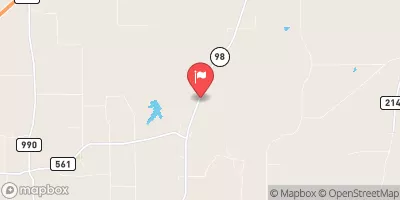
Mays Lake Dam, located in Cass County, Texas, was completed in 1969 and serves as a crucial water resource for fire protection and stock or small fish pond purposes.
Summary
This privately owned earth dam stands at a height of 22 feet and has a length of 380 feet, with a storage capacity of 194 acre-feet. The dam has a high risk assessment rating of 2, indicating the potential for significant consequences in the event of failure.
Despite being a non-federally regulated structure, Mays Lake Dam is subject to state permitting and inspection requirements. The dam lacks a spillway and has no locks, with outlet gates being the only control mechanism in place. While the dam's condition assessment is currently not rated, its hazard potential is not available, emphasizing the need for comprehensive risk management measures to mitigate any potential hazards.
Water resource and climate enthusiasts will be interested in the unique design and function of Mays Lake Dam, and its significance in providing essential water resources for fire protection and stock purposes in the region. The dam's location on TR-Black Bayou and its high risk assessment underscore the importance of ongoing monitoring and maintenance to ensure the safety and integrity of this critical infrastructure.
Regional Streamflow Levels
 Sulphur Rv Nr Texarkana
|
2030cfs |
 Red River At Spring Bank
|
10400cfs |
 Anderson Ck At Hwy 98 Nr Simms
|
398cfs |
 Black Cypress Bayou At Jefferson
|
86cfs |
 Big Cypress Ck Abv Sh 43 Nr Karnack
|
458cfs |
 Little Cypress Ck Nr Jefferson
|
101cfs |
15-Day Long Term Forecast
Year Completed |
1969 |
Dam Length |
380 |
Dam Height |
22 |
River Or Stream |
TR-BLACK BAYOU |
Primary Dam Type |
Earth |
Surface Area |
17 |
Hydraulic Height |
22 |
Nid Storage |
194 |
Structural Height |
22 |
Outlet Gates |
None - 1 |
Hazard Potential |
Not Available |
Foundations |
Unlisted/Unknown |
Nid Height |
22 |
Seasonal Comparison
5-Day Hourly Forecast Detail
Dam Data Reference
Condition Assessment
SatisfactoryNo existing or potential dam safety deficiencies are recognized. Acceptable performance is expected under all loading conditions (static, hydrologic, seismic) in accordance with the minimum applicable state or federal regulatory criteria or tolerable risk guidelines.
Fair
No existing dam safety deficiencies are recognized for normal operating conditions. Rare or extreme hydrologic and/or seismic events may result in a dam safety deficiency. Risk may be in the range to take further action. Note: Rare or extreme event is defined by the regulatory agency based on their minimum
Poor A dam safety deficiency is recognized for normal operating conditions which may realistically occur. Remedial action is necessary. POOR may also be used when uncertainties exist as to critical analysis parameters which identify a potential dam safety deficiency. Investigations and studies are necessary.
Unsatisfactory
A dam safety deficiency is recognized that requires immediate or emergency remedial action for problem resolution.
Not Rated
The dam has not been inspected, is not under state or federal jurisdiction, or has been inspected but, for whatever reason, has not been rated.
Not Available
Dams for which the condition assessment is restricted to approved government users.
Hazard Potential Classification
HighDams assigned the high hazard potential classification are those where failure or mis-operation will probably cause loss of human life.
Significant
Dams assigned the significant hazard potential classification are those dams where failure or mis-operation results in no probable loss of human life but can cause economic loss, environment damage, disruption of lifeline facilities, or impact other concerns. Significant hazard potential classification dams are often located in predominantly rural or agricultural areas but could be in areas with population and significant infrastructure.
Low
Dams assigned the low hazard potential classification are those where failure or mis-operation results in no probable loss of human life and low economic and/or environmental losses. Losses are principally limited to the owner's property.
Undetermined
Dams for which a downstream hazard potential has not been designated or is not provided.
Not Available
Dams for which the downstream hazard potential is restricted to approved government users.
 Atlanta State Park
 Jackson Creek Park - Lake Texarkana
 Cass County Park
 Rocky Point - Wright Patman Lake
 Kelly Creek Park - Lake Wright Patman
 PR 42 Cass County