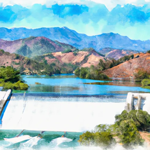
Isabella Dam Reservoir
As of August 3, 2026, Isabella Dam is holding 334,976 acre-ft of water — 142% of normal storage for this date. Storage data refreshed throughout the day.

Isabella Dam
Isabella Dam is a concrete gravity dam on the Kern River in Kern County, California. The dam was constructed in 1953 and is operated by the U.S. Army Corps of Engineers. It is 190 feet high and 1,550 feet long. The reservoir created by the dam, Lake Isabella, has a capacity of 568,000 acre-feet and is used for flood control, irrigation, and recreation. The hydrology of the area is characterized by a Mediterranean climate with wet winters and dry summers. The Kern River and its tributaries are the primary surface water providers for the area, while snowpack from the Sierra Nevada Mountains also contributes to the water supply. The dam provides water for agricultural purposes in the region, including crops such as alfalfa, cotton, and citrus. Recreational activities at Lake Isabella include fishing, boating, and camping.
Daily levels at Isabella Dam
Storage volume, pool elevation, and total release plotted from the operating agency's daily observations.
Storage
acre-ft · code 2
Pool Elevation
ft · code 1
Plan around the weather
Same NOAA / yr.no feed Snoflo's iOS app uses. Watch the precipitation column on the meteogram -- rain on the basin upstream typically lifts inflow 24-72 hours later.
Next 5 days, hour by hour
Temperature line with weather symbols on top, snow + rain accumulation as columns, humidity as a dotted line.
5-day forecast table
Every 3 hours, broken out across temperature, snow, rain, humidity, and wind. Each cell is colour-coded relative to the column min/max.
| Time | Condition | Temp (°F) | Snow (in) | Rain (in) | Humidity (%) | Wind (mps) | Wind dir |
|---|---|---|---|---|---|---|---|
| Loading detailed forecast… | |||||||
15-day temperature & precipitation
Daily temperatures, snow, and rain projected over the next two weeks.
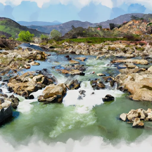
Nearby streamflow gauges
USGS streamgauges around Isabella Dam -- inflows here typically show up in storage 24-72 hours later.
| Streamgauge | Discharge | View |
|---|---|---|
| Sf Kern R Nr Onyx Ca | 13 cfs | → |
| Deer C Nr Fountain Springs Ca | 4 cfs | → |
| Sf Tule R Nr Cholollo Campground Nr Porterville Ca | 7 cfs | → |
| Sf Tule R Nr Reservation Bndry Nr Porterville Ca | 8 cfs | → |


About Isabella Dam
What is the water level at Isabella Dam Reservoir right now?
As of August 3, 2026, Isabella Dam Reservoir is holding 334,976 acre-ft, about 142% of normal for this date. Pool elevation and the year-over-year trend are shown above.
Is Isabella Dam Reservoir high or low right now?
Compare the percent-of-normal figure on this page: above 100% means storage is higher than the historical average for the date (a wet year), below 100% means lower (a dry year or drought). The daily-levels chart shows the current trend.
Where does the data for Isabella Dam come from?
Daily storage, pool elevation, and release rates are sourced from USGS, USBR, and USACE monitoring stations. Weather forecast comes from NOAA / yr.no -- the same feed Snoflo's iOS app uses.
How often is the report updated?
Storage observations are updated daily by the operating agency. The 15-day weather forecast refreshes throughout the day. Snoflo caches and renders the most recent observation -- check the "as of" timestamp on the storage card.
What does the Hazard hazard rating mean?
The Corps of Engineers' hazard potential classification grades probable consequences if the dam fails: High = probable loss of human life; Significant = no probable loss of human life but possible economic loss / environmental damage; Low = no probable loss of human life, only minor economic / environmental losses. See the Dam Data Reference card below for the full definitions.
What's "% of normal"?
The current storage value compared to the historical average storage on this calendar day. 100% = right on average; values above 100% mean above-normal storage (wet year); values below mean below-normal (dry year or drought).
Can I get alerts when storage crosses a threshold?
Yes -- alerts are managed in the Snoflo iOS app. Favorite this reservoir, set a threshold, and you'll get a push the moment conditions cross.