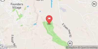
Big Sandy Creek Watershed S-17 Reservoir Report
Last Updated: February 21, 2026
Big Sandy Creek Watershed S-17, also known as Ververs South, is a crucial flood risk reduction structure located in El Paso County, Colorado.
Summary
This earth dam, designed by the USDA NRCS and completed in 1959, stands at a height of 40 feet and stretches to a length of 2387 feet. With a normal storage capacity of 371 acre-feet and a maximum discharge of 7603 cubic feet per second, this structure plays a vital role in managing water flow and reducing flood risks in the Big Sandy Creek-TR river system.
Managed by the local government in Simla, Colorado, Big Sandy Creek Watershed S-17 is regulated by the Colorado Department of Water Resources to ensure its proper maintenance and operation. Despite its low hazard potential and satisfactory condition assessment, the structure poses a high risk (2) due to its critical role in flood risk reduction within the region. With a last inspection date in October 2020 and an inspection frequency of 3 years, efforts are consistently made to monitor and manage the structure to meet regulatory standards and protect the surrounding communities and environment.
The importance of Big Sandy Creek Watershed S-17 lies in its essential function of flood risk reduction, providing a protective barrier against potential inundation and safeguarding the local area from water-related disasters. With a history dating back to its completion in 1959, this earth dam continues to serve as a vital component of water resource management in the region, highlighting the ongoing efforts to maintain and improve infrastructure for climate resilience and water security in El Paso County, Colorado.
°F
°F
mph
Wind
%
Humidity
15-Day Weather Outlook
Year Completed |
1959 |
Dam Length |
2387 |
Dam Height |
37 |
River Or Stream |
BIG SANDY CREEK-TR |
Primary Dam Type |
Earth |
Surface Area |
33 |
Hydraulic Height |
38 |
Drainage Area |
4 |
Nid Storage |
536 |
Structural Height |
40 |
Outlet Gates |
Needle - 0 |
Hazard Potential |
Low |
Nid Height |
40 |
Seasonal Comparison
5-Day Hourly Forecast Detail
Nearby Streamflow Levels
Dam Data Reference
Condition Assessment
SatisfactoryNo existing or potential dam safety deficiencies are recognized. Acceptable performance is expected under all loading conditions (static, hydrologic, seismic) in accordance with the minimum applicable state or federal regulatory criteria or tolerable risk guidelines.
Fair
No existing dam safety deficiencies are recognized for normal operating conditions. Rare or extreme hydrologic and/or seismic events may result in a dam safety deficiency. Risk may be in the range to take further action. Note: Rare or extreme event is defined by the regulatory agency based on their minimum
Poor A dam safety deficiency is recognized for normal operating conditions which may realistically occur. Remedial action is necessary. POOR may also be used when uncertainties exist as to critical analysis parameters which identify a potential dam safety deficiency. Investigations and studies are necessary.
Unsatisfactory
A dam safety deficiency is recognized that requires immediate or emergency remedial action for problem resolution.
Not Rated
The dam has not been inspected, is not under state or federal jurisdiction, or has been inspected but, for whatever reason, has not been rated.
Not Available
Dams for which the condition assessment is restricted to approved government users.
Hazard Potential Classification
HighDams assigned the high hazard potential classification are those where failure or mis-operation will probably cause loss of human life.
Significant
Dams assigned the significant hazard potential classification are those dams where failure or mis-operation results in no probable loss of human life but can cause economic loss, environment damage, disruption of lifeline facilities, or impact other concerns. Significant hazard potential classification dams are often located in predominantly rural or agricultural areas but could be in areas with population and significant infrastructure.
Low
Dams assigned the low hazard potential classification are those where failure or mis-operation results in no probable loss of human life and low economic and/or environmental losses. Losses are principally limited to the owner's property.
Undetermined
Dams for which a downstream hazard potential has not been designated or is not provided.
Not Available
Dams for which the downstream hazard potential is restricted to approved government users.


 Big Sandy Creek Watershed S-17