
Clear Lake Dike 1 Reservoir Report
Nearby: Clear Lake Big Johnson
Last Updated: December 24, 2025
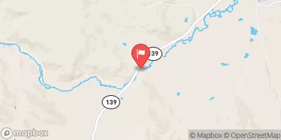
Clear Lake Dike 1, located in Modoc County, California, is a rockfill dam with a primary purpose of irrigation.
°F
°F
mph
Wind
%
Humidity
Summary
Built in 1910 by the Bureau of Reclamation, this structure stands at a height of 13 feet and has a hydraulic height of 6 feet. With a storage capacity of 584,050 acre-feet and a surface area of 23,960 acres, Clear Lake Dike 1 plays a crucial role in managing water resources for agricultural needs in the region.
This dam, situated on the Lost River, is owned and operated by the Bureau of Reclamation and falls under federal jurisdiction. Despite being classified as having a low hazard potential, Clear Lake Dike 1 undergoes regular inspections by the Bureau of Reclamation to ensure its structural integrity and safety. The surrounding area benefits from the controlled water release through a 357-foot uncontrolled spillway, which helps prevent flooding and maintain a stable water supply for irrigation in the region.
As a key component of the water management infrastructure in the area, Clear Lake Dike 1 contributes to the overall sustainability of water resources in Modoc County. With its moderate risk assessment rating and a history dating back over a century, this dam continues to play a vital role in supporting agriculture and maintaining a reliable water supply for the local community.
Year Completed |
1910 |
Dam Length |
1600 |
Dam Height |
13 |
River Or Stream |
LOST RIVER |
Primary Dam Type |
Rockfill |
Surface Area |
23960 |
Hydraulic Height |
6 |
Drainage Area |
735 |
Nid Storage |
584050 |
Structural Height |
12 |
Hazard Potential |
Low |
Foundations |
Rock |
Nid Height |
13 |
Seasonal Comparison
Weather Forecast
Nearby Streamflow Levels
 Pit R Nr Canby Ca
|
1110cfs |
 Klamath Straits Drain Near Worden
|
6cfs |
 Ady Canal At Highway 97
|
3cfs |
 North Canal At Highway 97
|
2cfs |
 Link River At Klamath Falls
|
287cfs |
 Klamath River At Keno
|
707cfs |
Dam Data Reference
Condition Assessment
SatisfactoryNo existing or potential dam safety deficiencies are recognized. Acceptable performance is expected under all loading conditions (static, hydrologic, seismic) in accordance with the minimum applicable state or federal regulatory criteria or tolerable risk guidelines.
Fair
No existing dam safety deficiencies are recognized for normal operating conditions. Rare or extreme hydrologic and/or seismic events may result in a dam safety deficiency. Risk may be in the range to take further action. Note: Rare or extreme event is defined by the regulatory agency based on their minimum
Poor A dam safety deficiency is recognized for normal operating conditions which may realistically occur. Remedial action is necessary. POOR may also be used when uncertainties exist as to critical analysis parameters which identify a potential dam safety deficiency. Investigations and studies are necessary.
Unsatisfactory
A dam safety deficiency is recognized that requires immediate or emergency remedial action for problem resolution.
Not Rated
The dam has not been inspected, is not under state or federal jurisdiction, or has been inspected but, for whatever reason, has not been rated.
Not Available
Dams for which the condition assessment is restricted to approved government users.
Hazard Potential Classification
HighDams assigned the high hazard potential classification are those where failure or mis-operation will probably cause loss of human life.
Significant
Dams assigned the significant hazard potential classification are those dams where failure or mis-operation results in no probable loss of human life but can cause economic loss, environment damage, disruption of lifeline facilities, or impact other concerns. Significant hazard potential classification dams are often located in predominantly rural or agricultural areas but could be in areas with population and significant infrastructure.
Low
Dams assigned the low hazard potential classification are those where failure or mis-operation results in no probable loss of human life and low economic and/or environmental losses. Losses are principally limited to the owner's property.
Undetermined
Dams for which a downstream hazard potential has not been designated or is not provided.
Not Available
Dams for which the downstream hazard potential is restricted to approved government users.
 Clear Lake Dike 1