
Francis E. Walter Dam Reservoir Report
Last Updated: December 28, 2025
Francis E.
°F
°F
mph
Wind
%
Humidity
Summary
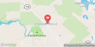
Walter Dam, also known as Francis E. Walter Reservoir, is a remarkable Earth dam located in White Haven, Pennsylvania. Completed in 1961 by the US Army Corps of Engineers, this dam primarily serves the purpose of flood risk reduction, showcasing a high hazard potential due to its location on the Lehigh River. With a structural height of 239 feet and a storage capacity of 160,290 acre-feet, the dam plays a crucial role in managing water levels and mitigating flood risks in the region.
Managed and operated by the US Army Corps of Engineers, Francis E. Walter Dam is equipped with modern risk management measures to ensure its structural integrity and the safety of surrounding communities. Regular inspections, maintenance, and emergency action plans are in place to address any potential risks associated with the dam. The dam's hydraulic height of 233 feet and a maximum discharge of 128,000 cubic feet per second demonstrate its capacity to handle significant water flow, providing essential protection against flooding events.
As a key component in the flood risk reduction strategy, Francis E. Walter Dam exemplifies the dedication of the US Army Corps of Engineers in safeguarding water resources and enhancing climate resilience in the area. With ongoing monitoring and collaborative efforts with local emergency managers, the dam continues to play a vital role in protecting lives, property, and the environment from the impacts of severe weather events and potential flooding incidents.
Year Completed |
1961 |
Dam Length |
3000 |
River Or Stream |
LEHIGH RIVER |
Primary Dam Type |
Earth |
Surface Area |
80 |
Hydraulic Height |
233 |
Drainage Area |
288 |
Nid Storage |
160290 |
Structural Height |
239 |
Outlet Gates |
None - 0 |
Hazard Potential |
High |
Foundations |
Rock |
Nid Height |
239 |
Seasonal Comparison
Weather Forecast
Nearby Streamflow Levels


Dam Data Reference
Condition Assessment
SatisfactoryNo existing or potential dam safety deficiencies are recognized. Acceptable performance is expected under all loading conditions (static, hydrologic, seismic) in accordance with the minimum applicable state or federal regulatory criteria or tolerable risk guidelines.
Fair
No existing dam safety deficiencies are recognized for normal operating conditions. Rare or extreme hydrologic and/or seismic events may result in a dam safety deficiency. Risk may be in the range to take further action. Note: Rare or extreme event is defined by the regulatory agency based on their minimum
Poor A dam safety deficiency is recognized for normal operating conditions which may realistically occur. Remedial action is necessary. POOR may also be used when uncertainties exist as to critical analysis parameters which identify a potential dam safety deficiency. Investigations and studies are necessary.
Unsatisfactory
A dam safety deficiency is recognized that requires immediate or emergency remedial action for problem resolution.
Not Rated
The dam has not been inspected, is not under state or federal jurisdiction, or has been inspected but, for whatever reason, has not been rated.
Not Available
Dams for which the condition assessment is restricted to approved government users.
Hazard Potential Classification
HighDams assigned the high hazard potential classification are those where failure or mis-operation will probably cause loss of human life.
Significant
Dams assigned the significant hazard potential classification are those dams where failure or mis-operation results in no probable loss of human life but can cause economic loss, environment damage, disruption of lifeline facilities, or impact other concerns. Significant hazard potential classification dams are often located in predominantly rural or agricultural areas but could be in areas with population and significant infrastructure.
Low
Dams assigned the low hazard potential classification are those where failure or mis-operation results in no probable loss of human life and low economic and/or environmental losses. Losses are principally limited to the owner's property.
Undetermined
Dams for which a downstream hazard potential has not been designated or is not provided.
Not Available
Dams for which the downstream hazard potential is restricted to approved government users.
Area Campgrounds
| Location | Reservations | Toilets |
|---|---|---|
 Lehigh Gorge Campground
|
||
 Camp Shehaqua
|
||
 Camp Daddy Allen
|
||
 Pennsylvania Youth Forestry Camp #2
|
||
 Hickory Run State Park
|
||
 Organized Group Tenting Area
|
 Francis E. Walter Dam