
Richland Creek Ws Scs Site 8 Dam Reservoir Report
Last Updated: December 24, 2025
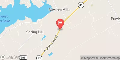
Richland Creek WS SCS Site 8 Dam, located in Limestone County, Texas, is a vital flood risk reduction structure designed by the USDA NRCS and completed in 1959.
°F
°F
mph
Wind
%
Humidity
Summary
The dam, primarily serving the purpose of flood risk reduction, stands at a height of 28 feet and spans a length of 2084 feet. With a normal storage capacity of 185 acre-feet and a maximum storage of 1206 acre-feet, the dam plays a crucial role in managing water flow and protecting the surrounding area from potential flooding events.
Managed by the TCEQ and regulated by the state of Texas, Richland Creek WS SCS Site 8 Dam is considered to have a high risk level (2) based on a risk assessment. This earth dam with buttress core types and unlisted/unknown foundations sits on the TR-MUNGER BRANCH river or stream, providing essential water resource management in the region. While the dam does not have a spillway, it is equipped with one outlet gate. Despite not having a hazard potential rating or condition assessment, the dam remains a key structure in the area's water infrastructure network.
With no recent inspection date or condition assessment available, there is a need for further evaluation of Richland Creek WS SCS Site 8 Dam to ensure its continued effectiveness in flood risk reduction. The dam's emergency action plan status, inundation maps, and risk management measures are also areas that require attention to enhance the overall safety and resilience of the structure. As water resource and climate enthusiasts, monitoring and maintaining the integrity of this essential infrastructure will be crucial in safeguarding the local community and environment from potential water-related hazards.
Year Completed |
1959 |
Dam Length |
2084 |
Dam Height |
28 |
River Or Stream |
TR-MUNGER BRANCH |
Primary Dam Type |
Earth |
Surface Area |
38 |
Hydraulic Height |
28 |
Drainage Area |
1.74 |
Nid Storage |
1206 |
Structural Height |
28 |
Outlet Gates |
None - 1 |
Hazard Potential |
Not Available |
Foundations |
Unlisted/Unknown |
Nid Height |
28 |
Seasonal Comparison
Weather Forecast
Nearby Streamflow Levels
 Richland Ck Nr Dawson
|
0cfs |
 Ash Ck At Hwy 171 Nr Malone
|
865cfs |
 White Rk Ck At Fm 308 Nr Irene
|
515cfs |
 Navasota Rv Abv Groesbeck
|
2cfs |
 Richland Ck At Hwy 22 Nr Mertens
|
338cfs |
 Tehuacana Ck Nr Streetman
|
2cfs |
Dam Data Reference
Condition Assessment
SatisfactoryNo existing or potential dam safety deficiencies are recognized. Acceptable performance is expected under all loading conditions (static, hydrologic, seismic) in accordance with the minimum applicable state or federal regulatory criteria or tolerable risk guidelines.
Fair
No existing dam safety deficiencies are recognized for normal operating conditions. Rare or extreme hydrologic and/or seismic events may result in a dam safety deficiency. Risk may be in the range to take further action. Note: Rare or extreme event is defined by the regulatory agency based on their minimum
Poor A dam safety deficiency is recognized for normal operating conditions which may realistically occur. Remedial action is necessary. POOR may also be used when uncertainties exist as to critical analysis parameters which identify a potential dam safety deficiency. Investigations and studies are necessary.
Unsatisfactory
A dam safety deficiency is recognized that requires immediate or emergency remedial action for problem resolution.
Not Rated
The dam has not been inspected, is not under state or federal jurisdiction, or has been inspected but, for whatever reason, has not been rated.
Not Available
Dams for which the condition assessment is restricted to approved government users.
Hazard Potential Classification
HighDams assigned the high hazard potential classification are those where failure or mis-operation will probably cause loss of human life.
Significant
Dams assigned the significant hazard potential classification are those dams where failure or mis-operation results in no probable loss of human life but can cause economic loss, environment damage, disruption of lifeline facilities, or impact other concerns. Significant hazard potential classification dams are often located in predominantly rural or agricultural areas but could be in areas with population and significant infrastructure.
Low
Dams assigned the low hazard potential classification are those where failure or mis-operation results in no probable loss of human life and low economic and/or environmental losses. Losses are principally limited to the owner's property.
Undetermined
Dams for which a downstream hazard potential has not been designated or is not provided.
Not Available
Dams for which the downstream hazard potential is restricted to approved government users.
 Richland Creek Ws Scs Site 8 Dam
 Navarro Mills Lk Nr Dawson
 Lk Mexia Nr Mexia