
School Section Reservoir Report
Nearby: Houston No. 1 John Beaton
Last Updated: December 22, 2025
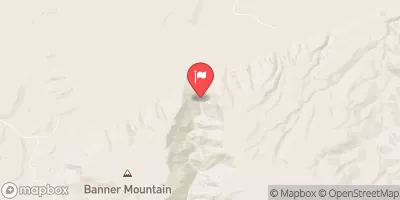
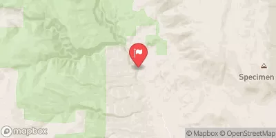
School Section is a privately owned dam located in Natrona County, Wyoming, specifically in the city of Edgerton.
°F
°F
mph
Wind
%
Humidity
Summary
Built in 1954, this earth dam stands at a height of 31 feet and serves multiple purposes including fire protection, stock, and small fish pond. With a maximum storage capacity of 109 acre-feet and a normal storage of 58 acre-feet, School Section is primarily regulated by the Wyoming State Engineer's Office and is inspected every five years to ensure its fair condition and low hazard potential.
Situated on East Teapot Creek, School Section plays a crucial role in water resource management in the area. The dam has a surface area of 8 acres and a spillway width of 10 feet, with an uncontrolled spillway type. Despite its moderate risk assessment, the dam meets regulatory guidelines and is well-equipped with a valve outlet gate. Its location in Congressional District 00 of Wyoming, represented by Liz Cheney (R), underscores its importance in the region's water infrastructure.
Water resource and climate enthusiasts will appreciate School Section's contribution to the local ecosystem and its role in mitigating the risk of floods and ensuring water availability for various uses. With a commitment to regular inspections and maintenance, this dam stands as a testament to responsible water management practices in the state of Wyoming.
Year Completed |
1954 |
Dam Length |
440 |
Dam Height |
31 |
River Or Stream |
EAST TEAPOT CREEK |
Primary Dam Type |
Earth |
Surface Area |
8 |
Hydraulic Height |
26 |
Nid Storage |
109 |
Structural Height |
31 |
Outlet Gates |
Valve - 1 |
Hazard Potential |
Low |
Foundations |
Soil |
Nid Height |
31 |
Seasonal Comparison
Weather Forecast
Nearby Streamflow Levels
Dam Data Reference
Condition Assessment
SatisfactoryNo existing or potential dam safety deficiencies are recognized. Acceptable performance is expected under all loading conditions (static, hydrologic, seismic) in accordance with the minimum applicable state or federal regulatory criteria or tolerable risk guidelines.
Fair
No existing dam safety deficiencies are recognized for normal operating conditions. Rare or extreme hydrologic and/or seismic events may result in a dam safety deficiency. Risk may be in the range to take further action. Note: Rare or extreme event is defined by the regulatory agency based on their minimum
Poor A dam safety deficiency is recognized for normal operating conditions which may realistically occur. Remedial action is necessary. POOR may also be used when uncertainties exist as to critical analysis parameters which identify a potential dam safety deficiency. Investigations and studies are necessary.
Unsatisfactory
A dam safety deficiency is recognized that requires immediate or emergency remedial action for problem resolution.
Not Rated
The dam has not been inspected, is not under state or federal jurisdiction, or has been inspected but, for whatever reason, has not been rated.
Not Available
Dams for which the condition assessment is restricted to approved government users.
Hazard Potential Classification
HighDams assigned the high hazard potential classification are those where failure or mis-operation will probably cause loss of human life.
Significant
Dams assigned the significant hazard potential classification are those dams where failure or mis-operation results in no probable loss of human life but can cause economic loss, environment damage, disruption of lifeline facilities, or impact other concerns. Significant hazard potential classification dams are often located in predominantly rural or agricultural areas but could be in areas with population and significant infrastructure.
Low
Dams assigned the low hazard potential classification are those where failure or mis-operation results in no probable loss of human life and low economic and/or environmental losses. Losses are principally limited to the owner's property.
Undetermined
Dams for which a downstream hazard potential has not been designated or is not provided.
Not Available
Dams for which the downstream hazard potential is restricted to approved government users.
 School Section