
Oaklimeter Creek Watershed Structure Lt-8-40 Dam Reservoir Report
Nearby: Ms05572 Lake Dam Nichols Lake Dam
Last Updated: December 5, 2025
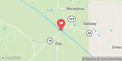
The Oaklimeter Creek Watershed Structure Lt-8-40 Dam, located in Benton, Mississippi, is a key component in flood risk reduction in the area.
°F
°F
mph
Wind
%
Humidity
Summary
The dam, completed in 1975, stands at a height of 28 feet and has a storage capacity of 406 acre-feet. Designed by the USDA NRCS, this earth dam with a buttress core serves the primary purpose of flood risk reduction along the TR- Oaklimeter Creek.
Managed by the Mississippi Department of Environmental Quality, the Oaklimeter Creek Watershed Structure Lt-8-40 Dam is regulated, inspected, and enforced to ensure its safety and functionality. Despite having a low hazard potential, the dam's risk assessment indicates a moderate risk level, emphasizing the importance of ongoing monitoring and risk management measures. With uncontrolled spillways and outlet gates, the dam is designed to handle potential flood events effectively while protecting the surrounding area from excessive water flow. For water resource and climate enthusiasts, this dam serves as a fascinating example of sustainable infrastructure in managing water resources and mitigating flood risks in Mississippi.
Year Completed |
1975 |
Dam Height |
28 |
River Or Stream |
TR- OAKLIMETER CREEK |
Primary Dam Type |
Earth |
Drainage Area |
1.06 |
Nid Storage |
406 |
Outlet Gates |
Uncontrolled |
Hazard Potential |
Low |
Foundations |
Soil |
Nid Height |
28 |
Seasonal Comparison
Weather Forecast
Nearby Streamflow Levels
 Little Tallahatchie River At Etta
|
156cfs |
 Yocona River Nr Oxford
|
96cfs |
 Wolf River At Lagrange
|
227cfs |
 Coldwater River Nr Olive Branch
|
104cfs |
 Wolf River At Rossville
|
497cfs |
 Hatchie River Near Walnut
|
153cfs |
Dam Data Reference
Condition Assessment
SatisfactoryNo existing or potential dam safety deficiencies are recognized. Acceptable performance is expected under all loading conditions (static, hydrologic, seismic) in accordance with the minimum applicable state or federal regulatory criteria or tolerable risk guidelines.
Fair
No existing dam safety deficiencies are recognized for normal operating conditions. Rare or extreme hydrologic and/or seismic events may result in a dam safety deficiency. Risk may be in the range to take further action. Note: Rare or extreme event is defined by the regulatory agency based on their minimum
Poor A dam safety deficiency is recognized for normal operating conditions which may realistically occur. Remedial action is necessary. POOR may also be used when uncertainties exist as to critical analysis parameters which identify a potential dam safety deficiency. Investigations and studies are necessary.
Unsatisfactory
A dam safety deficiency is recognized that requires immediate or emergency remedial action for problem resolution.
Not Rated
The dam has not been inspected, is not under state or federal jurisdiction, or has been inspected but, for whatever reason, has not been rated.
Not Available
Dams for which the condition assessment is restricted to approved government users.
Hazard Potential Classification
HighDams assigned the high hazard potential classification are those where failure or mis-operation will probably cause loss of human life.
Significant
Dams assigned the significant hazard potential classification are those dams where failure or mis-operation results in no probable loss of human life but can cause economic loss, environment damage, disruption of lifeline facilities, or impact other concerns. Significant hazard potential classification dams are often located in predominantly rural or agricultural areas but could be in areas with population and significant infrastructure.
Low
Dams assigned the low hazard potential classification are those where failure or mis-operation results in no probable loss of human life and low economic and/or environmental losses. Losses are principally limited to the owner's property.
Undetermined
Dams for which a downstream hazard potential has not been designated or is not provided.
Not Available
Dams for which the downstream hazard potential is restricted to approved government users.
 Oaklimeter Creek Watershed Structure Lt-8-40 Dam