


Wells Lake Dam Lower Reservoir Report
Last Updated: April 26, 2026
°F
°F
mph
Wind
%
Humidity
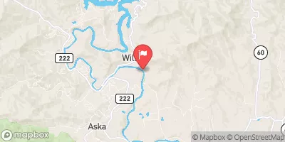
Wells Lake Dam Lower, located in Cherokee, North Carolina, is a privately owned structure regulated by the NCDEQ Dam Safety Program.
Summary
This earth dam, with a hydraulic height of 23.5 feet and a structural height of 30 feet, serves primarily for recreational purposes along the Gold Branch stream. The dam has a storage capacity of 600 acre-feet and a surface area of 50 acres, providing opportunities for boating, fishing, and other outdoor activities in the area.
Despite its low hazard potential and fair condition assessment, Wells Lake Dam Lower undergoes regular inspections every five years to ensure its safety and integrity. The last inspection in January 2017 confirmed its overall stability, although no specific modifications or enhancements have been recorded since its completion. With a maximum discharge capacity of 340 cubic feet per second, the dam plays a crucial role in water resource management and flood control in the region.
As a key component of the local recreational landscape, Wells Lake Dam Lower remains a significant feature for water resource and climate enthusiasts in the area. Its strategic location along the Gold Branch stream, combined with its impressive storage capacity and recreational opportunities, highlights the importance of maintaining and monitoring such structures to ensure the safety and well-being of the surrounding environment and community.
Regional Streamflow Levels
 Valley River At Tomotla
|
130cfs |
 Nottely River Near Blairsville
|
75cfs |
 Ocoee River At Copperhill
|
301cfs |
 Toccoa River Near Dial
|
268cfs |
 Tellico River At Tellico Plains
|
119cfs |
 Nantahala River Near Rainbow Springs
|
125cfs |
15-Day Long Term Forecast
Dam Length |
310 |
River Or Stream |
Gold Branch |
Primary Dam Type |
Earth |
Surface Area |
50 |
Hydraulic Height |
23.5 |
Nid Storage |
600 |
Structural Height |
30 |
Hazard Potential |
Low |
Nid Height |
30 |
Seasonal Comparison
5-Day Hourly Forecast Detail
Dam Data Reference
Condition Assessment
SatisfactoryNo existing or potential dam safety deficiencies are recognized. Acceptable performance is expected under all loading conditions (static, hydrologic, seismic) in accordance with the minimum applicable state or federal regulatory criteria or tolerable risk guidelines.
Fair
No existing dam safety deficiencies are recognized for normal operating conditions. Rare or extreme hydrologic and/or seismic events may result in a dam safety deficiency. Risk may be in the range to take further action. Note: Rare or extreme event is defined by the regulatory agency based on their minimum
Poor A dam safety deficiency is recognized for normal operating conditions which may realistically occur. Remedial action is necessary. POOR may also be used when uncertainties exist as to critical analysis parameters which identify a potential dam safety deficiency. Investigations and studies are necessary.
Unsatisfactory
A dam safety deficiency is recognized that requires immediate or emergency remedial action for problem resolution.
Not Rated
The dam has not been inspected, is not under state or federal jurisdiction, or has been inspected but, for whatever reason, has not been rated.
Not Available
Dams for which the condition assessment is restricted to approved government users.
Hazard Potential Classification
HighDams assigned the high hazard potential classification are those where failure or mis-operation will probably cause loss of human life.
Significant
Dams assigned the significant hazard potential classification are those dams where failure or mis-operation results in no probable loss of human life but can cause economic loss, environment damage, disruption of lifeline facilities, or impact other concerns. Significant hazard potential classification dams are often located in predominantly rural or agricultural areas but could be in areas with population and significant infrastructure.
Low
Dams assigned the low hazard potential classification are those where failure or mis-operation results in no probable loss of human life and low economic and/or environmental losses. Losses are principally limited to the owner's property.
Undetermined
Dams for which a downstream hazard potential has not been designated or is not provided.
Not Available
Dams for which the downstream hazard potential is restricted to approved government users.
 Nottely Dam Road Union County