
Anita Charbula Dam Reservoir Report
Last Updated: December 5, 2025
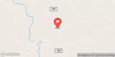
Anita Charbula Dam, located in Dubina, Texas, along the TR-East Navidad River, was completed in 1993 by the USDA NRCS.
°F
°F
mph
Wind
%
Humidity
Summary
This private dam, standing at a height of 21 feet and with a hydraulic height of 18 feet, serves a primary purpose that is classified as 'Other'. Its design, an Earth dam with a Buttress core type, spans a length of 765 feet and has a storage capacity of 250 acre-feet. Despite its lack of spillway and locks, the dam is equipped with one outlet gate for operational control.
With a drainage area of 1.19 square miles and a surface area of 0.7 acres, Anita Charbula Dam presents a high risk level of 2, making it a critical infrastructure for water resource management in the region. While its hazard potential and condition assessment are currently not available or rated, the dam's location in Fayette County, Texas, underscores its importance in mitigating flood risks and ensuring water supply reliability. As an essential structure for the local community, ongoing inspections, risk assessments, and emergency action plans are crucial for maintaining the dam's safety and functionality amidst changing climate conditions.
Year Completed |
1993 |
Dam Length |
765 |
Dam Height |
21 |
River Or Stream |
TR-EAST NAVIDAD RIVER |
Primary Dam Type |
Earth |
Surface Area |
0.7 |
Hydraulic Height |
18 |
Drainage Area |
1.19 |
Nid Storage |
250 |
Structural Height |
22 |
Outlet Gates |
None - 1 |
Hazard Potential |
Not Available |
Foundations |
Unlisted/Unknown |
Nid Height |
22 |
Seasonal Comparison
Weather Forecast
Nearby Streamflow Levels
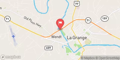 Colorado Rv Abv La Grange
|
497cfs |
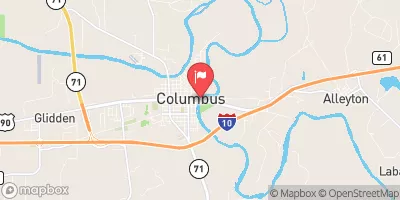 Colorado Rv At Columbus
|
216cfs |
 Redgate Ck Nr Columbus
|
1cfs |
 Navidad Rv Nr Hallettsville
|
0cfs |
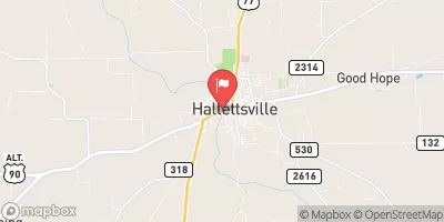 Lavaca Rv At Hallettsville
|
0cfs |
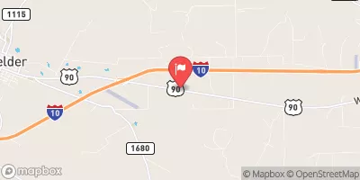 Peach Creek At Hwy 90 Nr Waelder
|
0cfs |
Dam Data Reference
Condition Assessment
SatisfactoryNo existing or potential dam safety deficiencies are recognized. Acceptable performance is expected under all loading conditions (static, hydrologic, seismic) in accordance with the minimum applicable state or federal regulatory criteria or tolerable risk guidelines.
Fair
No existing dam safety deficiencies are recognized for normal operating conditions. Rare or extreme hydrologic and/or seismic events may result in a dam safety deficiency. Risk may be in the range to take further action. Note: Rare or extreme event is defined by the regulatory agency based on their minimum
Poor A dam safety deficiency is recognized for normal operating conditions which may realistically occur. Remedial action is necessary. POOR may also be used when uncertainties exist as to critical analysis parameters which identify a potential dam safety deficiency. Investigations and studies are necessary.
Unsatisfactory
A dam safety deficiency is recognized that requires immediate or emergency remedial action for problem resolution.
Not Rated
The dam has not been inspected, is not under state or federal jurisdiction, or has been inspected but, for whatever reason, has not been rated.
Not Available
Dams for which the condition assessment is restricted to approved government users.
Hazard Potential Classification
HighDams assigned the high hazard potential classification are those where failure or mis-operation will probably cause loss of human life.
Significant
Dams assigned the significant hazard potential classification are those dams where failure or mis-operation results in no probable loss of human life but can cause economic loss, environment damage, disruption of lifeline facilities, or impact other concerns. Significant hazard potential classification dams are often located in predominantly rural or agricultural areas but could be in areas with population and significant infrastructure.
Low
Dams assigned the low hazard potential classification are those where failure or mis-operation results in no probable loss of human life and low economic and/or environmental losses. Losses are principally limited to the owner's property.
Undetermined
Dams for which a downstream hazard potential has not been designated or is not provided.
Not Available
Dams for which the downstream hazard potential is restricted to approved government users.
 Anita Charbula Dam
 Wolters Park
 Hill Memorial Park
 Kreische Brewery State Historic Site
 Kruschel Memorial Park