Heil No 1 Reservoir Report
Nearby: Cedar Creek Cedar Creek Holding
Last Updated: January 10, 2026
Heil No 1, also known as Heil Dam Upper, is a privately owned structure located in Twin Falls, Idaho.
°F
°F
mph
Wind
%
Humidity
Summary
Completed in 1974, this earth dam serves primarily for irrigation purposes along the Worley Draw and Devil Creek. Standing at a height of 24.2 feet with a storage capacity of 480 acre-feet, Heil No 1 covers a surface area of 58 acres and has a drainage area of 3.5 square miles.
Managed by the Idaho Department of Water Resources, Heil No 1 is regulated, permitted, inspected, and enforced by the state agency to ensure its structural integrity and compliance with safety protocols. Despite being classified as a low hazard potential dam with fair condition assessment, there is a moderate risk associated with its operation, signifying the importance of ongoing risk management measures. With a spillway type of uncontrolled and a maximum discharge capacity of 52 cubic feet per second, Heil No 1 plays a crucial role in water resource management in the region.
Overall, Heil No 1 serves as a vital infrastructure for irrigation in the area, highlighting the intersection of water resource management and climate adaptation efforts. As enthusiasts in these fields continue to monitor and assess the condition of dams like Heil No 1, ensuring their resilience in the face of changing environmental conditions remains a key priority for sustainable water management practices.
Year Completed |
1974 |
Dam Length |
1380 |
Dam Height |
24.2 |
River Or Stream |
WORLEY DRAW DEVIL CREEK |
Surface Area |
58 |
Hydraulic Height |
21.7 |
Drainage Area |
3.5 |
Nid Storage |
480 |
Hazard Potential |
Low |
Foundations |
Rock |
Nid Height |
24 |
Seasonal Comparison
Weather Forecast
Nearby Streamflow Levels
Dam Data Reference
Condition Assessment
SatisfactoryNo existing or potential dam safety deficiencies are recognized. Acceptable performance is expected under all loading conditions (static, hydrologic, seismic) in accordance with the minimum applicable state or federal regulatory criteria or tolerable risk guidelines.
Fair
No existing dam safety deficiencies are recognized for normal operating conditions. Rare or extreme hydrologic and/or seismic events may result in a dam safety deficiency. Risk may be in the range to take further action. Note: Rare or extreme event is defined by the regulatory agency based on their minimum
Poor A dam safety deficiency is recognized for normal operating conditions which may realistically occur. Remedial action is necessary. POOR may also be used when uncertainties exist as to critical analysis parameters which identify a potential dam safety deficiency. Investigations and studies are necessary.
Unsatisfactory
A dam safety deficiency is recognized that requires immediate or emergency remedial action for problem resolution.
Not Rated
The dam has not been inspected, is not under state or federal jurisdiction, or has been inspected but, for whatever reason, has not been rated.
Not Available
Dams for which the condition assessment is restricted to approved government users.
Hazard Potential Classification
HighDams assigned the high hazard potential classification are those where failure or mis-operation will probably cause loss of human life.
Significant
Dams assigned the significant hazard potential classification are those dams where failure or mis-operation results in no probable loss of human life but can cause economic loss, environment damage, disruption of lifeline facilities, or impact other concerns. Significant hazard potential classification dams are often located in predominantly rural or agricultural areas but could be in areas with population and significant infrastructure.
Low
Dams assigned the low hazard potential classification are those where failure or mis-operation results in no probable loss of human life and low economic and/or environmental losses. Losses are principally limited to the owner's property.
Undetermined
Dams for which a downstream hazard potential has not been designated or is not provided.
Not Available
Dams for which the downstream hazard potential is restricted to approved government users.

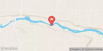

 Heil No 1