Osburn Reservoir Report
Last Updated: January 11, 2026
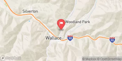
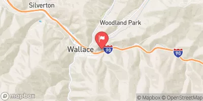
Located in Osburn, Idaho, the Osburn Tailings Cell No's 1 & 2 is a private water resource structure regulated by the Idaho Department of Water Resources.
°F
°F
mph
Wind
%
Humidity
Summary
This tailings facility sits along the South Fork Coeur d'Alene River, serving the primary purpose of storing tailings. The dam itself is an earth structure with a stone core, reaching a height of 71 feet and a hydraulic height of 62 feet, with a storage capacity of 1800 acre-feet.
Despite being classified as having a high hazard potential, the Osburn tailings facility is currently in fair condition, as assessed during the last inspection in September 2020. While the dam does not have a spillway, it is equipped with other controlled outlet gates. The facility covers a surface area of 22 acres and has a drainage area of 0.3 square miles, making it a crucial component of water management in the region.
Overall, the Osburn Tailings Cell serves as a critical water resource infrastructure in Shoshone County, Idaho, contributing to the management of water quality and quantity in the area. With its high hazard potential and fair condition, continued monitoring and maintenance will be essential to ensure the safety and effectiveness of this vital water resource structure for the local community and environment.
Dam Length |
3200 |
Dam Height |
71 |
River Or Stream |
SOUTH FORK COEUR D ALENE RIVER COEUR D ALENE RIVER |
Surface Area |
22 |
Hydraulic Height |
62 |
Drainage Area |
0.3 |
Nid Storage |
1800 |
Outlet Gates |
Other Controlled |
Hazard Potential |
High |
Foundations |
Rock, Soil |
Nid Height |
71 |
Seasonal Comparison
Weather Forecast
Nearby Streamflow Levels
Dam Data Reference
Condition Assessment
SatisfactoryNo existing or potential dam safety deficiencies are recognized. Acceptable performance is expected under all loading conditions (static, hydrologic, seismic) in accordance with the minimum applicable state or federal regulatory criteria or tolerable risk guidelines.
Fair
No existing dam safety deficiencies are recognized for normal operating conditions. Rare or extreme hydrologic and/or seismic events may result in a dam safety deficiency. Risk may be in the range to take further action. Note: Rare or extreme event is defined by the regulatory agency based on their minimum
Poor A dam safety deficiency is recognized for normal operating conditions which may realistically occur. Remedial action is necessary. POOR may also be used when uncertainties exist as to critical analysis parameters which identify a potential dam safety deficiency. Investigations and studies are necessary.
Unsatisfactory
A dam safety deficiency is recognized that requires immediate or emergency remedial action for problem resolution.
Not Rated
The dam has not been inspected, is not under state or federal jurisdiction, or has been inspected but, for whatever reason, has not been rated.
Not Available
Dams for which the condition assessment is restricted to approved government users.
Hazard Potential Classification
HighDams assigned the high hazard potential classification are those where failure or mis-operation will probably cause loss of human life.
Significant
Dams assigned the significant hazard potential classification are those dams where failure or mis-operation results in no probable loss of human life but can cause economic loss, environment damage, disruption of lifeline facilities, or impact other concerns. Significant hazard potential classification dams are often located in predominantly rural or agricultural areas but could be in areas with population and significant infrastructure.
Low
Dams assigned the low hazard potential classification are those where failure or mis-operation results in no probable loss of human life and low economic and/or environmental losses. Losses are principally limited to the owner's property.
Undetermined
Dams for which a downstream hazard potential has not been designated or is not provided.
Not Available
Dams for which the downstream hazard potential is restricted to approved government users.


 Osburn