Sulphur Gulch Reservoir Report
Nearby: Lodge Pond Dry Creek Diversion
Last Updated: January 11, 2026
Sulphur Gulch is a privately owned dam located in Payette, Idaho, that serves the primary purpose of irrigation.
°F
°F
mph
Wind
%
Humidity
Summary
Constructed in 1976, this earth dam with stone core stands at a height of 22.8 meters and has a hydraulic height of 15.5 meters. With a normal storage capacity of 50 acre-feet and a surface area of 8 acres, Sulphur Gulch plays a crucial role in providing water for agricultural activities in the surrounding area.
Managed by the Idaho Department of Water Resources (IDWR), Sulphur Gulch is regulated, permitted, inspected, and enforced by the state. Despite being classified as a low hazard potential structure, its condition is assessed as fair. The last inspection in June 2019 indicated that the dam's risk assessment is very high, emphasizing the importance of maintaining and managing this vital water resource infrastructure. With a controlled spillway and a maximum discharge capacity of 56 cubic feet per second, Sulphur Gulch ensures efficient water management and flood control for the Sulphur Gulch Creek and Big Willow Creek watersheds.
For water resource and climate enthusiasts, Sulphur Gulch presents an intriguing case study of a privately owned irrigation dam in Idaho. Its construction, design, and operational details offer valuable insights into sustainable water management practices and the importance of regular maintenance and risk assessment for ensuring the safety and efficiency of water infrastructure. As part of the Walla Walla District managed by the US Army Corps of Engineers, Sulphur Gulch plays a significant role in supporting agricultural activities and water supply reliability in the region, highlighting the interconnectedness between water resources, infrastructure, and environmental stewardship.
Year Completed |
1976 |
Dam Length |
350 |
Dam Height |
22.8 |
River Or Stream |
SULPHUR GULCH CREEK BIG WILLOW CREEK |
Surface Area |
8 |
Hydraulic Height |
15.5 |
Drainage Area |
2.3 |
Nid Storage |
50 |
Hazard Potential |
Low |
Foundations |
Rock, Soil |
Nid Height |
23 |
Seasonal Comparison
Weather Forecast
Nearby Streamflow Levels
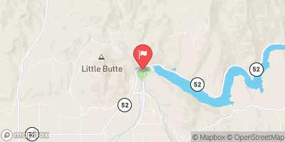
 Payette River Nr Emmett Id
|
2030cfs |
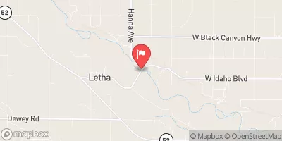
 Payette River Nr Letha Id
|
2110cfs |
 Weiser River Nr Weiser Id
|
1230cfs |
 Payette River Nr Horseshoe Bend Id
|
1690cfs |
 Payette River Nr Payette Id
|
2710cfs |
 Crane Creek At Mouth Nr Weiser Id
|
10cfs |
Dam Data Reference
Condition Assessment
SatisfactoryNo existing or potential dam safety deficiencies are recognized. Acceptable performance is expected under all loading conditions (static, hydrologic, seismic) in accordance with the minimum applicable state or federal regulatory criteria or tolerable risk guidelines.
Fair
No existing dam safety deficiencies are recognized for normal operating conditions. Rare or extreme hydrologic and/or seismic events may result in a dam safety deficiency. Risk may be in the range to take further action. Note: Rare or extreme event is defined by the regulatory agency based on their minimum
Poor A dam safety deficiency is recognized for normal operating conditions which may realistically occur. Remedial action is necessary. POOR may also be used when uncertainties exist as to critical analysis parameters which identify a potential dam safety deficiency. Investigations and studies are necessary.
Unsatisfactory
A dam safety deficiency is recognized that requires immediate or emergency remedial action for problem resolution.
Not Rated
The dam has not been inspected, is not under state or federal jurisdiction, or has been inspected but, for whatever reason, has not been rated.
Not Available
Dams for which the condition assessment is restricted to approved government users.
Hazard Potential Classification
HighDams assigned the high hazard potential classification are those where failure or mis-operation will probably cause loss of human life.
Significant
Dams assigned the significant hazard potential classification are those dams where failure or mis-operation results in no probable loss of human life but can cause economic loss, environment damage, disruption of lifeline facilities, or impact other concerns. Significant hazard potential classification dams are often located in predominantly rural or agricultural areas but could be in areas with population and significant infrastructure.
Low
Dams assigned the low hazard potential classification are those where failure or mis-operation results in no probable loss of human life and low economic and/or environmental losses. Losses are principally limited to the owner's property.
Undetermined
Dams for which a downstream hazard potential has not been designated or is not provided.
Not Available
Dams for which the downstream hazard potential is restricted to approved government users.

 Sulphur Gulch