Scott Creek Reservoir Report
Nearby: Jenkins Creek Barton
Last Updated: January 11, 2026
Scott Creek, located in West Weiser, Idaho, is a privately owned dam with a primary purpose of irrigation.
°F
°F
mph
Wind
%
Humidity
Summary
Completed in 1977, this earth dam stands at a height of 20.3 meters and has a hydraulic height of 17.3 meters. With a storage capacity of 90 acre-feet and a surface area of 14 acres, Scott Creek serves as a vital water resource for the surrounding area, drawing from the Snake River for its water source.
Despite its fair condition assessment as of October 2018, Scott Creek poses a significant hazard potential, with a very high risk assessment rating of 1. The dam features a controlled spillway with a width of 40 meters and a maximum discharge capacity of 100 cubic feet per second. While it is state regulated and inspected, the dam's hazard potential warrants ongoing risk management measures to ensure the safety of the surrounding community and environment.
Overall, Scott Creek serves as a crucial infrastructure for irrigation in the region, but its significant hazard potential underscores the importance of proactive risk management and regular inspections. With its location in the Walla Walla District and under the jurisdiction of the Idaho Department of Water Resources, Scott Creek stands as a reminder of the delicate balance between water resource utilization and environmental safety in the face of changing climate conditions.
Year Completed |
1977 |
Dam Length |
3450 |
Dam Height |
20.3 |
River Or Stream |
SCOTT CREEK SNAKE RIVER |
Surface Area |
14 |
Hydraulic Height |
17.3 |
Drainage Area |
13.2 |
Nid Storage |
90 |
Hazard Potential |
Significant |
Foundations |
Rock, Soil |
Nid Height |
20 |
Seasonal Comparison
Weather Forecast
Nearby Streamflow Levels
 Snake River At Weiser Id
|
12700cfs |
 Crane Creek At Mouth Nr Weiser Id
|
12cfs |
 Weiser River Nr Weiser Id
|
1450cfs |
 Payette River Nr Payette Id
|
2950cfs |
 Malheur River Below Nevada Dam Near Vale Or
|
140cfs |
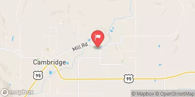 Weiser River Nr Cambridge Id
|
888cfs |
Dam Data Reference
Condition Assessment
SatisfactoryNo existing or potential dam safety deficiencies are recognized. Acceptable performance is expected under all loading conditions (static, hydrologic, seismic) in accordance with the minimum applicable state or federal regulatory criteria or tolerable risk guidelines.
Fair
No existing dam safety deficiencies are recognized for normal operating conditions. Rare or extreme hydrologic and/or seismic events may result in a dam safety deficiency. Risk may be in the range to take further action. Note: Rare or extreme event is defined by the regulatory agency based on their minimum
Poor A dam safety deficiency is recognized for normal operating conditions which may realistically occur. Remedial action is necessary. POOR may also be used when uncertainties exist as to critical analysis parameters which identify a potential dam safety deficiency. Investigations and studies are necessary.
Unsatisfactory
A dam safety deficiency is recognized that requires immediate or emergency remedial action for problem resolution.
Not Rated
The dam has not been inspected, is not under state or federal jurisdiction, or has been inspected but, for whatever reason, has not been rated.
Not Available
Dams for which the condition assessment is restricted to approved government users.
Hazard Potential Classification
HighDams assigned the high hazard potential classification are those where failure or mis-operation will probably cause loss of human life.
Significant
Dams assigned the significant hazard potential classification are those dams where failure or mis-operation results in no probable loss of human life but can cause economic loss, environment damage, disruption of lifeline facilities, or impact other concerns. Significant hazard potential classification dams are often located in predominantly rural or agricultural areas but could be in areas with population and significant infrastructure.
Low
Dams assigned the low hazard potential classification are those where failure or mis-operation results in no probable loss of human life and low economic and/or environmental losses. Losses are principally limited to the owner's property.
Undetermined
Dams for which a downstream hazard potential has not been designated or is not provided.
Not Available
Dams for which the downstream hazard potential is restricted to approved government users.
Area Campgrounds
| Location | Reservations | Toilets |
|---|---|---|
 Catfish Junction RV Park
|
||
 Oasis
Oasis
|
||
 Mann Creek Campground
|
||
 Steck Park
|
||
 Spring Recreation Site
|
||
 Spring
|

 Scott Creek