Fairchild No 2 (Lower) Reservoir Report
Nearby: Fairchild No. 1 (Upper) Mann Creek
Last Updated: January 11, 2026
Fairchild No 2 (Lower), also known as Lower Fairchild Dam, is a privately owned structure located in Midvale, Idaho.
°F
°F
mph
Wind
%
Humidity
Summary
Completed in 1988, this earth dam stands at a height of 24.4 feet and serves primarily for irrigation purposes in the region. It impounds an unnamed stream and Sage Creek, providing a storage capacity of 108 acre-feet and covering a surface area of 10 acres.
With a spillway width of 17 feet and a maximum discharge capacity of 80 cubic feet per second, Fairchild No 2 (Lower) has been deemed to have a significant hazard potential. Despite this, the dam's condition assessment in 2017 rated it as fair, with a moderate risk level. Regular inspections are carried out every 4 years to ensure its structural integrity and safety, with the Idaho Department of Water Resources overseeing state regulation, permitting, inspection, and enforcement of this crucial water resource infrastructure.
For water resource and climate enthusiasts, Fairchild No 2 (Lower) offers a glimpse into the intricate network of dams that support agricultural irrigation in Idaho. Its location, design features, and regulatory oversight provide valuable insights into the management of water resources in the region, highlighting the importance of maintaining infrastructure like this for sustainable water use and management in a changing climate.
Year Completed |
1988 |
Dam Length |
1700 |
Dam Height |
24.4 |
River Or Stream |
UNNAMED STREAM SAGE CREEK |
Surface Area |
10 |
Hydraulic Height |
21.2 |
Drainage Area |
0.7 |
Nid Storage |
108 |
Hazard Potential |
Significant |
Foundations |
Rock, Soil |
Nid Height |
24 |
Seasonal Comparison
Weather Forecast
Nearby Streamflow Levels
 Weiser River Nr Cambridge Id
|
734cfs |
 Crane Creek At Mouth Nr Weiser Id
|
10cfs |
 Weiser River Nr Weiser Id
|
1230cfs |
 Snake River At Weiser Id
|
12300cfs |
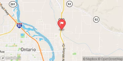 Payette River Nr Payette Id
|
2710cfs |
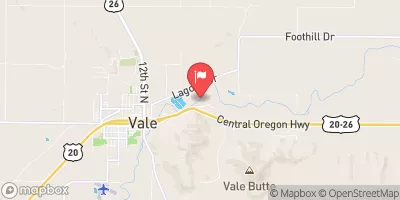 Malheur River Below Nevada Dam Near Vale Or
|
138cfs |
Dam Data Reference
Condition Assessment
SatisfactoryNo existing or potential dam safety deficiencies are recognized. Acceptable performance is expected under all loading conditions (static, hydrologic, seismic) in accordance with the minimum applicable state or federal regulatory criteria or tolerable risk guidelines.
Fair
No existing dam safety deficiencies are recognized for normal operating conditions. Rare or extreme hydrologic and/or seismic events may result in a dam safety deficiency. Risk may be in the range to take further action. Note: Rare or extreme event is defined by the regulatory agency based on their minimum
Poor A dam safety deficiency is recognized for normal operating conditions which may realistically occur. Remedial action is necessary. POOR may also be used when uncertainties exist as to critical analysis parameters which identify a potential dam safety deficiency. Investigations and studies are necessary.
Unsatisfactory
A dam safety deficiency is recognized that requires immediate or emergency remedial action for problem resolution.
Not Rated
The dam has not been inspected, is not under state or federal jurisdiction, or has been inspected but, for whatever reason, has not been rated.
Not Available
Dams for which the condition assessment is restricted to approved government users.
Hazard Potential Classification
HighDams assigned the high hazard potential classification are those where failure or mis-operation will probably cause loss of human life.
Significant
Dams assigned the significant hazard potential classification are those dams where failure or mis-operation results in no probable loss of human life but can cause economic loss, environment damage, disruption of lifeline facilities, or impact other concerns. Significant hazard potential classification dams are often located in predominantly rural or agricultural areas but could be in areas with population and significant infrastructure.
Low
Dams assigned the low hazard potential classification are those where failure or mis-operation results in no probable loss of human life and low economic and/or environmental losses. Losses are principally limited to the owner's property.
Undetermined
Dams for which a downstream hazard potential has not been designated or is not provided.
Not Available
Dams for which the downstream hazard potential is restricted to approved government users.
Area Campgrounds
| Location | Reservations | Toilets |
|---|---|---|
 Mann Creek Campground
|
||
 Kiwanis Campground
|
||
 Justrite Campground
|
||
 Crane Creek Reservoir
|
||
 Mundo Hot Springs
|

 Fairchild No 2 (Lower)