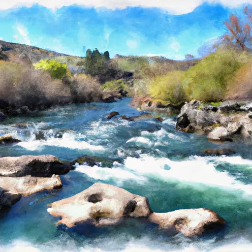
Salmon River Canal Co Reservoir Near Rogerson Id Reservoir
As of July 26, 2026, Salmon River Canal Co Res Nr Rogerson Id is holding 5 ft of water — 14% of normal storage for this date. Storage data refreshed throughout the day.

Salmon River Canal Co Res Nr Rogerson Id
The Salmon River Canal Co Res NR Rogerson ID is a magnificent reservoir that is located in Idaho. The reservoir was constructed in the late 1800s to provide water for agricultural purposes in the Snake River Plain. The reservoir receives water from several sources, including surface flow, snowpack, and precipitation. The water is then used for irrigation purposes to support the agricultural industry in the region. The reservoir also provides recreational opportunities such as fishing and boating. The hydrology of the area is characterized by a significant snowpack that feeds the reservoir during the spring months. The snowpack is essential for maintaining the water levels in the reservoir during the summer months when water demand for irrigation is at its highest.
Daily levels at Salmon River Canal Co Res Nr Rogerson Id
Storage volume, pool elevation, and total release plotted from the operating agency's daily observations.
Reservoir storage, acre-ft
ac-ft · code 00054
Gage height, ft
ft · code 00065
Plan around the weather
Same NOAA / yr.no feed Snoflo's iOS app uses. Watch the precipitation column on the meteogram -- rain on the basin upstream typically lifts inflow 24-72 hours later.
Next 5 days, hour by hour
Temperature line with weather symbols on top, snow + rain accumulation as columns, humidity as a dotted line.
5-day forecast table
Every 3 hours, broken out across temperature, snow, rain, humidity, and wind. Each cell is colour-coded relative to the column min/max.
| Time | Condition | Temp (°F) | Snow (in) | Rain (in) | Humidity (%) | Wind (mps) | Wind dir |
|---|---|---|---|---|---|---|---|
| Loading detailed forecast… | |||||||
15-day temperature & precipitation
Daily temperatures, snow, and rain projected over the next two weeks.
Nearby streamflow gauges
USGS streamgauges around Salmon River Canal Co Res Nr Rogerson Id -- inflows here typically show up in storage 24-72 hours later.
| Streamgauge | Discharge | View |
|---|---|---|
| Salmon River Canal Co Canal Nr Rogerson Id | 20 cfs | → |
| Salmon Falls Creek Nr San Jacinto Nv | 30 cfs | → |
| Rock Creek Ab Hwy 30/93 Xing At Twin Falls Id | 131 cfs | → |
| Snake River Nr Twin Falls Id | 464 cfs | → |
| Blue Lakes Spring Bl Pump Plant Nr Twin Falls Id | 149 cfs | → |
| Snake River Nr Buhl Id | 1,610 cfs | → |


About Salmon River Canal Co Res Nr Rogerson Id
What is the water level at Salmon River Canal Co Reservoir Near Rogerson Id Reservoir right now?
As of July 26, 2026, Salmon River Canal Co Reservoir Near Rogerson Id Reservoir is holding 5 ft, about 14% of normal for this date. Pool elevation and the year-over-year trend are shown above.
Is Salmon River Canal Co Reservoir Near Rogerson Id Reservoir high or low right now?
Compare the percent-of-normal figure on this page: above 100% means storage is higher than the historical average for the date (a wet year), below 100% means lower (a dry year or drought). The daily-levels chart shows the current trend.
Where does the data for Salmon River Canal Co Reservoir Near Rogerson Id come from?
Daily storage, pool elevation, and release rates are sourced from USGS, USBR, and USACE monitoring stations. Weather forecast comes from NOAA / yr.no -- the same feed Snoflo's iOS app uses.
How often is the report updated?
Storage observations are updated daily by the operating agency. The 15-day weather forecast refreshes throughout the day. Snoflo caches and renders the most recent observation -- check the "as of" timestamp on the storage card.
What does the Hazard hazard rating mean?
The Corps of Engineers' hazard potential classification grades probable consequences if the dam fails: High = probable loss of human life; Significant = no probable loss of human life but possible economic loss / environmental damage; Low = no probable loss of human life, only minor economic / environmental losses. See the Dam Data Reference card below for the full definitions.
What's "% of normal"?
The current storage value compared to the historical average storage on this calendar day. 100% = right on average; values above 100% mean above-normal storage (wet year); values below mean below-normal (dry year or drought).
Can I get alerts when storage crosses a threshold?
Yes -- alerts are managed in the Snoflo iOS app. Favorite this reservoir, set a threshold, and you'll get a push the moment conditions cross.