
Mississippi River Lock And Dam 16 Reservoir Report
Nearby: Hon Dam Whispering Pines Dam
Last Updated: April 1, 2026
Mississippi River Lock and Dam 16, also known as Pool 16, is a federal-owned structure located in Muscatine, Iowa along the Mississippi River.
Summary
Completed in 1937, this concrete dam serves the primary purpose of navigation on the river, with a hydraulic height of 9 feet and a structural height of 34 feet. It features a multi-arch core design and spans 4400 feet in length, with a spillway width of 1315 feet to manage water levels during periods of high discharge.
Managed by the US Army Corps of Engineers, Lock and Dam 16 plays a crucial role in mitigating flood risks in the area. With a significant hazard potential, the dam is regularly inspected and monitored to ensure its structural integrity and readiness for emergency situations. The Corps actively engages with local emergency managers and the public to raise awareness and develop emergency action plans, emphasizing the importance of preparedness and response in case of a dam-related emergency. Additionally, ongoing maintenance and repairs are conducted to keep the dam functioning effectively and safely.
In the face of evolving climate conditions and potential severe weather events, the management measures implemented by the US Army Corps of Engineers for Lock and Dam 16 aim to address all types of flood risks associated with the structure. By prioritizing activities that reduce risks, maintaining communication with stakeholders, and updating emergency action plans, the Corps strives to ensure the resilience and reliability of the dam in the long term. As water releases and pressure management are key strategies for flood risk management, ongoing efforts are dedicated to safeguarding the surrounding community and the integrity of Lock and Dam 16.
°F
°F
mph
Wind
%
Humidity
15-Day Weather Outlook
Year Completed |
1937 |
Dam Length |
4400 |
River Or Stream |
MISSISSIPPI RIVER |
Primary Dam Type |
Concrete |
Surface Area |
12047 |
Length Of Locks |
600 |
Hydraulic Height |
9 |
Drainage Area |
99400 |
Nid Storage |
88000 |
Structural Height |
34 |
Outlet Gates |
Roller - 4, Tainter (radial) - 15, Uncontrolled - 0 |
Hazard Potential |
Significant |
Foundations |
Soil |
Nid Height |
34 |
Seasonal Comparison
5-Day Hourly Forecast Detail
Nearby Streamflow Levels
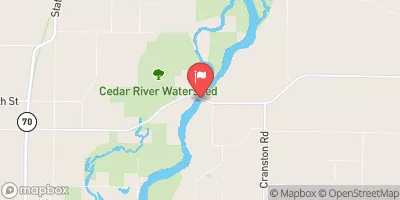 Cedar River Near Conesville
|
7020cfs |
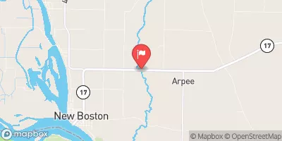 Edwards River Near New Boston
|
313cfs |
 Duck Creek At 110th Ave At Davenport
|
10cfs |
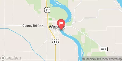 Iowa River At Wapello
|
7940cfs |
 Pope Creek Near Keithsburg
|
114cfs |
 Mill Creek At Milan
|
26cfs |
Dam Data Reference
Condition Assessment
SatisfactoryNo existing or potential dam safety deficiencies are recognized. Acceptable performance is expected under all loading conditions (static, hydrologic, seismic) in accordance with the minimum applicable state or federal regulatory criteria or tolerable risk guidelines.
Fair
No existing dam safety deficiencies are recognized for normal operating conditions. Rare or extreme hydrologic and/or seismic events may result in a dam safety deficiency. Risk may be in the range to take further action. Note: Rare or extreme event is defined by the regulatory agency based on their minimum
Poor A dam safety deficiency is recognized for normal operating conditions which may realistically occur. Remedial action is necessary. POOR may also be used when uncertainties exist as to critical analysis parameters which identify a potential dam safety deficiency. Investigations and studies are necessary.
Unsatisfactory
A dam safety deficiency is recognized that requires immediate or emergency remedial action for problem resolution.
Not Rated
The dam has not been inspected, is not under state or federal jurisdiction, or has been inspected but, for whatever reason, has not been rated.
Not Available
Dams for which the condition assessment is restricted to approved government users.
Hazard Potential Classification
HighDams assigned the high hazard potential classification are those where failure or mis-operation will probably cause loss of human life.
Significant
Dams assigned the significant hazard potential classification are those dams where failure or mis-operation results in no probable loss of human life but can cause economic loss, environment damage, disruption of lifeline facilities, or impact other concerns. Significant hazard potential classification dams are often located in predominantly rural or agricultural areas but could be in areas with population and significant infrastructure.
Low
Dams assigned the low hazard potential classification are those where failure or mis-operation results in no probable loss of human life and low economic and/or environmental losses. Losses are principally limited to the owner's property.
Undetermined
Dams for which a downstream hazard potential has not been designated or is not provided.
Not Available
Dams for which the downstream hazard potential is restricted to approved government users.
 Fairport State Recreation Area Campground
 Fairport State Rec Area
 Blanchard Island - COE
 Blanchard Island - Mississippi River
 Shady Creek - Mississippi River
 Wildcat Den State Park Campground
 Mississippi River Lock And Dam 16