


Payer Lake No 1 Dam Reservoir Report
Last Updated: May 4, 2026
°F
°F
mph
Wind
%
Humidity
Payer Lake No 1 Dam, located in Crocketts Bluff, Arkansas, is a privately owned earth dam designed by USDA NRCS and completed in 1969 for recreational purposes.
Summary
With a height of 27 feet and a length of 760 feet, this dam has a storage capacity of 260 acre-feet and a normal storage level of 202 acre-feet. The dam is regulated, permitted, inspected, and enforced by the Arkansas Natural Resources Commission, ensuring its safety and compliance with state regulations.
Despite its low hazard potential, Payer Lake No 1 Dam has a moderate risk assessment due to its location on the White River. The dam has an uncontrolled spillway type and a maximum discharge capacity of 4696 cubic feet per second. It covers a surface area of 12 acres and serves as a recreational area for water resource and climate enthusiasts. The dam's risk management measures and emergency preparedness status are not explicitly stated in the data, indicating potential areas for improvement in ensuring the dam's safety and resilience in the face of climate challenges.
Overall, Payer Lake No 1 Dam presents an intriguing case study for water resource and climate enthusiasts, showcasing the intersection of infrastructure, regulation, and risk management in maintaining a recreational water feature. With its historical construction by the USDA NRCS and ongoing state oversight by the Arkansas Natural Resources Commission, this dam serves as a vital piece of water infrastructure in Arkansas, balancing the need for recreation with the necessity of ensuring public safety and environmental protection in the face of changing climate conditions.
Regional Streamflow Levels
 White River At Devalls Bluff
|
18300cfs |
 Cache River Near Cotton Plant
|
899cfs |
 Bayou Meto Near Lonoke
|
193cfs |
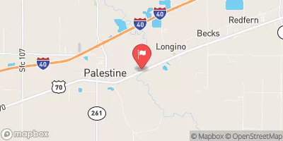 Languille River At Palestine
|
3920cfs |
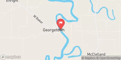 White River At Georgetown
|
16500cfs |
 Big Sunflower River At Clarksdale
|
0cfs |
15-Day Long Term Forecast
Year Completed |
1969 |
Dam Length |
760 |
Dam Height |
27 |
River Or Stream |
WHITE RIVER-TR |
Primary Dam Type |
Earth |
Surface Area |
12 |
Hydraulic Height |
22 |
Drainage Area |
0.13 |
Nid Storage |
260 |
Structural Height |
27 |
Hazard Potential |
Low |
Nid Height |
27 |
Seasonal Comparison
5-Day Hourly Forecast Detail
Dam Data Reference
Condition Assessment
SatisfactoryNo existing or potential dam safety deficiencies are recognized. Acceptable performance is expected under all loading conditions (static, hydrologic, seismic) in accordance with the minimum applicable state or federal regulatory criteria or tolerable risk guidelines.
Fair
No existing dam safety deficiencies are recognized for normal operating conditions. Rare or extreme hydrologic and/or seismic events may result in a dam safety deficiency. Risk may be in the range to take further action. Note: Rare or extreme event is defined by the regulatory agency based on their minimum
Poor A dam safety deficiency is recognized for normal operating conditions which may realistically occur. Remedial action is necessary. POOR may also be used when uncertainties exist as to critical analysis parameters which identify a potential dam safety deficiency. Investigations and studies are necessary.
Unsatisfactory
A dam safety deficiency is recognized that requires immediate or emergency remedial action for problem resolution.
Not Rated
The dam has not been inspected, is not under state or federal jurisdiction, or has been inspected but, for whatever reason, has not been rated.
Not Available
Dams for which the condition assessment is restricted to approved government users.
Hazard Potential Classification
HighDams assigned the high hazard potential classification are those where failure or mis-operation will probably cause loss of human life.
Significant
Dams assigned the significant hazard potential classification are those dams where failure or mis-operation results in no probable loss of human life but can cause economic loss, environment damage, disruption of lifeline facilities, or impact other concerns. Significant hazard potential classification dams are often located in predominantly rural or agricultural areas but could be in areas with population and significant infrastructure.
Low
Dams assigned the low hazard potential classification are those where failure or mis-operation results in no probable loss of human life and low economic and/or environmental losses. Losses are principally limited to the owner's property.
Undetermined
Dams for which a downstream hazard potential has not been designated or is not provided.
Not Available
Dams for which the downstream hazard potential is restricted to approved government users.
 Monroe County
 Spring Creek
 Lake Greenlee
 Bayou Meto
 Collins Creek
 Plum Bayou