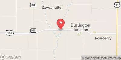
Williams Dam Reservoir Report
Nearby: Posten Dam Goddard Dam
Last Updated: February 8, 2026
Williams Dam, located in Clarinda, Iowa, is a privately-owned structure designed by the USDA NRCS with a primary purpose of providing fire protection and serving as a stock or small fish pond.
Summary
Completed in 1969, this earth dam stands at 37 feet in height and spans a length of 332 feet, with a storage capacity of 45 acre-feet. Situated on the TR-West Nodoway River, Williams Dam is regulated by the Iowa Department of Natural Resources and undergoes regular inspections, enforcement, and permitting to ensure its safety and compliance with state regulations.
With a low hazard potential and a moderate risk assessment rating, Williams Dam has not been officially rated for its condition. Despite this, the dam remains a crucial resource for fire protection and agricultural purposes in the region. As an uncontrolled spillway type structure, Williams Dam plays a vital role in managing water flow and storage in the area, serving as a valuable asset for water resource management and climate resilience efforts. Enthusiasts of water resources and climate management will find Williams Dam to be a fascinating example of sustainable infrastructure that supports both human and environmental needs in the region.
°F
°F
mph
Wind
%
Humidity
15-Day Weather Outlook
Year Completed |
1969 |
Dam Length |
332 |
Dam Height |
37 |
River Or Stream |
TR-WEST NODOWAY RIVER |
Primary Dam Type |
Earth |
Surface Area |
2.2 |
Drainage Area |
0.31 |
Nid Storage |
45 |
Hazard Potential |
Low |
Foundations |
Soil |
Nid Height |
37 |
Seasonal Comparison
5-Day Hourly Forecast Detail
Nearby Streamflow Levels
Dam Data Reference
Condition Assessment
SatisfactoryNo existing or potential dam safety deficiencies are recognized. Acceptable performance is expected under all loading conditions (static, hydrologic, seismic) in accordance with the minimum applicable state or federal regulatory criteria or tolerable risk guidelines.
Fair
No existing dam safety deficiencies are recognized for normal operating conditions. Rare or extreme hydrologic and/or seismic events may result in a dam safety deficiency. Risk may be in the range to take further action. Note: Rare or extreme event is defined by the regulatory agency based on their minimum
Poor A dam safety deficiency is recognized for normal operating conditions which may realistically occur. Remedial action is necessary. POOR may also be used when uncertainties exist as to critical analysis parameters which identify a potential dam safety deficiency. Investigations and studies are necessary.
Unsatisfactory
A dam safety deficiency is recognized that requires immediate or emergency remedial action for problem resolution.
Not Rated
The dam has not been inspected, is not under state or federal jurisdiction, or has been inspected but, for whatever reason, has not been rated.
Not Available
Dams for which the condition assessment is restricted to approved government users.
Hazard Potential Classification
HighDams assigned the high hazard potential classification are those where failure or mis-operation will probably cause loss of human life.
Significant
Dams assigned the significant hazard potential classification are those dams where failure or mis-operation results in no probable loss of human life but can cause economic loss, environment damage, disruption of lifeline facilities, or impact other concerns. Significant hazard potential classification dams are often located in predominantly rural or agricultural areas but could be in areas with population and significant infrastructure.
Low
Dams assigned the low hazard potential classification are those where failure or mis-operation results in no probable loss of human life and low economic and/or environmental losses. Losses are principally limited to the owner's property.
Undetermined
Dams for which a downstream hazard potential has not been designated or is not provided.
Not Available
Dams for which the downstream hazard potential is restricted to approved government users.
Area Campgrounds
| Location | Reservations | Toilets |
|---|---|---|
 Viking Lake State Park
|
||
 Viking Lake State Park Campground
|
||
 Hacklebarney Woods County Park
|


 Williams Dam