Scott Dam Reservoir Report
Last Updated: February 4, 2026
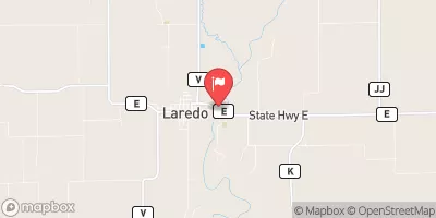
Scott Dam, located in Decatur, Iowa, was completed in 1981 by the Soil Conservation Service (SCS) and serves multiple purposes including fire protection, stock, and small fish pond management.
°F
°F
mph
Wind
%
Humidity
15-Day Weather Outlook
Summary
With a height of 28 feet and a length of 540 feet, the dam has a storage capacity of 140 acre-feet and covers a surface area of 5.9 acres. It is situated on the TR-Little River and is regulated by the Iowa Department of Natural Resources.
Despite being classified as having a low hazard potential, Scott Dam is considered to have a moderate risk level. The dam is designed as an earth structure with a spillway type of uncontrolled. It is owned privately and falls under the jurisdiction of the state of Iowa. The dam has not been rated for its condition assessment, and there is no available information on its emergency action plan or risk management measures.
For water resource and climate enthusiasts, Scott Dam presents an interesting case study in dam management and regulation. Its location in a rural area and its multiple purposes highlight the importance of balancing water resource utilization with environmental conservation. The dam's history, design, and risk assessment provide valuable insights into the complexities of managing water infrastructure in a changing climate.
Year Completed |
1981 |
Dam Length |
540 |
Dam Height |
28 |
River Or Stream |
TR-LITTLE RIVER |
Primary Dam Type |
Earth |
Surface Area |
5.9 |
Drainage Area |
0.6 |
Nid Storage |
140 |
Hazard Potential |
Low |
Foundations |
Soil |
Nid Height |
28 |
Seasonal Comparison
Hourly Weather Forecast
Nearby Streamflow Levels
Dam Data Reference
Condition Assessment
SatisfactoryNo existing or potential dam safety deficiencies are recognized. Acceptable performance is expected under all loading conditions (static, hydrologic, seismic) in accordance with the minimum applicable state or federal regulatory criteria or tolerable risk guidelines.
Fair
No existing dam safety deficiencies are recognized for normal operating conditions. Rare or extreme hydrologic and/or seismic events may result in a dam safety deficiency. Risk may be in the range to take further action. Note: Rare or extreme event is defined by the regulatory agency based on their minimum
Poor A dam safety deficiency is recognized for normal operating conditions which may realistically occur. Remedial action is necessary. POOR may also be used when uncertainties exist as to critical analysis parameters which identify a potential dam safety deficiency. Investigations and studies are necessary.
Unsatisfactory
A dam safety deficiency is recognized that requires immediate or emergency remedial action for problem resolution.
Not Rated
The dam has not been inspected, is not under state or federal jurisdiction, or has been inspected but, for whatever reason, has not been rated.
Not Available
Dams for which the condition assessment is restricted to approved government users.
Hazard Potential Classification
HighDams assigned the high hazard potential classification are those where failure or mis-operation will probably cause loss of human life.
Significant
Dams assigned the significant hazard potential classification are those dams where failure or mis-operation results in no probable loss of human life but can cause economic loss, environment damage, disruption of lifeline facilities, or impact other concerns. Significant hazard potential classification dams are often located in predominantly rural or agricultural areas but could be in areas with population and significant infrastructure.
Low
Dams assigned the low hazard potential classification are those where failure or mis-operation results in no probable loss of human life and low economic and/or environmental losses. Losses are principally limited to the owner's property.
Undetermined
Dams for which a downstream hazard potential has not been designated or is not provided.
Not Available
Dams for which the downstream hazard potential is restricted to approved government users.


 Scott Dam