Hillsdale Lk Nr Hillsdale Reservoir Report
Last Updated: February 23, 2026
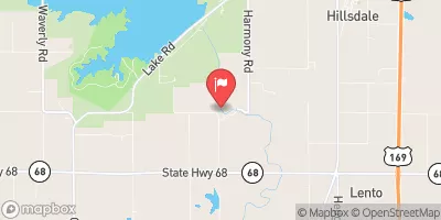
Hillsdale Lake, located near Hillsdale, KS in Kansas, was created in 1982 by the U.S.
Summary
Army Corps of Engineers for flood control and water supply purposes. The lake has a capacity of 50,000 acre-feet and covers 4,580 acres. The hydrology of the lake is mainly from the Middle Creek and Big Bull Creek watersheds. The lake provides surface water for communities in the surrounding area and is also used for recreational activities such as fishing, boating, and camping. The lake is also a popular destination for hunting and hiking. The surrounding area is primarily agricultural, with crops such as corn, soybeans, and wheat. Snowpack providers for the lake include precipitation and runoff from the surrounding watersheds, which replenish the lake's water levels.
°F
°F
mph
Wind
%
Humidity
15-Day Weather Outlook
Reservoir Details
| Lake Or Reservoir Water Surface Elevation Above Ngvd 1929, Ft 24hr Change | -0.01% |
| Percent of Normal | 100% |
| Minimum |
906.63 ft
2023-09-20 |
| Maximum |
929.34 ft
2019-06-07 |
| Average | 916 ft |
| Hydraulic_Height | 100 |
| Drainage_Area | 144 |
| Year_Completed | 1981 |
| Nid_Storage | 160000 |
| Structural_Height | 105 |
| River_Or_Stream | BIG BULL CREEK |
| Foundations | Rock, Soil |
| Surface_Area | 4580 |
| Hazard_Potential | High |
| Outlet_Gates | Uncontrolled - 0 |
| Dam_Length | 11640 |
| Primary_Dam_Type | Earth |
| Nid_Height | 105 |
Seasonal Comparison
Reservoir Storage, Acre-Ft Levels
Lake Or Reservoir Water Surface Elevation Above Ngvd 1929, Ft Levels
5-Day Hourly Forecast Detail
Nearby Streamflow Levels
 Big Bull C Nr Hillsdale
|
96cfs |
 L Bull C Nr Spring Hill
|
2cfs |
 Big Bull C Nr Edgerton
|
2cfs |
 Pottawatomie C At Lane
|
212cfs |
 Blue R Nr Stanley
|
7cfs |
 Marais Des Cygnes R Nr Ottawa
|
1860cfs |
Dam Data Reference
Condition Assessment
SatisfactoryNo existing or potential dam safety deficiencies are recognized. Acceptable performance is expected under all loading conditions (static, hydrologic, seismic) in accordance with the minimum applicable state or federal regulatory criteria or tolerable risk guidelines.
Fair
No existing dam safety deficiencies are recognized for normal operating conditions. Rare or extreme hydrologic and/or seismic events may result in a dam safety deficiency. Risk may be in the range to take further action. Note: Rare or extreme event is defined by the regulatory agency based on their minimum
Poor A dam safety deficiency is recognized for normal operating conditions which may realistically occur. Remedial action is necessary. POOR may also be used when uncertainties exist as to critical analysis parameters which identify a potential dam safety deficiency. Investigations and studies are necessary.
Unsatisfactory
A dam safety deficiency is recognized that requires immediate or emergency remedial action for problem resolution.
Not Rated
The dam has not been inspected, is not under state or federal jurisdiction, or has been inspected but, for whatever reason, has not been rated.
Not Available
Dams for which the condition assessment is restricted to approved government users.
Hazard Potential Classification
HighDams assigned the high hazard potential classification are those where failure or mis-operation will probably cause loss of human life.
Significant
Dams assigned the significant hazard potential classification are those dams where failure or mis-operation results in no probable loss of human life but can cause economic loss, environment damage, disruption of lifeline facilities, or impact other concerns. Significant hazard potential classification dams are often located in predominantly rural or agricultural areas but could be in areas with population and significant infrastructure.
Low
Dams assigned the low hazard potential classification are those where failure or mis-operation results in no probable loss of human life and low economic and/or environmental losses. Losses are principally limited to the owner's property.
Undetermined
Dams for which a downstream hazard potential has not been designated or is not provided.
Not Available
Dams for which the downstream hazard potential is restricted to approved government users.
Area Campgrounds
| Location | Reservations | Toilets |
|---|---|---|
 Lake Miola City Park
|
||
 Osawatomie City Lake
|
||
 John Brown Memorial Park
|

 Hillsdale Dam
 Hillsdale Lk Nr Hillsdale
 Miami County