Glen Elder -Downs Protective Dike Reservoir Report
Last Updated: February 21, 2026
The Glen Elder - Downs Protective Dike is a crucial structure located in Osborne, Kansas, designed and owned by the Bureau of Reclamation to mitigate flood risks in the area.
Summary
Completed in 1969, this earth dam stands at 85 feet high with a hydraulic height of 41 feet and a length of 14,650 feet. It has a storage capacity of 1,128,740 acre-feet, serving as a vital tool in managing water resources in the region.
With a high hazard potential, this protective dike plays a significant role in flood risk reduction for the surrounding community. Although its condition assessment is not currently available, the Bureau of Reclamation is responsible for its inspections, operations, and regulatory oversight. The structure's primary purpose of flood risk reduction aligns with its design and construction, making it a key asset for climate and water resource enthusiasts interested in understanding the management of water infrastructure in Kansas.
As a federally owned and funded project, the Glen Elder - Downs Protective Dike is a testament to the collaborative efforts between government agencies to safeguard communities from potential disasters. Its strategic location in S27, T6S, R11W, further emphasizes its importance in protecting the residents of Downs and the wider Osborne County. This structure stands as a symbol of resilience and proactive measures in the face of natural hazards, making it an intriguing subject for those passionate about water resource management and climate adaptation strategies.
°F
°F
mph
Wind
%
Humidity
15-Day Weather Outlook
Year Completed |
1969 |
Dam Length |
14650 |
Dam Height |
85 |
Primary Dam Type |
Earth |
Surface Area |
13500 |
Hydraulic Height |
41 |
Drainage Area |
2520 |
Nid Storage |
1128740 |
Structural Height |
85 |
Hazard Potential |
High |
Foundations |
Rock |
Nid Height |
85 |
Seasonal Comparison
5-Day Hourly Forecast Detail
Nearby Streamflow Levels
 Nf Solomon R At Portis
|
21cfs |
 Sf Solomon R At Osborne
|
8cfs |
 Solomon R Nr Glen Elder
|
16cfs |
 Solomon R At Beloit
|
16cfs |
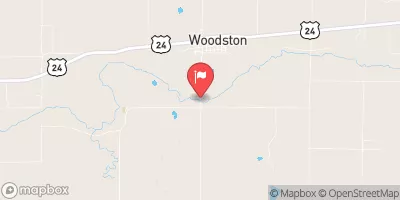 Sf Solomon R At Woodston
|
0cfs |
 White Rock C Nr Burr Oak
|
6cfs |
Dam Data Reference
Condition Assessment
SatisfactoryNo existing or potential dam safety deficiencies are recognized. Acceptable performance is expected under all loading conditions (static, hydrologic, seismic) in accordance with the minimum applicable state or federal regulatory criteria or tolerable risk guidelines.
Fair
No existing dam safety deficiencies are recognized for normal operating conditions. Rare or extreme hydrologic and/or seismic events may result in a dam safety deficiency. Risk may be in the range to take further action. Note: Rare or extreme event is defined by the regulatory agency based on their minimum
Poor A dam safety deficiency is recognized for normal operating conditions which may realistically occur. Remedial action is necessary. POOR may also be used when uncertainties exist as to critical analysis parameters which identify a potential dam safety deficiency. Investigations and studies are necessary.
Unsatisfactory
A dam safety deficiency is recognized that requires immediate or emergency remedial action for problem resolution.
Not Rated
The dam has not been inspected, is not under state or federal jurisdiction, or has been inspected but, for whatever reason, has not been rated.
Not Available
Dams for which the condition assessment is restricted to approved government users.
Hazard Potential Classification
HighDams assigned the high hazard potential classification are those where failure or mis-operation will probably cause loss of human life.
Significant
Dams assigned the significant hazard potential classification are those dams where failure or mis-operation results in no probable loss of human life but can cause economic loss, environment damage, disruption of lifeline facilities, or impact other concerns. Significant hazard potential classification dams are often located in predominantly rural or agricultural areas but could be in areas with population and significant infrastructure.
Low
Dams assigned the low hazard potential classification are those where failure or mis-operation results in no probable loss of human life and low economic and/or environmental losses. Losses are principally limited to the owner's property.
Undetermined
Dams for which a downstream hazard potential has not been designated or is not provided.
Not Available
Dams for which the downstream hazard potential is restricted to approved government users.

 Glen Elder -Downs Protective Dike