Summary
The lake, completed in 1956, serves as a vital water source for the surrounding area and has a normal storage capacity of 1200 acre-feet. Located in Atchison County, the lake is situated along Independence Creek and covers a surface area of approximately 1950 acres.
The dam at Atchison County State Lake is a buttress type structure with a height of 62 feet and a hydraulic height of 56 feet. The spillway width is 100 feet, and the hazard potential of the dam is rated as low. Despite not having a condition assessment, the dam has been inspected by state authorities in 1998 and is subject to regular inspections, enforcement, and permitting by the Kansas Department of Agriculture. While the dam has not been modified in recent years, it remains a crucial component of the local water infrastructure.
The Atchison County State Lake offers a serene and picturesque setting for water and climate enthusiasts to explore. With its low hazard potential and state-regulated status, the lake provides a safe and reliable water source for the community. The dam, designed by Wilson and Co, stands as a testament to engineering excellence and serves as a vital resource for water management in the region. Whether for recreational purposes or as a source of irrigation, Atchison County State Lake plays a crucial role in ensuring water security and environmental sustainability in Atchison, Kansas.
°F
°F
mph
Wind
%
Humidity
15-Day Weather Outlook
Year Completed |
1956 |
Dam Length |
1010 |
Dam Height |
62 |
River Or Stream |
INDEPENDENCE CREEK-TR |
Hydraulic Height |
56 |
Nid Storage |
1950 |
Structural Height |
62 |
Outlet Gates |
None |
Hazard Potential |
Low |
Foundations |
Unlisted/Unknown |
Nid Height |
62 |
Seasonal Comparison
5-Day Hourly Forecast Detail
Nearby Streamflow Levels
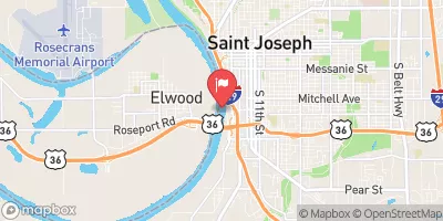
 Stranger C Nr Potter
|
199cfs |
 Missouri River At St. Joseph
|
22300cfs |
 Delaware R Nr Muscotah
|
30cfs |
 Platte River Near Agency
|
91cfs |
 Platte River At Sharps Station
|
87cfs |
 Missouri River At Rulo
|
22600cfs |
Dam Data Reference
Condition Assessment
SatisfactoryNo existing or potential dam safety deficiencies are recognized. Acceptable performance is expected under all loading conditions (static, hydrologic, seismic) in accordance with the minimum applicable state or federal regulatory criteria or tolerable risk guidelines.
Fair
No existing dam safety deficiencies are recognized for normal operating conditions. Rare or extreme hydrologic and/or seismic events may result in a dam safety deficiency. Risk may be in the range to take further action. Note: Rare or extreme event is defined by the regulatory agency based on their minimum
Poor A dam safety deficiency is recognized for normal operating conditions which may realistically occur. Remedial action is necessary. POOR may also be used when uncertainties exist as to critical analysis parameters which identify a potential dam safety deficiency. Investigations and studies are necessary.
Unsatisfactory
A dam safety deficiency is recognized that requires immediate or emergency remedial action for problem resolution.
Not Rated
The dam has not been inspected, is not under state or federal jurisdiction, or has been inspected but, for whatever reason, has not been rated.
Not Available
Dams for which the condition assessment is restricted to approved government users.
Hazard Potential Classification
HighDams assigned the high hazard potential classification are those where failure or mis-operation will probably cause loss of human life.
Significant
Dams assigned the significant hazard potential classification are those dams where failure or mis-operation results in no probable loss of human life but can cause economic loss, environment damage, disruption of lifeline facilities, or impact other concerns. Significant hazard potential classification dams are often located in predominantly rural or agricultural areas but could be in areas with population and significant infrastructure.
Low
Dams assigned the low hazard potential classification are those where failure or mis-operation results in no probable loss of human life and low economic and/or environmental losses. Losses are principally limited to the owner's property.
Undetermined
Dams for which a downstream hazard potential has not been designated or is not provided.
Not Available
Dams for which the downstream hazard potential is restricted to approved government users.

 Atchison County State Lake