Summary
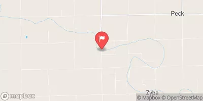
Built in 1967 by the USDA NRCS, this earth-type dam serves the primary purpose of flood risk reduction along the Muddy Creek, with a hydraulic height of 45 feet and a structural height of 54 feet. The dam has a storage capacity of 10,825 acre-feet and covers a surface area of 93.1 acres, impacting a drainage area of 29.55 square miles.
With a spillway width of 400 feet and a high hazard potential, Frd No 4-6 is regulated by the Kansas Department of Agriculture and undergoes regular inspections every three years. The dam has not been rated for condition assessment, but it is categorized as having a moderate risk level. While the dam does not have any associated locks or outlet gates, it plays a critical role in managing flood risks in the region and offers recreational opportunities for the local community. As a significant water resource infrastructure in Butler County, Frd No 4-6 highlights the importance of effective dam management and climate resilience measures in safeguarding our water resources for the future.
°F
°F
mph
Wind
%
Humidity
15-Day Weather Outlook
Year Completed |
1967 |
Dam Length |
3400 |
Dam Height |
45 |
River Or Stream |
MUDDY CREEK |
Primary Dam Type |
Earth |
Surface Area |
93.1 |
Hydraulic Height |
45 |
Drainage Area |
29.55 |
Nid Storage |
10825 |
Structural Height |
54 |
Outlet Gates |
None |
Hazard Potential |
High |
Foundations |
Unlisted/Unknown |
Nid Height |
54 |
Seasonal Comparison
5-Day Hourly Forecast Detail
Nearby Streamflow Levels
 Whitewater R At Towanda
|
125cfs |
 Arkansas R At Derby
|
455cfs |
 Walnut R At Winfield
|
986cfs |
 Arkansas R At Wichita
|
361cfs |
 Ninnescah R Nr Peck
|
633cfs |
 Floodway At Arkansas R At Wichita
|
0cfs |
Dam Data Reference
Condition Assessment
SatisfactoryNo existing or potential dam safety deficiencies are recognized. Acceptable performance is expected under all loading conditions (static, hydrologic, seismic) in accordance with the minimum applicable state or federal regulatory criteria or tolerable risk guidelines.
Fair
No existing dam safety deficiencies are recognized for normal operating conditions. Rare or extreme hydrologic and/or seismic events may result in a dam safety deficiency. Risk may be in the range to take further action. Note: Rare or extreme event is defined by the regulatory agency based on their minimum
Poor A dam safety deficiency is recognized for normal operating conditions which may realistically occur. Remedial action is necessary. POOR may also be used when uncertainties exist as to critical analysis parameters which identify a potential dam safety deficiency. Investigations and studies are necessary.
Unsatisfactory
A dam safety deficiency is recognized that requires immediate or emergency remedial action for problem resolution.
Not Rated
The dam has not been inspected, is not under state or federal jurisdiction, or has been inspected but, for whatever reason, has not been rated.
Not Available
Dams for which the condition assessment is restricted to approved government users.
Hazard Potential Classification
HighDams assigned the high hazard potential classification are those where failure or mis-operation will probably cause loss of human life.
Significant
Dams assigned the significant hazard potential classification are those dams where failure or mis-operation results in no probable loss of human life but can cause economic loss, environment damage, disruption of lifeline facilities, or impact other concerns. Significant hazard potential classification dams are often located in predominantly rural or agricultural areas but could be in areas with population and significant infrastructure.
Low
Dams assigned the low hazard potential classification are those where failure or mis-operation results in no probable loss of human life and low economic and/or environmental losses. Losses are principally limited to the owner's property.
Undetermined
Dams for which a downstream hazard potential has not been designated or is not provided.
Not Available
Dams for which the downstream hazard potential is restricted to approved government users.

 Frd No 4-6