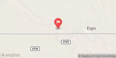
Summary
Constructed in 1966 by the USDA NRCS, this earth dam stands at a height of 27 feet and spans a length of 1270 feet. With a storage capacity of 662.52 acre-feet and a normal storage level of 24 feet, Frd No 1 helps to mitigate potential flooding in the Rock Creek-TR watershed.
Managed by the local government and regulated by the Kansas Department of Agriculture, Frd No 1 is inspected regularly to ensure its structural integrity and effectiveness in flood control. With a low hazard potential and a moderate risk assessment rating, this dam plays a vital role in protecting the surrounding area from potential inundation. Despite being last inspected in 1979, Frd No 1 continues to serve its primary purpose of flood risk reduction, showcasing the importance of proper infrastructure for water resource management in the face of changing climate conditions.
°F
°F
mph
Wind
%
Humidity
15-Day Weather Outlook
Year Completed |
1966 |
Dam Length |
1270 |
Dam Height |
27 |
River Or Stream |
ROCK CREEK-TR |
Primary Dam Type |
Earth |
Surface Area |
8.88 |
Hydraulic Height |
22 |
Drainage Area |
1.16 |
Nid Storage |
662.52 |
Structural Height |
27 |
Outlet Gates |
None |
Hazard Potential |
Low |
Foundations |
Unlisted/Unknown |
Nid Height |
27 |
Seasonal Comparison
5-Day Hourly Forecast Detail
Nearby Streamflow Levels
 Otter C At Climax
|
32cfs |
 Elk R At Elk Falls
|
43cfs |
 Whitewater R At Towanda
|
125cfs |
 Walnut R At Winfield
|
986cfs |
 Arkansas R At Derby
|
455cfs |
 Caney R Nr Elgin
|
63cfs |
Dam Data Reference
Condition Assessment
SatisfactoryNo existing or potential dam safety deficiencies are recognized. Acceptable performance is expected under all loading conditions (static, hydrologic, seismic) in accordance with the minimum applicable state or federal regulatory criteria or tolerable risk guidelines.
Fair
No existing dam safety deficiencies are recognized for normal operating conditions. Rare or extreme hydrologic and/or seismic events may result in a dam safety deficiency. Risk may be in the range to take further action. Note: Rare or extreme event is defined by the regulatory agency based on their minimum
Poor A dam safety deficiency is recognized for normal operating conditions which may realistically occur. Remedial action is necessary. POOR may also be used when uncertainties exist as to critical analysis parameters which identify a potential dam safety deficiency. Investigations and studies are necessary.
Unsatisfactory
A dam safety deficiency is recognized that requires immediate or emergency remedial action for problem resolution.
Not Rated
The dam has not been inspected, is not under state or federal jurisdiction, or has been inspected but, for whatever reason, has not been rated.
Not Available
Dams for which the condition assessment is restricted to approved government users.
Hazard Potential Classification
HighDams assigned the high hazard potential classification are those where failure or mis-operation will probably cause loss of human life.
Significant
Dams assigned the significant hazard potential classification are those dams where failure or mis-operation results in no probable loss of human life but can cause economic loss, environment damage, disruption of lifeline facilities, or impact other concerns. Significant hazard potential classification dams are often located in predominantly rural or agricultural areas but could be in areas with population and significant infrastructure.
Low
Dams assigned the low hazard potential classification are those where failure or mis-operation results in no probable loss of human life and low economic and/or environmental losses. Losses are principally limited to the owner's property.
Undetermined
Dams for which a downstream hazard potential has not been designated or is not provided.
Not Available
Dams for which the downstream hazard potential is restricted to approved government users.

 Frd No 1