Summary
Completed in 1969, this earth dam serves the primary purpose of flood risk reduction along the Rock Creek-TR stream. With a height of 27 feet and a length of 750 feet, Frd No 10 has a storage capacity of 330 acre-feet and covers a surface area of 8.3 acres.
Managed by the Kansas Department of Agriculture, Frd No 10 has a low hazard potential and is currently in a not rated condition assessment. The dam features an uncontrolled spillway with a width of 40 feet and a maximum discharge capacity of 207 cubic feet per second. While the structure has not been modified in recent years, it is subject to state regulation, inspection, and enforcement to ensure its continued efficacy in mitigating flood risks in the region.
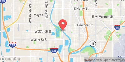
Located in Winfield, Kansas, Frd No 10 plays a crucial role in protecting the surrounding area from potential flooding events. As a key component of flood risk reduction efforts, this dam serves as a testament to the collaborative efforts between local government agencies, the USDA NRCS, and the Kansas Department of Agriculture in safeguarding communities and water resources from the impacts of extreme weather and climate events.
°F
°F
mph
Wind
%
Humidity
15-Day Weather Outlook
Year Completed |
1969 |
Dam Length |
750 |
Dam Height |
27 |
River Or Stream |
ROCK CREEK-TR |
Primary Dam Type |
Earth |
Surface Area |
8.3 |
Hydraulic Height |
24 |
Drainage Area |
1.11 |
Nid Storage |
330 |
Structural Height |
27 |
Outlet Gates |
None |
Hazard Potential |
Low |
Foundations |
Unlisted/Unknown |
Nid Height |
27 |
Seasonal Comparison
5-Day Hourly Forecast Detail
Nearby Streamflow Levels
 Walnut R At Winfield
|
986cfs |
 Whitewater R At Towanda
|
125cfs |
 Arkansas R At Derby
|
455cfs |
 Elk R At Elk Falls
|
43cfs |
 Otter C At Climax
|
32cfs |
 Arkansas R At Wichita
|
361cfs |
Dam Data Reference
Condition Assessment
SatisfactoryNo existing or potential dam safety deficiencies are recognized. Acceptable performance is expected under all loading conditions (static, hydrologic, seismic) in accordance with the minimum applicable state or federal regulatory criteria or tolerable risk guidelines.
Fair
No existing dam safety deficiencies are recognized for normal operating conditions. Rare or extreme hydrologic and/or seismic events may result in a dam safety deficiency. Risk may be in the range to take further action. Note: Rare or extreme event is defined by the regulatory agency based on their minimum
Poor A dam safety deficiency is recognized for normal operating conditions which may realistically occur. Remedial action is necessary. POOR may also be used when uncertainties exist as to critical analysis parameters which identify a potential dam safety deficiency. Investigations and studies are necessary.
Unsatisfactory
A dam safety deficiency is recognized that requires immediate or emergency remedial action for problem resolution.
Not Rated
The dam has not been inspected, is not under state or federal jurisdiction, or has been inspected but, for whatever reason, has not been rated.
Not Available
Dams for which the condition assessment is restricted to approved government users.
Hazard Potential Classification
HighDams assigned the high hazard potential classification are those where failure or mis-operation will probably cause loss of human life.
Significant
Dams assigned the significant hazard potential classification are those dams where failure or mis-operation results in no probable loss of human life but can cause economic loss, environment damage, disruption of lifeline facilities, or impact other concerns. Significant hazard potential classification dams are often located in predominantly rural or agricultural areas but could be in areas with population and significant infrastructure.
Low
Dams assigned the low hazard potential classification are those where failure or mis-operation results in no probable loss of human life and low economic and/or environmental losses. Losses are principally limited to the owner's property.
Undetermined
Dams for which a downstream hazard potential has not been designated or is not provided.
Not Available
Dams for which the downstream hazard potential is restricted to approved government users.

 32
32
 30
30
 27
27
 Frd No 10