Summary
Built in 1968 by USDA NRCS, this dam serves the primary purpose of flood risk reduction in the region. Standing at a structural height of 37 feet and a hydraulic height of 34 feet, the dam has a capacity to store 3097.8 acre-feet of water and covers a surface area of 34.01 acres.
Owned by the local government and regulated by the Kansas Department of Agriculture, Frd No 41-A is inspected every 5 years to ensure its fair condition and significant hazard potential is managed effectively. The dam features an uncontrolled spillway with a width of 400 feet and no outlet gates. While the risk assessment categorizes it as moderate, the dam's condition assessment remains fair, highlighting the importance of ongoing monitoring and risk management measures to safeguard against potential emergencies and ensure the safety of the surrounding community.
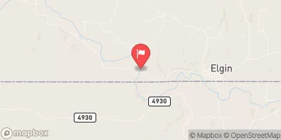
With its close proximity to the community and critical role in flood risk reduction, Frd No 41-A stands as a vital infrastructure in Elk County, Kansas. As climate change continues to impact water resources and weather patterns, the proper maintenance and regulation of this dam will be essential to mitigate risks and protect the area from potential flooding events.
°F
°F
mph
Wind
%
Humidity
15-Day Weather Outlook
Year Completed |
1968 |
Dam Length |
2200 |
Dam Height |
36.1 |
River Or Stream |
CORUM CREEK |
Primary Dam Type |
Earth |
Surface Area |
34.01 |
Hydraulic Height |
34 |
Drainage Area |
7.64 |
Nid Storage |
3097.8 |
Structural Height |
37 |
Outlet Gates |
None |
Hazard Potential |
Significant |
Foundations |
Unlisted/Unknown |
Nid Height |
37 |
Seasonal Comparison
5-Day Hourly Forecast Detail
Nearby Streamflow Levels
 Elk R At Elk Falls
|
38cfs |
 Caney R Nr Elgin
|
58cfs |
 Otter C At Climax
|
27cfs |
 Walnut R At Winfield
|
883cfs |
 Fall R At Fredonia
|
858cfs |
 Arkansas R At Arkansas City
|
1430cfs |
Dam Data Reference
Condition Assessment
SatisfactoryNo existing or potential dam safety deficiencies are recognized. Acceptable performance is expected under all loading conditions (static, hydrologic, seismic) in accordance with the minimum applicable state or federal regulatory criteria or tolerable risk guidelines.
Fair
No existing dam safety deficiencies are recognized for normal operating conditions. Rare or extreme hydrologic and/or seismic events may result in a dam safety deficiency. Risk may be in the range to take further action. Note: Rare or extreme event is defined by the regulatory agency based on their minimum
Poor A dam safety deficiency is recognized for normal operating conditions which may realistically occur. Remedial action is necessary. POOR may also be used when uncertainties exist as to critical analysis parameters which identify a potential dam safety deficiency. Investigations and studies are necessary.
Unsatisfactory
A dam safety deficiency is recognized that requires immediate or emergency remedial action for problem resolution.
Not Rated
The dam has not been inspected, is not under state or federal jurisdiction, or has been inspected but, for whatever reason, has not been rated.
Not Available
Dams for which the condition assessment is restricted to approved government users.
Hazard Potential Classification
HighDams assigned the high hazard potential classification are those where failure or mis-operation will probably cause loss of human life.
Significant
Dams assigned the significant hazard potential classification are those dams where failure or mis-operation results in no probable loss of human life but can cause economic loss, environment damage, disruption of lifeline facilities, or impact other concerns. Significant hazard potential classification dams are often located in predominantly rural or agricultural areas but could be in areas with population and significant infrastructure.
Low
Dams assigned the low hazard potential classification are those where failure or mis-operation results in no probable loss of human life and low economic and/or environmental losses. Losses are principally limited to the owner's property.
Undetermined
Dams for which a downstream hazard potential has not been designated or is not provided.
Not Available
Dams for which the downstream hazard potential is restricted to approved government users.

 Frd No 41-A